Finedon Walks
![]()
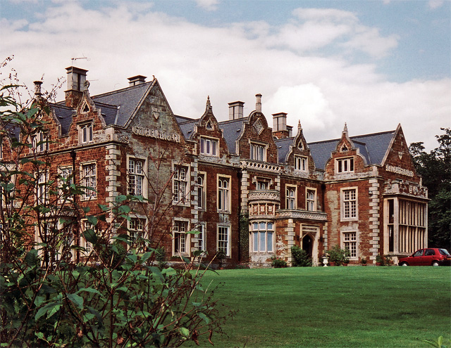
![]() This circular walk takes you around the Northamptonshire town of Finedon passing the old Finedon Hall and visiting Finedon Pocket Park.
This circular walk takes you around the Northamptonshire town of Finedon passing the old Finedon Hall and visiting Finedon Pocket Park.
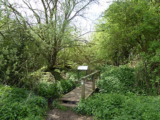
The park is a pleasant place for a stroll with woodland, meadow, a tree lined path and the chance to walk on the sleepers from the old quarry rail. The park is nicely ecomanaged by local volunteers and includes woodland containing mainly ash, sycamore and oak.
You can extend the walk by continuing west along the dismantled railway from the park. This will take you towards Cally Banks Nature Reserve and the River Ise. In this area you can look out for a variety of butterflies during the warmer months.
Finedon Ordnance Survey Map  - view and print off detailed OS map
Finedon Open Street Map  - view and print off detailed map
Finedon OS Map  - Mobile GPS OS Map with Location tracking
Finedon Open Street Map  - Mobile GPS Map with Location tracking
Walks near Finedon
- Titchmarsh Nature Reserve - Enjoy waterside walking in this nature reserve in Thrapston, near Kettering
- Nene Way - Follow the River Nene through the beautiful Nene Valley on this fabulous walk through Cambridgeshire, Lincolnshire and Northamptonshire.
The long distance path runs for over 100 miles, passing Northampton, Wellingborough, Oundle, Peterborough and Wisbech.
There's much to enjoy on the way with rushing weirs, a series of historic villages and old mills - Stanwick Lakes - Explore 750 acres of parkland and nature reserve in the heart of Northamptonshire's beautiful Nene Valley
- Fermyn Woods - This country park and forest has a number of walking trails and two bridleways for cyclists
- Cransley Reservoir - This walk visits Cransley Reservoir from the village of Thorpe Malsor in Northamptonshire.
- Ringstead - This circular walk explores the countryside and neighbouring villages around the Northamptonshire village of Ringstead.
- Wellingborough - The Northamptonshire town of Wellingborough has some lovely walking trails to follow through the Nene Valley
- Thrapston - This walk from the Northamptonshire town of Thrapston takes you along the River Nene to the neighbouring village of Wadenhoe
- Rushden Lakes - This walk visits Rushden Lakes in the Nene Valley area of Northamptonshire
- Irchester Country Park - Enjoy numerous walking and cycling trails in this splendid country park in Wellingborough, Northamptonshire
- Sywell Country Park - Follow the waterside path around the delightful Sywell Reservoir on this easy walk in Northamptonshire
- Northampton Canal Walk - This easy walk follow the Northampton Arm of the Grand Union Canal from the town centre to the countryside near Milton Malsor
- Grand Union Canal Walk - Follow the towpath of Britain's longest canal from London to Birmingham on this fabulous waterside walk
- Ringstead - This circular walk explores the countryside and neighbouring villages around the Northamptonshire village of Ringstead.
- Summer Leys - This walk explores the Summer Leys Nature Reserve and the countryside around the village of Great Doddington near Wellingborough in Northamptonshire.
- Barnwell Country Park - Enjoy lovely waterside walking trails in this country park in Oundle, Northamptonshire
- Orlingbury - This Northamptonshire based village is located near the towns of Kettering and Wellingborough.
- Grafton Underwood - This walk visits the pretty Northamptonshire village of Grafton Underwood
Photos
Finedon Obelisk. Erected by John English Dolben in 1789 at the cross-turnpikes (now the A6 and A510). It probably celebrated the recovery of George III from a period of insanity. The faces displayed verses to give delight, and gave distances to various destinations.
Cally Banks. Finedon Cally Banks is a nature reserve north-east of Wellingborough in Northamptonshire. It is managed by the Wildlife Trust for Bedfordshire, Cambridgeshire and Northamptonshire. The site is linked to the quarry first worked in the 1870s at Finedon Pocket Park. The ore was transported along a specially constructed railway to what is now the reserve. The name Cally Banks comes from the process of burning iron ore to remove impurities, leaving a deposit called calcine which provides the poor soil conditions in which wildflowers flourish. Look for beautiful speckled wood butterflies among these flowers in spring and autumn. Crickets, dragonflies and wetland flora also thrive here, while hawthorn and blackthorn scrub is a haven for warblers.


