Glenoe Waterfall Walk
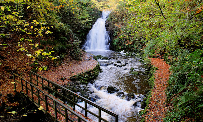
![]() This walk visits the lovely Glenoe Waterfall in the hamlet of Glenoe in County Antrim.
This walk visits the lovely Glenoe Waterfall in the hamlet of Glenoe in County Antrim.
It's a fine place for a walk with pleasant trails taking you through peaceful woodland to the 30ft high waterfall.
The National Trust owned area includes a car park and the church of St. Columbas.
It's a brief stroll from the pretty settlement of Glenoe, with pathways winding their way around the small, verdant glen. Eventually you will come to one of Northern Ireland's most picturesque waterfalls nestled within the valley.
The well-marked walk features numerous steps, meandering along the sides of the lush valley and the delightful Glenoe Water.
A favoured spot for photographers, it is now included in the official Causeway Coastal Driving Route.
Starting from the car park, the trail leads through wooded areas, branching out into a network of pathways and steps, guiding adventurers across varying terrain. The ground may be uneven and steep, owing to the deep gorge, and damp underfoot due to flowing water and mist.
Postcode
BT40 3LE - Please note: Postcode may be approximate for some rural locationsPlease click here for more information
Glenoe Waterfall Open Street Map  - view and print off detailed map
Glenoe Waterfall Open Street Map  - Mobile GPS Map with Location tracking
Further Information and Other Local Ideas
To the south there's the Woodburn Forest near Carrickfergus. Here you'll find miles of good woodland trails and a number of attractive reservoirs.
Head east and you could visit the Blackhead Lighthouse. There's some fine coastal trails around the lighthouse with views over the Belfast Lough. The popular and dramatic Gobbins Cliff Path can also be picked up in this area.
To the south west there's the wonderful viewpoints at Cave Hill Country Park, Belfast Castle and Black Mountain to explore.
To the north west there's Ballyboley Forest where you'll find more peaceful woodland trails and waterside walks along the Kilylane Reservoir. Tardree Forest can also be found in this area.


