Goatfell Walk
![]()
![]() Climb to the high point on the Isle of Arran and enjoy wonderful views over the surrounding area on this challenging walk.
Climb to the high point on the Isle of Arran and enjoy wonderful views over the surrounding area on this challenging walk.
The walk starts from the Cladach car park near Brodick Castle. You can reach Brodick by catching the ferry from Ardrossan Harbour. Trains run to Ardrossan Harbour from Glasgow and take about 45 minutes so the walk is quite accessible if you are coming without a car from the city.
From Brodick the route ascends on a good path through woodland and heather moorland.
At the 874 m (2,867 ft) summit there are wide ranging views with the Arran peaks, the Mull of Kintyre, the Clyde Estuary and Ireland all visible on a clear day. You descend on the same path with great views of Brodick Bay as you go.
If you'd like to continue your walking in the area then you could explore the lovely Brodick Castle Country Park which has lots of good walking trails to try.
At the castle you can also pick up the Arran Coastal Way and explore the whole coastline of the island. The 66 mile route is classified as one of Scotland's Great Trails.
Postcode
KA27 8HY - Please note: Postcode may be approximate for some rural locationsGoatfell Ordnance Survey Map  - view and print off detailed OS map
Goatfell Open Street Map  - view and print off detailed map
Goatfell OS Map  - Mobile GPS OS Map with Location tracking
Goatfell Open Street Map  - Mobile GPS Map with Location tracking
Further Information and Other Local Ideas
To the south there's the lovely Glenashdale Falls where you can enjoy a fine walk along the Glenashdale Burn in the pretty coastal village of Whiting Bay.
The Glen Rosa Waterfall Walk starts from the car park on the western side of the Brodick Castle grounds. This will take you along the delightful Glenrosa Water with its picturesque waterfalls and stunning views.
Cycle Routes and Walking Routes Nearby
Photos
On the Goatfell hill path from High Corrie which is just to the south of the village of Corrie on the Isle of Arran.
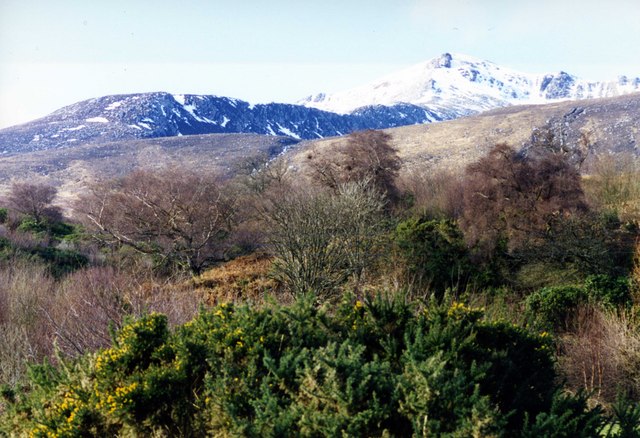
The last of the trees and bushes on the way up Goatfell using the path from High Corrie. Corrie burn running over the brow of the hill with Meall Breac and Goatfell beyond.


