Hednesford Hills
![]()
![]() This circular walk explores the Hednesford Hills in the Cannock Chase district of Staffordshire.
This circular walk explores the Hednesford Hills in the Cannock Chase district of Staffordshire.
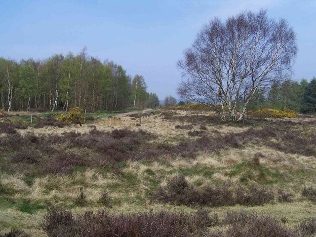
The area is located just east of the town of Hednesford and includes a local nature reserve criss crossed with miles footpaths and mountain bike trails. There's expansive heathland with lots of wildlife and pretty heather in the late summer. Look out for birds such as Yellowhammer, bullfinch, song thrush, and greenfinch as you make your way across the site.
You can start the walk from the car park at the southern end of the reserve. There's various trails to choose from with one heading around the Hednesford Raceway. The popular raceway is a stock car track built on the site of a disused reservoir, bringing thousands of race fans to the area since the mid-1950s.
At the northern end of the reserve there's also the Museum of Cannock Chase where you can learn all about the mining history of the area.
You could extend the walk by heading a couple of miles north to visit Cannock Chase Country Park. There's a visitor centre, cafe and some pleasant woodland trails here.
Postcode
WS12 1TD - Please note: Postcode may be approximate for some rural locationsHednesford Hills Ordnance Survey Map  - view and print off detailed OS map
Hednesford Hills Open Street Map  - view and print off detailed map
Hednesford Hills OS Map  - Mobile GPS OS Map with Location tracking
Hednesford Hills Open Street Map  - Mobile GPS Map with Location tracking
Walks near Hednesford
- Cannock Chase Country Park - This huge country park has 3000 acres of cycling and walking trails to explore
- Milford Common - This walk takes you around Milford Common near Stafford
- Shugborough Park - This circular walk uses public footpaths and the Staffordshire Way to take you around Shugborough Park in Great Haywood
- Chasewater Country Park - Enjoy a lovely waterside walk or cycle around Chasewater in Burntwood, near Lichfield
- Penkridge - This Staffordshire based market town is in an ideal spot for exploring the countryside and woodland of the Cannock Chase AONB
- Staffordshire and Worcestershire Canal - Follow the Staffordshire and Worcestershire Canal from Stourport-on-Severn to Great Haywood on this easy waterside walking and cycling route
- Birches Valley - This circular walk visits the Birches Valley area of the Cannock Chase AONB.
- Gailey Reservoir - These pretty reservoirs are located near the Staffordshire village of Gailey in the Penkridge area of the county
- Hednesford Hills - This circular walk explores the Hednesford Hills in the Cannock Chase district of Staffordshire.
- Gentleshaw Common - This area of rare lowland heathland is located in the village of Gentleshaw in Staffordshire.
Further Information and Other Local Ideas
Just to the east there's some nice trails around Gentleshaw Common. The common has some lovely flora with pretty heather in the late summer and lots of wildlife to see as well.
Photos
The Museum of Cannock Chase. Formerly the site of the Valley Pit, a training pit for thousands of young miners, the museum covers the history of the Cannock Chase area, in particular the many mines that dotted the 'Chase'


