Ixworth Walks
![]()
![]() Ixworth is a charming village in Suffolk, England, known for its historical landmarks and community amenities.
Ixworth is a charming village in Suffolk, England, known for its historical landmarks and community amenities.
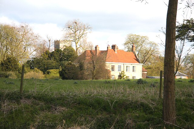
At the heart of the village lies St. Mary's Church, a historical gem with origins dating back to the late 14th century. Its distinctive late 15th-century tower is a prominent feature, and the church is home to memorials honoring figures like Richard Coddington, who acquired land previously owned by the priory following its dissolution. St. Mary's Church holds the distinction of being a Grade I Listed Building, underscoring its architectural and historical significance.
The village is dotted with a range of listed buildings, many of which are situated along High Street and boast medieval architectural elements. These structures contribute to the village's historical character. Ixworth is a self-sufficient community with a collection of local services that include shops, a post office, and public houses. Additionally, the village offers amenities like a village hall, doctor's surgery, a retained fire station, and a shared police station. This combination of history and community resources makes Ixworth an attractive place to live and visit in Suffolk.
The village lies just to the north west of Pakenham Water Mill. The mill is another local historic highlight situated in a picturesque location on the River Blackbourne.
Please scroll down for the full list of walks near and around Ixworth. The detailed maps below also show a range of footpaths, bridleways and cycle paths in the area.
Ixworth Ordnance Survey Map  - view and print off detailed OS map
Ixworth Open Street Map  - view and print off detailed map
*New* - Walks and Cycle Routes Near Me Map - Waymarked Routes and Mountain Bike Trails>>
Ixworth OS Map  - Mobile GPS OS Map with Location tracking
Ixworth Open Street Map  - Mobile GPS Map with Location tracking
Walks near Ixworth
- Pakenham - Pakenham is a picturesque village located near Bury St Edmunds in Suffolk.
- Thurston - This Suffolk based town lies just to the east of Bury St Edmunds.
- Great Barton - Great Barton is a picturesque village located in the county of Suffolk.
- Bury St Edmunds - This walk visits some of the highlights of this lovely Suffolk town using sections of the St Edmund Way and Bury to Clare Walk
- Clare Castle Country Park - This pretty country park is situated on the River Stour in the Suffolk town of Clare
- Bury to Clare Walk - Follow the Bury to Clare Walk from Bury St Edmunds to Clare on this walk through Suffolk
- Nowton Park - Explore 200 acres of beautiful Suffolk countryside landscaped in a beautiful Victorian style in this country park in Bury St Edmunds
- West Stow Country Park - Enjoy waterside walks alongside a number of pretty lakes and the River Lark in this splendid country park near Bury St Edmunds
- Ickworth Park - A circular walk around the parks and gardens at Ickworth in Bury St Edmunds
- Lark Valley Path - Travel through the River Lark Valley on this interesting and varied walk from Mildenhall to Bury St Edmunds via West Stow Country Park.
- Bradfield Woods - This National Nature Reserve near Bury St Edmunds is one of the best places in Suffolk for wildlife
- Cavenham Heath - Enjoy a short stroll around this pretty nature reserve near Bury St Edmunds
- King's Forest - This large area of woodland near has miles of cycling and walking trails to enjoy
- Lackford Lakes - This walk visits the pretty Lackford Lakes Nature Reserve near Bury St Edmunds in Suffolk.
- Tuddenham - This circular walk explores the countryside around the village of Tuddenham in Suffolk
- Haughley Park - The historic Haughley Park is located just west of the Suffolk village of Haughley.
- Stowmarket - Enjoy a walk along the River Gipping on this walk from Stowmarket to Needham Market
- Gipping Valley River Path - Follow the River Gipping from Stowmarket to Ipswich on this pleasant riverside walk
- Ipswich - A circular walk around Ipswich with lovely river views and visits to a series of attractive parks
- Needham Lake - Enjoy an easy stroll around Needham Lake on this short walk in Needham Market
- Eye - This walk visits the Suffolk market town of Eye
- Coddenham - This walk explores the parkland, countryside and rivers around the Suffolk village of Coddenham
- Thornham Magna - This attractive Suffolk village includes a 14th century church, a fine 15th century pub and wonderful walking trails in the Thornham Hall Estate.
- Woolpit - This Suffolk village is located close to the towns of Bury St Edmunds and Stowmarket.
- Elmswell - This Suffolk based village is located near to the towns of Bury St Edmunds and Stowmarket.
Further Information and Other Local Ideas
Bangrove Wood, situated approximately 1 mile (1.6 km) to the north of the village, holds the designation of a Site of Special Scientific Interest (SSSI). Encompassing an expanse of 18.2 hectares (45 acres), this wood is a haven of ancient woodland. Within its boundaries, one can find a variety of tree species, including ash, field maple, oak, and hazel, alongside the delightful presence of wild cherry trees. The woodland floor thrives with an array of ground vegetation species, adding to the ecological richness of this natural environment. Bangrove Wood serves as an essential and protected site for those interested in the study and conservation of ancient woodlands and their diverse ecosystems.


