Thurston Walks
![]()
![]() This Suffolk based town lies just to the east of Bury St Edmunds.
This Suffolk based town lies just to the east of Bury St Edmunds.
Thurston includes a church with medieval features, two pubs and a mock tudor hotel for accommodation. Neighbouring settlements include Pakenham, Tostock and Great Barton. The Rougham Estate and Barton Mere are also close at hand.
This walk from the village takes you west along a shared cycle and walking route to Battlies Green and then into Bury St Edmunds. It's a nice, flat, traffic free path that will take you into the heart of the town before finishing at the historic abbey with its beautiful gardens. In the town you can also pick up the St Edmund Way and Bury to Clare Walk, long distance footpaths.
Please scroll down for the full list of walks near and around Thurston. The detailed maps below also show a range of footpaths, bridleways and cycle paths in the area.
Thurston Ordnance Survey Map  - view and print off detailed OS map
Thurston Open Street Map  - view and print off detailed map
Thurston OS Map  - Mobile GPS OS Map with Location tracking
Thurston Open Street Map  - Mobile GPS Map with Location tracking
Walks near Thurston
- Pakenham - Pakenham is a picturesque village located near Bury St Edmunds in Suffolk.
- Ixworth - Ixworth is a charming village in Suffolk, England, known for its historical landmarks and community amenities.
- Great Barton - Great Barton is a picturesque village located in the county of Suffolk.
- Bury St Edmunds - This walk visits some of the highlights of this lovely Suffolk town using sections of the St Edmund Way and Bury to Clare Walk
- Clare Castle Country Park - This pretty country park is situated on the River Stour in the Suffolk town of Clare
- Bury to Clare Walk - Follow the Bury to Clare Walk from Bury St Edmunds to Clare on this walk through Suffolk
- Nowton Park - Explore 200 acres of beautiful Suffolk countryside landscaped in a beautiful Victorian style in this country park in Bury St Edmunds
- West Stow Country Park - Enjoy waterside walks alongside a number of pretty lakes and the River Lark in this splendid country park near Bury St Edmunds
- Ickworth Park - A circular walk around the parks and gardens at Ickworth in Bury St Edmunds
- Lark Valley Path - Travel through the River Lark Valley on this interesting and varied walk from Mildenhall to Bury St Edmunds via West Stow Country Park.
- Bradfield Woods - This National Nature Reserve near Bury St Edmunds is one of the best places in Suffolk for wildlife
- Cavenham Heath - Enjoy a short stroll around this pretty nature reserve near Bury St Edmunds
- King's Forest - This large area of woodland near has miles of cycling and walking trails to enjoy
- Lackford Lakes - This walk visits the pretty Lackford Lakes Nature Reserve near Bury St Edmunds in Suffolk.
- Tuddenham - This circular walk explores the countryside around the village of Tuddenham in Suffolk
- Haughley Park - The historic Haughley Park is located just west of the Suffolk village of Haughley.
- Stowmarket - Enjoy a walk along the River Gipping on this walk from Stowmarket to Needham Market
- Gipping Valley River Path - Follow the River Gipping from Stowmarket to Ipswich on this pleasant riverside walk
- Ipswich - A circular walk around Ipswich with lovely river views and visits to a series of attractive parks
- Needham Lake - Enjoy an easy stroll around Needham Lake on this short walk in Needham Market
- Eye - This walk visits the Suffolk market town of Eye
- Coddenham - This walk explores the parkland, countryside and rivers around the Suffolk village of Coddenham
- Thornham Magna - This attractive Suffolk village includes a 14th century church, a fine 15th century pub and wonderful walking trails in the Thornham Hall Estate.
- Woolpit - This Suffolk village is located close to the towns of Bury St Edmunds and Stowmarket.
- Elmswell - This Suffolk based village is located near to the towns of Bury St Edmunds and Stowmarket.
Pubs/Cafes
The Fox and Hounds dates from the 1840s and serves good quality food. You can find them on the Barton Road at postcode IP31 3QT. The pub is dog friendly.
Further Information and Other Local Ideas
Just north is Pakenham where you can enjoy a walk to the historic water mill located on the River Blackbourne.
Photos
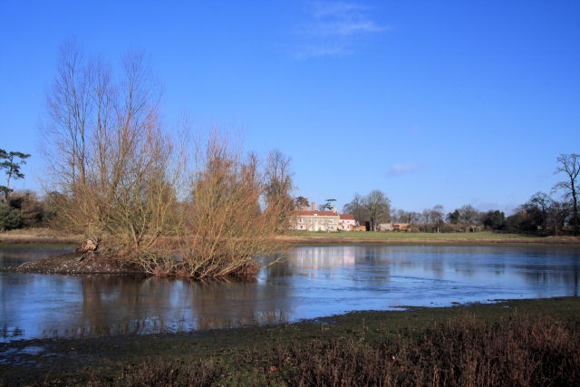
Barton Mere. The house in the background is Bartonmere House. Located to the north east of the village.
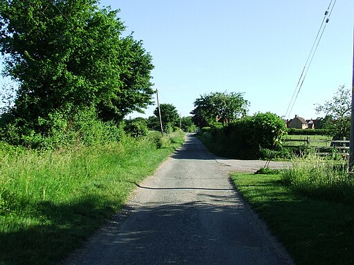
National Cycle Route 51 at Battlies Green. This off-road section of NCR51 follows the northern boundary of the former Rougham Airfield.


