Leighton Moss Nature Reserve
![]()
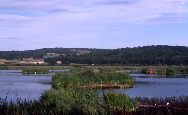
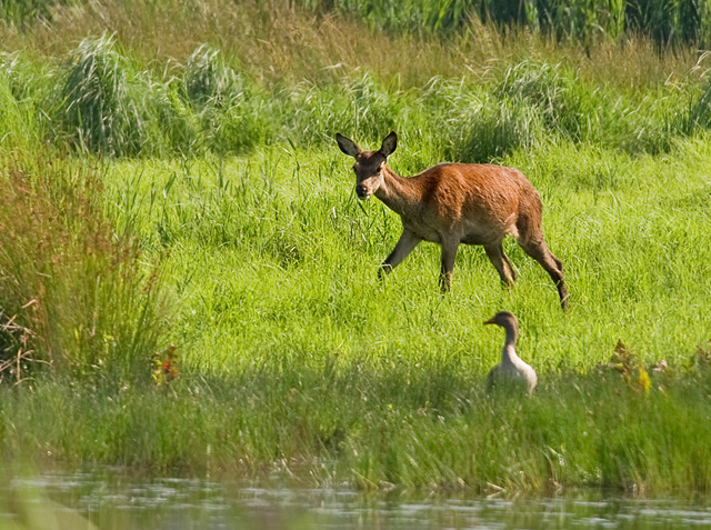
![]() This large nature reserve in Silverdale, is the perfect place for a peaceful walk in beautiful surroundings. Leighton Moss is the largest reedbed in the north west and has a number of well laid out trails for you to explore the area. An abundance of wildlife can be seen in the reserve including breeding bitterns, starlings, bearded tits, marsh harriers (see video) and red deer. There is also a fantastic cafe in a converted barn.
This large nature reserve in Silverdale, is the perfect place for a peaceful walk in beautiful surroundings. Leighton Moss is the largest reedbed in the north west and has a number of well laid out trails for you to explore the area. An abundance of wildlife can be seen in the reserve including breeding bitterns, starlings, bearded tits, marsh harriers (see video) and red deer. There is also a fantastic cafe in a converted barn.
Leighton Moss is located in the Arnside and Silverdale AONB and on the Lancashire Coastal Way walking route so there is scope for continuing your walk towards Arnside or Carnforth. You could also pay a visit to the nearby Arnside Knott. This small hill has woodland walks and fabulous views over Silverdale and the coastal estuary. Also nearby is Warton Crag nature reserve with its rare butterflies and plants.
Just to the north west you can visit Eaves Wood, Gait Barrows and enjoy a climb to the Victorian Pepperpot monument on King William's Hill.
The reserve is located right next to Silverdale railway station so is easy to access.
Postcode
LA5 0SW - Please note: Postcode may be approximate for some rural locationsPlease click here for more information
Leighton Moss Nature Reserve Ordnance Survey Map  - view and print off detailed OS map
Leighton Moss Nature Reserve Open Street Map  - view and print off detailed map
Leighton Moss Nature Reserve OS Map  - Mobile GPS OS Map with Location tracking
Leighton Moss Nature Reserve Open Street Map  - Mobile GPS Map with Location tracking
Pubs/Cafes
There's a good on site cafe where you can enjoy a range of refreshments after your walk.
Dog Walking
The reserve is a nice place for a dog walk though you are restricted on where you can go and they should be kept on leads. There's a designated dog friendly path which you can find more about at the visitor centre. There's water bowls to be found here too.
Further Information and Other Local Ideas
Silverdale train station is right next to the reserve so it's easy to visit the area by public transport. From here you could catch a train over the Kent viaduct to Grange Over Sands on the other side of the river. Here you can pick up the popular Grange-over-Sands and Cartmel Circular Walk which visits the fascinating 12th century Cartmel Priory and the splendidly positioned Hampsfell Hospice.
A few miles to the north east there's another local geological highlight at Beetham's Fairy Steps. Here you will find an unusual natural limestone staircase which you can climb for more excellent views. The little village of Beetham is also well worth exploring with its 14th century ruined manor house and a particularly lovely garden centre. Near here there's also the market town of Milnthorpe. Here you can enjoy a lovely walk along Milnthorpe Sands to the River Kent Estuary and the wonderful topiary at Levens Hall.
For more walking ideas in the area see the Arnside and Silverdale Walks page.


