Carnforth Canal Walk
![]()
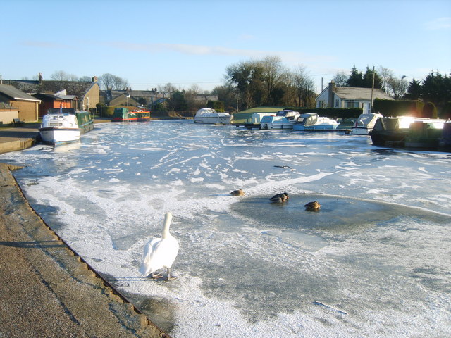
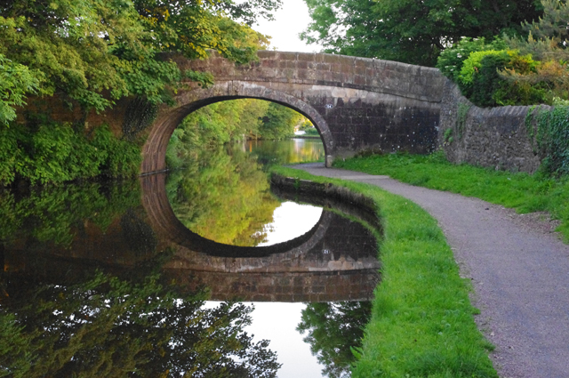
![]() Enjoy a stroll along the Lancaster Canal from Carnforth to Bolton-le-Sands on this easy. Along the way there's nice views towards Morecambe Bay and the mountains of the Lake District.
Enjoy a stroll along the Lancaster Canal from Carnforth to Bolton-le-Sands on this easy. Along the way there's nice views towards Morecambe Bay and the mountains of the Lake District.
The walk starts just to the east of the town centre and train station. You can pick up the canal towpath on Kellet Road and follow it south west to Bolton-le-Sands. The large village has an old church with a tower dating from 1500. There's also a number of nice pubs where you can stop for refreshment at what is the halfway point of the walk.
After exploring the village the walk follows a mixture of country lanes and public footpaths back to Carnforth. This section takes you through the countryside around Mount Pleasant, where you can enjoy great views to the coast from the elevated position.
The Lancashire Coastal Way passes through the town and is a great way of continuing your walking in the area. You could follow the long distance path north and visit Warton Crag in the Arnside and Silverdale AONB. The nature reserve has another great viewpoint and also includes lots of interesting flora and fauna. Leighton Moss Nature Reserve can be found in this area too.
Heading south along the trail will take you along Morecambe Bay to the town of Morecambe.
The Lunesdale Walk also starts in Carnforth. The long distance trail explores the woodland, countryside and hills surrounding the town.
Carnforth Canal Walk Ordnance Survey Map  - view and print off detailed OS map
Carnforth Canal Walk Open Street Map  - view and print off detailed map
Carnforth Canal Walk OS Map  - Mobile GPS OS Map with Location tracking
Carnforth Canal Walk Open Street Map  - Mobile GPS Map with Location tracking
Walks near Carnforth
- Lancashire Coastal Way - Travel along the beautiful Lancashire coast from Silverdale to Freckleton on this fairly easy walk.
You start off at Silverdale and head south to Morecambe Bay passing Warton and Bolton le Sands - Warton Crag - Enjoy a circular walk around Warton Crag on this lovely route in Lancashire
- Morecambe Bay - Enjoy a visit to the Morecambe Bay Nature Reserve and a stroll along the Lancaster Canal on this circular cycle or walk in Lancashire
- Lunesdale Walk - This figure of eight walk takes you on a tour of the beautiful scenery around Carnforth.
- Tewitfield Canal Locks Walk - A circular walk visiting the picturesque Tewitfield Canal Locks on the Lancaster Canal
- Hutton Roof Crags and Farleton Fell - Explore some of the finest limestone pavement in the country on this climb to Hutton Roof Crags and Farleton Fell
- Barbon Beck Barbondale - This lovely valley in the Cumbrian section of the Yorkshire Dales is a great place for a peaceful, waterside walk
Pubs/Cafes
At the end of the walk you could enjoy some refreshments at The Royal Hotel in Bolton-le-Sands. The inn is located in a fine spot next to the canal so you can enjoy your meal in the nice garden area by the water. They serve good quality food and can be found at postcode LA5 8DQ for your sat navs.
Further Information and Other Local Ideas
Head north along the canal from the town and you can visit the Tewitfield Canal Locks. It's a very picturesque area with an attractive modern marina and series of locks and weirs.
If you head a few miles inland you can explore the superb limestone pavement at Hutton Roof Crags and Farleton Fell. Near here there's the remote and pretty village of Barbon where you can try the Barbon Beck Barbondale Walk. The little village includes a noteworthy 17th century pub as well.
For more walking ideas in the area see the Lancashire Walks page.


