Lancashire Coastal Way Route Map
![]()
![]() Travel along the beautiful Lancashire coast from Silverdale to Freckleton on this fairly easy walk.
Travel along the beautiful Lancashire coast from Silverdale to Freckleton on this fairly easy walk.
You start off at Silverdale and head south to Morecambe Bay passing Warton and Bolton le Sands. At Morecambe you'll pass the Eric Morecambe statue with great views over the bay towards the Lake District. There's also a great deal of coastal wildlife to look out for including Cormorants, Curlews, Lapwings and Oystercatchers. The area includes Hest Bank and is a RSPB reserve with sandflats and saltmarshes that attract thousands of birds. As such it is considered the second most important estuary in the UK.
From Morecambe you head inland towards Lancaster and along the River Lune to Glasson Dock.
The next section takes you to along Cockerham Sands to Knott End on Sea where you catch the ferry to Fleetwood and continue south towards the world famous seaside resort of Blackpool with the iconic tower and pleasure beach.
The final section runs through the pretty resort of Lytham St Annes with Fairhaven Lake at Ansdell, views over the Ribble Estuary and the landmark windmill on Lytham front the highlights.
From Lytham you continue to the finish point at the village of Freckleton. There's lots of wildlife to look out for on the river and views of the planes taking off as you pass Warton Aerodrome on this final leg. There's also good views of the Pennine Hills and the Bowland Hills as you finish the walk.
Lancashire Coastal Way Ordnance Survey Map  - view and print off detailed OS map
Lancashire Coastal Way Open Street Map  - view and print off detailed map
*New* - Walks and Cycle Routes Near Me Map - Waymarked Routes and Mountain Bike Trails>>
Lancashire Coastal Way OS Map  - Mobile GPS OS Map with Location tracking
Lancashire Coastal Way Open Street Map  - Mobile GPS Map with Location tracking
Pubs/Cafes
In the village of Bolton le Sands there's the The Royal Hotel to consider for a pit stop. The inn is located in a fine spot next to the Lancaster Canal so you can enjoy your meal in the nice garden area by the water. They serve good quality food and can be found at postcode LA5 8DQ for your sat navs. You can also create a circular walk with the canal and coast path in this area.
At the pretty Conder Green near Lancaster there's a lovely picnic site with views of the tidal River Conder. There's also the historic Mill at Conder where you can enjoy some fine dishes in a scenic location. They have seating next to the canal and a lovely garden with countryside views. You can find them on Thurnham Lane at postcode LA2 0BD.
At the end of the route in Freckleton, there's the excellent Ship Inn for refreshment. The pub is thought to be the oldest in the Fylde, dating back to the 14th century. There's an elevated outdoor seating area where you can enjoy excellent views over the Ribble Estuary with your drink/meal. You can find them close to the end point of the walk at Bunker Street with a postcode of PR4 1HA for your sat navs.
Cycle Routes and Walking Routes Nearby
Photos
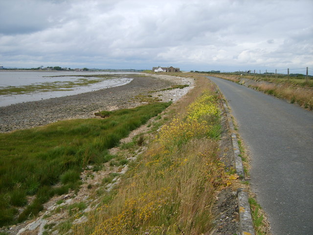
Warning sign, Pilling Marsh. There are several of these signs along this stretch of road, advising the public that there is no access to the marsh. The houses in the distance are in Ladies Hill. Access to the Pilling embankment is from the Lane Ends Amenity Area but this section of the Lancashire Coastal Way is closed between 26 December and Good Friday of each year to protect over-wintering birds and also not to disturb sheep during lambing season.
Elevation Profile


