Milnthorpe Walks
![]()
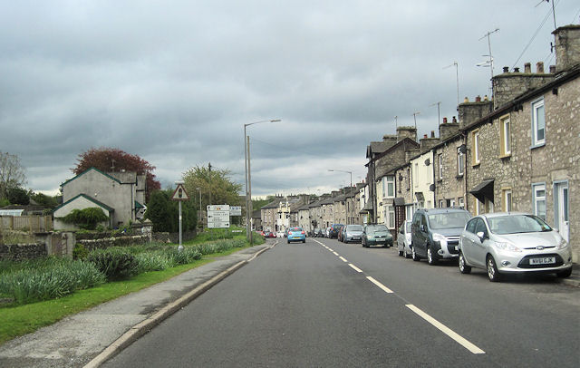
![]() This attractive Cumbrian market town is located near the Lake District town of Kendal and the Arnside and Silverdale AONB.
This attractive Cumbrian market town is located near the Lake District town of Kendal and the Arnside and Silverdale AONB.
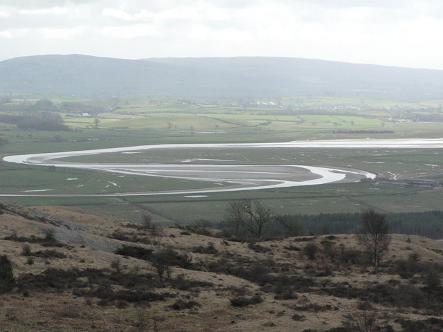
This walk from the town follows a pleasant section of the Cumbria Coastal Way to Levens Hall and Milnthorpe Sands. Along the way there's lovely views over the River Kent Estuary as you make your way along the scenic Milnthorpe Sands.
At Levens Hall you can explore the lovely gardens of the historic hall where you will find some marvellous topiary.
Towards the end of the walk you will pass very close to the Foulshaw Moss Nature Reserve. There's some nice trails here with lots of wildlife to look out for as well.
The walk could be extended by contunuing on to the lovely town of Grange-over-Sands where you could visit the ancient Cartmel Priory.
Milnthorpe Ordnance Survey Map  - view and print off detailed OS map
Milnthorpe Open Street Map  - view and print off detailed map
Milnthorpe OS Map  - Mobile GPS OS Map with Location tracking
Milnthorpe Open Street Map  - Mobile GPS Map with Location tracking
Walks near Milnthorpe
- Kendal Castle and River Walk - A circular walk visiting the River Kent and Kendal Castle
- Levens Hall - Enjoy a peaceful walk around the beautiful park and gardens surrounding this manor house in Kendal
- Grange-over-Sands and Cartmel Circular - This circular walk makes use of the Cumbria Coastal Way and Cistercian Way to take you on a tour of the area surrounding this lovely coastal town.
- Sizergh Castle - Enjoy a short walk through the delightful grounds of Sizergh Castle in the Lake District
- Arnside Knott - This popular circular walk takes you around a small, coastal hill in the Arnside and Silverdale AONB
- Limestone Link - Cumbria - This walk crosses the Limestone Hills from Arnside to Kirkby Lonsdale in Cumbria.
You start in Arnside and head east to Holme through Underlaid Wood - Warton Crag - Enjoy a circular walk around Warton Crag on this lovely route in Lancashire
- Leighton Moss Nature Reserve - This large nature reserve in Silverdale, is the perfect place for a peaceful walk in beautiful surroundings
- Eaves Wood - Explore Eaves Wood and enjoy a climb to the Pepperpot on this walk in the Arnside and Silverdale AONB
- Foulshaw Moss - This walk visits the Foulshaw Moss Nature Reserve near Witherslack in Cumbria.
- Carnforth Canal Walk - Enjoy a stroll along the Lancaster Canal from Carnforth to Bolton-le-Sands on this easy
- Milnthorpe - This attractive Cumbrian market town is located near the Lake District town of Kendal and the Arnside and Silverdale AONB.
- Brigsteer Woods - This walk takes you from the Cumbrian village of Brigsteer to Brigsteer Woods and the fine viewpoint at the 18th century Helsington Church.
Further Information and Other Local Ideas
To continue your walking in the area head south to climb to Arnside Knott. It's a popular walk with the elevated spot providing great views over Morecambe Bay.
If you follow the River Bela south you will soon come to a local geological highlight at Beetham's Fairy Steps. Here you will find an unusual natural limestone staircase which you can climb for more excellent views. The little village of Beetham is also well worth exploring with its 14th century ruined manor house and a particularly lovely garden centre.


