Lewes to Alfriston Walk
![]()
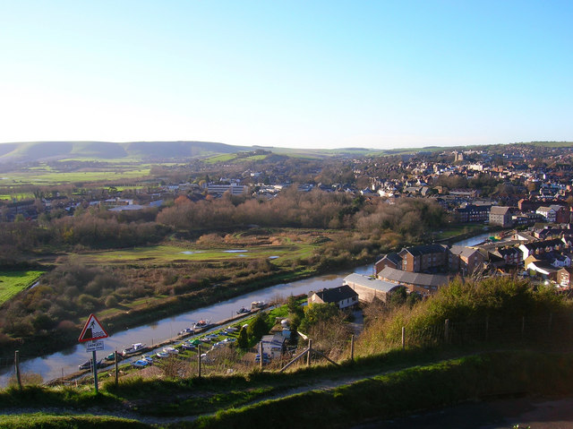
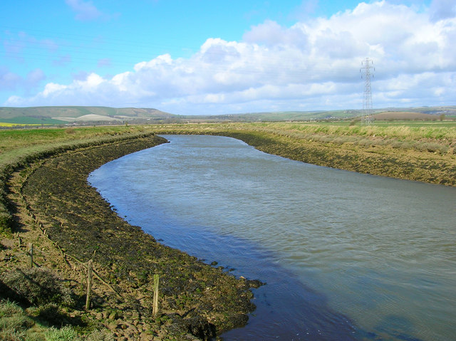
![]() A lovely walk from Lewes to Alfriston, first following the River Ouse before picking up the South Downs Way. It's a varied walk running for about 11 miles with flat riverside paths preceding some moderate climbs into the surrounding hills. From the high points there are tremendous views towards the south coast.
A lovely walk from Lewes to Alfriston, first following the River Ouse before picking up the South Downs Way. It's a varied walk running for about 11 miles with flat riverside paths preceding some moderate climbs into the surrounding hills. From the high points there are tremendous views towards the south coast.
The walk starts on the river at Cliffe, just to the east of the train station and the castle. From here you can pick up the Sussex Ouse Valley Way and follow it south past the Lewes Railway Nature Reserve to Southease. Here you pick up the South Downs Way and follow it east to Beddingham Hill and Firle Beacon. The beacon is one of the highlights of the area with wonderful views over the Weald towards the south coast. The Firle Escarpment is also a Site of Special Scientific Interest. The large area of chalkland is home to a variety of flora and fauna. Look out for the rare spider orchid Ophrys sphegodes and Exmoor Ponies as you make your way through this lovely area.
After taking in the views the route descends to Bostal Hill before coming into Alfriston.
The village is a great place for extending your exercise. You can enjoy a lovely waterside walk to Cuckmere River and Cuckmere Haven or head to the popular Seven Sisters Country Park.
You can extend the walk by heading all the way to the coast at Eastbourne on our Lewes to Eastbourne Walk.
Lewes to Alfriston Ordnance Survey Map  - view and print off detailed OS map
Lewes to Alfriston Open Street Map  - view and print off detailed map
Lewes to Alfriston OS Map  - Mobile GPS OS Map with Location tracking
Lewes to Alfriston Open Street Map  - Mobile GPS Map with Location tracking
Pubs/Cafes
At the end of the walk you can enjoy some well earned refreshments at The George Inn. The historic pub dates all the way back to the 14th century and has a charming interior with low beams and a roaring fire. Outside there's a lovely beer garden to relax in on warmer days. You can find the pub on the High Street at a postcode of BN26 5SY for your sat navs. The pub is also dog friendly if you have your canine friend with you.
Further Information and Other Local Ideas
Just a couple of miles to the south of Lewes you'll find the interesting village of Iford. The historic settlement includes 18 listed buildings, a 12th century church and a sundial marking the Greenwich meridian which runs through the village. From here you can enjoy a walk up to the viewpoint at Iford Hill on a particularly lovely section of the South Downs. On the Iford walk there's also Rodmell where you can visit the National Trust's Monk's House. The 16th-century weatherboarded cottage was once the home of author Virginia Woolfe and her husband. Next to the village there's also the Castle Hill National Nature Reserve. The significant site includes chalk grassland with ancient settlements and lots of interesting flora and fauna to see.


