Llan Ffestiniog Walks
![]()
![]() This historic village is located just south of Blaenau Ffestiniog in Gwynedd.
This historic village is located just south of Blaenau Ffestiniog in Gwynedd.
The village is surrounded by the wonderful scenery of the Snowdonia National Park, with mountains, waterfalls and lakes to explore.
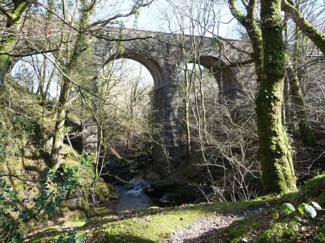
This walk from the village visits the nearby Rhaeadr Cynfal waterfalls. The falls are located just south of the settlement in the Afon Cynfal gorge. You can follow footpaths to the falls and then enjoy a riverside walk east to Bont Newydd, passing the railway viaduct over Ceunant Cynfal on the way.
To continue your waterside walking in the area head a few miles north west to the Llyn Stwlan Dam and the Tanygrisiau Reservoir.
Postcode
LL41 4PB - Please note: Postcode may be approximate for some rural locationsLlan Ffestiniog Ordnance Survey Map  - view and print off detailed OS map
Llan Ffestiniog Open Street Map  - view and print off detailed map
Llan Ffestiniog OS Map  - Mobile GPS OS Map with Location tracking
Llan Ffestiniog Open Street Map  - Mobile GPS Map with Location tracking
Walks near Llan Ffestiniog
- Blaenau Ffestiniog - This old slate mining town is located in Gwynedd in the Snowdonia National Park.
- Porthmadog - This attractive coastal town in Gwynedd has some lovely coastal walking paths and beautiful beaches to explore
- Gwydyr Forest - This large area of woodland encircles the popular village of Betws-y-Coed in the Snowdonia National Park
- Cwmorthin - This walk visit visits the Cwmorthin Quarry and the adjacent lake in Tanygrisiau, north Wales
- Maentwrog - This delightful village is located in a fine position in the Vale of Ffestiniog in Snowdonia
- Cwm Penmachno - This North Wales village sits in a remote location at the at the head of the River Machno
- Llyn Stwlan Dam - This circular walk takes you to the Llyn Stwlan Reservoir Dam near Tanygrisiau in Gwynedd, north-west Wales
- Snowdonia Slate Trail - This long circular walk explores Snowdonia's rich mining history
Pubs/Cafes
The Pengwerm is located on the village square, overlooking the Vale of Ffestiniog. The community run pub is situated in an old drovers inn. They serve a fine Sunday lunch and also provide rooms if you would like to stay in the area.
You can find them at postcode LL41 4PB for your sat navs. The pub is dog friendly.
Further Information and Other Local Ideas
The village is located on the Snowdonia Slate Trail, a long distance circular walk which explores the historical mining areas of the national park. The trail is a good option for extending your exercise in the area.


