Llanfrynach Walks
![]()
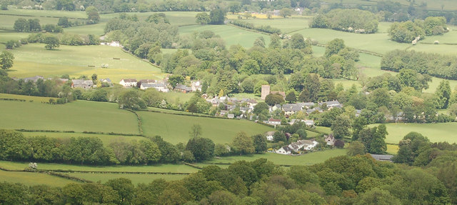
![]() This Powys village is located in a nice spot for walks along the Monmouthshire and Brecon Canal and the Taff Trail. The latter is also suitable for cyclists.
This Powys village is located in a nice spot for walks along the Monmouthshire and Brecon Canal and the Taff Trail. The latter is also suitable for cyclists.
This circular walk from the village visits the canal, the Grade II listed Cefn Brynich Canal Bridge Aqueduct and the neighbouring village of Pencelli.
Along the way there's some splendid views of the hills and mountains of the Brecon Beacons National Park.
Llanfrynach Ordnance Survey Map  - view and print off detailed OS map
Llanfrynach Open Street Map  - view and print off detailed map
Llanfrynach OS Map  - Mobile GPS OS Map with Location tracking
Llanfrynach Open Street Map  - Mobile GPS Map with Location tracking
Walks near Llanfrynach
- Pencelli - This Powys based village sits in a lovely canalside location with walkers able to enjoy the scenery of the Usk Valley and Brecon Beacons National Park.
- Brecon - This circular walk from the town of Brecon takes you along the Monmouthshire and Brecon Canal and the River Usk
- Taff Trail - Follow the River Taff, from Cardiff to Brecon, on this fantastic waterside cycling and walking route.
You start on the River Taff in Cardiff and head along the river northwards passing the Millennium Stadium and Cardiff Castle - Talybont Reservoir - This circular cycling and walking route takes you around the lovely Talybont Reservoir in the Brecon Beacons National Park
- Monmouthshire and Brecon Canal - Follow the Monmouthshire and Brecon Canal from Brecon to Newport on this super waterside walking and cycling route
- Pen Y Fan - Climb the highest peak in South Wales and southern Britain on this stunning walk in the Brecon Beacons National Park.
This is a challenging climb to the 2906 feet (886m) summit but the footpaths are generally very good for most of the walk.
You start at the car park at Pont ar Daf about 10 miles north of Merthyr Tydfil - Blaen y Glyn Waterfalls - This walk visits a series of beautiful waterfalls on the River Caerfanell near Talybont Reservoir in the Brecon Beacons
- Usk Valley Walk - This super waterside walk follows the River Usk, the Monmouthshire and Brecon Canal and the Brecon and Newport Canal from Caerleon to Brecon
- Pen y Crug - This walk climbs to the ancient hill fort and viewpoint on Pen-y-crug hill in Powys in the Brecon Beacons.
Further Information and Other Local Ideas
For more walking ideas in the area see the Brecon Beacons Walks page.
Photos
Aqueduct over the Afon Wysg-River Usk at Cefn-Brynich. Monmouthshire and Brecon Canal at Cefn-Brynich include the early 19th-century stone aqueduct of four arches and two cutwaters at Cefn Brynich which carries the canal across the river Usk, near the probably 18th-century stone-built Lock Road Bridge with its four massive arches and cutwaters.


