Miller's Dale Walk
![]()
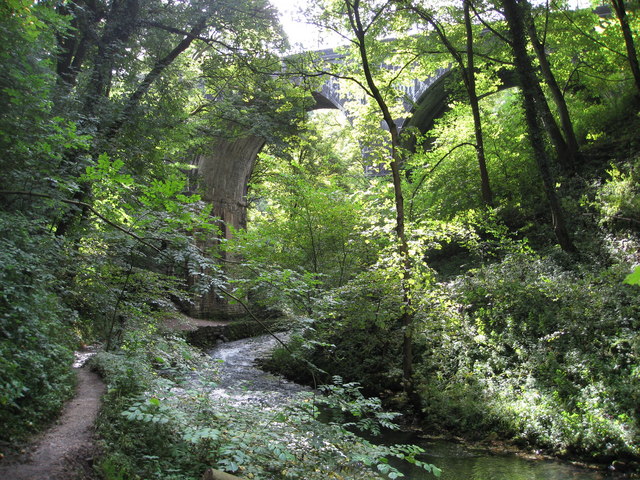
![]() This popular beauty spot on the River Wye is one of the highlights of the Peak District National Park. There's shady wooded valleys, rushing rivers and lots of interesting flora and fauna to look out for on the way. This circular walk takes in Miller's Dale, Tideswell Dale and Monk's Dale. You'll also visit the 18th century Litton Mill and the village of Tideswell. Highlights on the route include the impressive Monsal trail viaduct and the limestone scenery in Tideswell Dale.
This popular beauty spot on the River Wye is one of the highlights of the Peak District National Park. There's shady wooded valleys, rushing rivers and lots of interesting flora and fauna to look out for on the way. This circular walk takes in Miller's Dale, Tideswell Dale and Monk's Dale. You'll also visit the 18th century Litton Mill and the village of Tideswell. Highlights on the route include the impressive Monsal trail viaduct and the limestone scenery in Tideswell Dale.
The walk starts from the Miller's Dale car park. From here you can pick up the Monsal Trail to take you east towards Litton Mill. The mill was notorious for it's terrible treatment of the child workers. It has now been converted into apartments. You can virtually explore this part of the Monsal Trail using the google street view link below.
At the mill the route then turns north following path through Tideswell Dale to the large village of Tideswell. This section is quite challenging with the village sitting in an elevated position of over 1000ft. Tideswell is a good place to stop for refreshments with plenty of pubs and cafes to choose from.
From Tideswell you head west to Monk's Dale, part of the Derbyshire Dales National Nature Reserve. You head south through the woodland of the dale, leading you back to the car park.
Postcode
SK17 8SN - Please note: Postcode may be approximate for some rural locationsMiller's Dale Ordnance Survey Map  - view and print off detailed OS map
Miller's Dale Open Street Map  - view and print off detailed map
*New* - Walks and Cycle Routes Near Me Map - Waymarked Routes and Mountain Bike Trails>>
Miller's Dale OS Map  - Mobile GPS OS Map with Location tracking
Miller's Dale Open Street Map  - Mobile GPS Map with Location tracking
Explore the Area with Google Street View 
Pubs/Cafes
Head to the Millers Dale Station Cafe for some refreshments after your walk. The cafe is located in the old rail station and serves a good range of meals and snacks. There's seating indoors and outside if the weather is good. The cafe is located just to the east of Chee Dale next to the Millers Dale car park at a postcode of SK17 8SN for your sat navs.
For a pub lunch the Anglers Rest is a popular place. This 18th-century, ivy-covered pub has a charming interior with oak beams and a roaring fire. The pub is located right next to the river so you can sit outside and enjoy views of the Dale with your meal. You can find the pub at postcode SK17 8SN for your sat navs.
Dog Walking
The woodland and river paths in the Dale are ideal for dog walknig so you'll probably pass other dogs on your visit. The Station Cafe and Anglers Rest mentioned above are also dog friendly.
Further Information and Other Local Ideas
The Limestone Way and Pennine Bridleway long distance trails pass close to Monk's Dale. You can pick up the trails to extend your walk.
Continuing east along the Monsal Trail will take you to Cressbrook Dale, Monsal Head and Monsale Dale. Heading west takes you to Chee Dale and Wye Dale with the popular spa town of Buxton just beyond.
Our Monsal Trail Circular Walk starts from the same car park and uses part of the trail before visiting Monsal Dale and the village of Taddington.
The circular Chelmorton Walk visits the area from the village to the south. The village includes an ancient 11th century church and a fine 18th century pub.
For more walking ideas in the area see the Buxton Walks and Peak District Walks pages.


