Ramsbury Walks
![]()
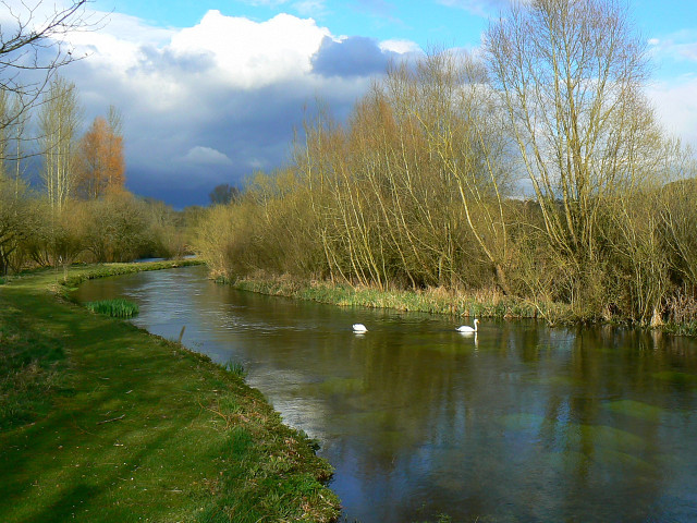
![]() This walk from the Wiltshire village of Ramsbury takes you along the River Kennet to the neighbouring village of Axford.
This walk from the Wiltshire village of Ramsbury takes you along the River Kennet to the neighbouring village of Axford.
You'll pass through Ramsbury Manor Park where there's woodland trails, a pretty lake and nice views of the countryside of the River Kennet valley.
The village itself is very pretty with idyllic cottages and a fine old pub to relax in after your exercise. You can extend the walk by continuing west along the River to Mildenhall and Marlborough.
Postcode
SN8 2PE - Please note: Postcode may be approximate for some rural locationsRamsbury Ordnance Survey Map  - view and print off detailed OS map
Ramsbury Open Street Map  - view and print off detailed map
Ramsbury OS Map  - Mobile GPS OS Map with Location tracking
Ramsbury Open Street Map  - Mobile GPS Map with Location tracking
Pubs/Cafes
Back in the village The Bell is a good choice for some post walk refreshment. The former coaching inn has some history, dating back 300 years and with some fine old oak beams inside. They serve high quality dishes with produce from their own kitchen garden. They also have a nice garden area for warmer days. You can find them on the Square at postcode SN8 2PE for your sat navs.
Dog Walking
The country and woodland trails on the Ramsbury Estate make for a fine dog walk. The Bell mentioned above is also very dog friendly.
Further Information and Other Local Ideas
The expansive Savernake Forest is located near the village. There's miles of good walking and cycling trails here to explore.
The little village of Chilton Foliat lies just to the east. It's a lovely place for a stroll with several pretty thatched cottages, wildlife rich marshland and nice views of the River Kennet which runs through the settlement. Near here you can also visit Littlecote House, another of the area's highlights. The house dates from the mid 16th century and is surrounded by beautiful parkland and gardens. There's also a wonderful ancient Roman mosaic and the opportunity to enjoy afternoon tea at the historic house which is now run as an hotel.
For more walking ideas in the area see the North Wessex Downs Walks and the Wiltshire Walks page.
Cycle Routes and Walking Routes Nearby
Photos
Ramsbury: Oxford Street. Looking north-eastwards from The Square up Oxford Street, there is a fine old yellow and black AA & MU road sign on the wall of the house on the left. It reads: "Aldbourne 3 RAMSBURY. Marlborough 7 London 68 Erected by the A.A. & M.U." The M.U. was the Motor Union and amalgamated with the Automobile Association around 1910, which gives a clue to the sign's age. Curiously, and possibly because it is in a different county to Ramsbury, Hungerford in Berkshire, which is only 5 miles away, did not warrant a mention on the sign.
Ramsbury: River Kennet bridge. This is a mallard's eye view of the new bridge over the Kennet taking the road to Froxfield south out of the town. Old Victorian Ordnance Survey maps show that at that time only a ford and a footbridge crossed at this point. The bridge, although functional, is hardly a thing of beauty.
This is the High Street with an old red telephone box, but with a rare old blue enamel sign above, on the corner of the building. Looking at old photographs of Ramsbury in the Francis Frith collection, it is evident that the centre of the town here, in The Square at the junction of the High Street, Oxford Street, Scholard's Lane and Back Lane, has historically been dominated by a large tree. Apparently it was an ancient wych elm that was eventually felled in 1986 because it had become too dangerous, and the current tree, which is an oak, was planted in its place the same year. There is a fine old pre-Worboys Report road sign on the building on the right. The A419 has long since disappeared from the road numbering system around here with the road between Swindon and Hungerford now downgraded to the B4192. The A419 still exists of course, but now only starts at Junction 15 of the M4 Motorway near Swindon heading north-westwards.
Ramsbury, Scholard's Lane. The early evening sun catches the inn sign and the whitewashed wall of an outbuilding of The Bell public house in this view looking, as the fine old pre-Worboys Committee sign says, towards Hungerford.


