Ravenglass Circular Beach Walk
![]()
![]() This coastal Cumbrian village is a great place for riverside, estuary and beach walking.
This coastal Cumbrian village is a great place for riverside, estuary and beach walking.
It is part of the Copeland District of the county and is notable as the only coastal village in the Lake District National Park. Ravenglass is located on no fewer than three river estuaries in the shape of the rivers Esk, Mite and Irt.
Also of interest is the wonderful Ravenglass and Eskdale Railway. The heritage steam railway will take you from the village to Dalegarth for Boot station, passing across the estuary and through the hills with some glorious scenery to enjoy on the way.
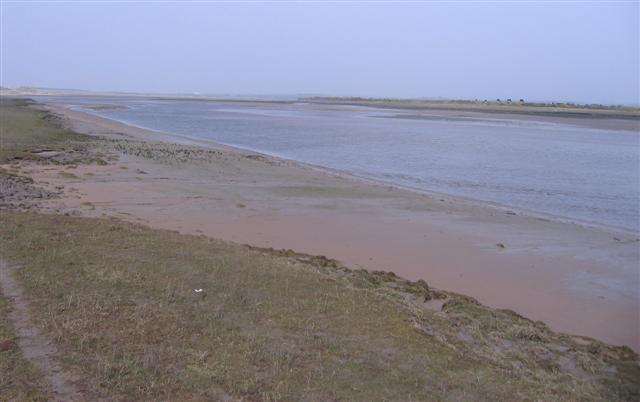
This circular walk from the village visits the Drigg Beach and River Irt Estuary Nature Reserve located just to the west of the settlement. You can follow a section of the waymarked Cumbria Coastal Way to the beach, passing Drigg village on the way. At the reserve you will find the lovely Eskmeals Dunes where there's grassland dunes, saltmarsh and lots of interesting flora and fauna to see. In the summer months look out for pretty wildflowers and birds including ringed plover, skylark and wheatear. You can often see butterflies fluttering around the flowers too.
On the estuary there's lots of waders, such as ringed plover, curlew and oystercatcher, alongside ducks like wigeon and goldeneye.
The site includes a 2.5 mile circular walk but is only accessible at low tide. Please check tide times before you start the walk.
To continue your walking around Ravenglass enjoy a climb to the viewpoint at Muncaster Fell and pay a visit to the striking Muncaster Castle.
Please scroll down for the full list of walks near and around Ravenglass. The detailed maps below also show a range of footpaths, bridleways and cycle paths in the area.
Ravenglass Ordnance Survey Map  - view and print off detailed OS map
Ravenglass Open Street Map  - view and print off detailed map
*New* - Walks and Cycle Routes Near Me Map - Waymarked Routes and Mountain Bike Trails>>
Ravenglass OS Map  - Mobile GPS OS Map with Location tracking
Ravenglass Open Street Map  - Mobile GPS Map with Location tracking
Walks near Ravenglass
- Ravenglass to Eskdale - This walk from Ravenglass takes you to the beautiful Eskdale in the Lake District National Park
- Eskdale - Explore beautiful Eskdale and enjoy waterside paths along the rushing River Esk on this varied route
- Stanley Ghyll Force - This lovely walk in Eskdale takes you to Stanley Ghyll Force Waterfall
- Swinside Stone Circle - This walk visits the Swinside Stone Circle north of Millom in Cumbria.
- Wast Water - Enjoy a circular walk around one of the most stunning lakes in the Lake District National Park.
- Devoke Water - This walk visits Devoke Water, the largest tarn in the Lake District
- Hodbarrow Lakes Nature Reserve - Enjoy a walk around Hodbarrow Lakes RSPB on the edge of the Lake District National Park
- Seascale - This Cumbrian village is located on the coast on the edge of the Lake District National Park.
- Haverigg - This Cumbrian village lies in a scenic spot at the mouth of the Duddon Estuary.
- Illgill Head - This circular walk climbs to Whin Rigg and Illgill Head above Wast Water in the Lake District
Pubs/Cafes
The Ratty Arms is a good choice for some refreshments after your exercise. The friendly pub is situated in a great spot on the platform of Ravenglass for Eskdale Rail Station. It's an attractive spot with the opportunity to watch the old trains roll into the station while you enjoy a meal. You can find them at postcode CA18 1SN for your sat navs.
Photos
Ravenglass Station on the Eskdale railway. The new diesel unit "Douglas Ferreria" at the business end of the train now waiting.


