Walk around Silsden - Reservoir and Country
![]()
![]() This West Yorkshire town is positioned on the River Aire and Leeds and Liverpool Canal near Skipton and Keighley.
This West Yorkshire town is positioned on the River Aire and Leeds and Liverpool Canal near Skipton and Keighley.
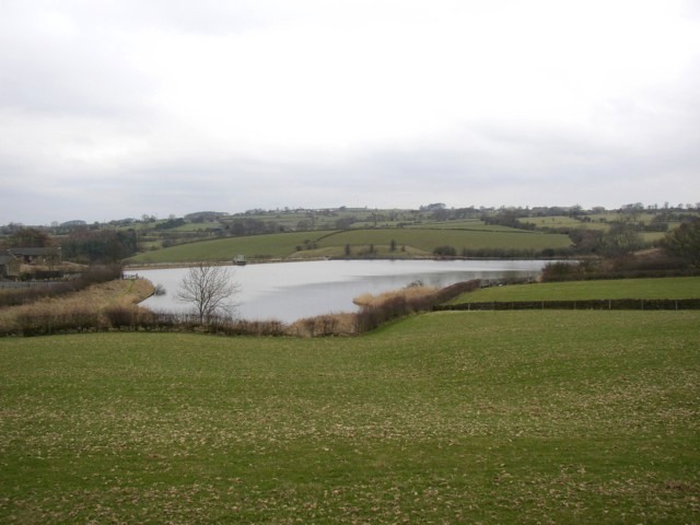
This circular walk around the town heads through the countryside around Silsden Reservoir to the north of the settlement.
The walk starts on the eastern side of the town where you can pick up the Bradford Millennium Way. Follow the waymarked footpath north and it will take you towards Silsden Moor and Dales Bank Farm. Here you head east to cross the Great Gill Beck before turning south towards Swartha. Near here you pick up the Millennium Way again and head west back to the town.
You can extend the walk by continuing south to pick up the Leeds and Liverpool Canal and enjoy a waterside stroll through the town.
Postcode
BD20 0JY - Please note: Postcode may be approximate for some rural locationsSilsden Ordnance Survey Map  - view and print off detailed OS map
Silsden Open Street Map  - view and print off detailed map
Silsden OS Map  - Mobile GPS OS Map with Location tracking
Silsden Open Street Map  - Mobile GPS Map with Location tracking
Walks near Silsden
- Bradford Millennium Way - This long distance, waymarked circular walk takes you on a tour of some of most beautiful countryside, pretty villages and attractive moorland in the Bradford area of West Yorkshire.
The walk starts on Shipley Green, just north of Shipley town centre - Silsden to Skipton Canal Walk - Enjoy and easy waterside stroll along the Leeds and Liverpool Canal on this walk from Silsden to Skipton
- Skipton Canal - This is a popular walk from Skipton to Gargrave along the Leeds and Liverpool Canal
- Ilkley to Addingham - This circular walk takes you from Ilkley to Addingham along the River Wharfe
- Bolton Abbey - Explore the huge estate surrounding the ruins of this 12th-century Augustinian monastery
- Cow and Calf and Twelve Apostles - This circular walk visits two of the higlights of Ilkley Moor and Burley Moor in West Yorkshire.
The walk starts from the Cow and Calf parking area on Hangingstone Road, just to the south east of the town of Ilkley - Burley in Wharfedale - This Yorkshire based village is in a great spot for exploring the famous Ilkley Moor and the beautiful Wharfedale
- Leeds and Liverpool Canal - Enjoy waterside cycling and walking along Britain's longest single canal
- Keighley - This circular walk from the West Yorkshire town of Keighley makes use of the waymarked Worth Way to visit nearby Haworth and Penistone Hill Country Park
- Embsay Reservoir - Enjoy a short stroll around this reservoir in North Yorkshire
- Beamsley Beacon - This short climb in the Yorkshire Dales visits Beamsley Beacon which is also known as Howber Hill
- Shipley Glen - Enjoy a short walk through this delightful glen near Bradford
- Horton Bank Country Park - This pretty country park in Bradford has some well laid out walking trails to try.
- Chellow Dene Reservoir - Visit this lovely beauty spot on the outskirts of Bradford on this easy circular walk in West Yorkshire
- Sutton in Craven - This North Yorkshire based village is located near Keighley and Skipton in the Craven District of the county.
Pubs/Cafes
The Kings Arms is a friendly pub with a good selection of real ales. You can find them on Bolton Road at postcode BD20 0JY for your sat navs.
Dog Walking
The country trails make for a fine dog walk and the Kings Arms mentioned above is also dog friendly.
Further Information and Other Local Ideas
Just to the east you can pick up the circular Ilkley to Addingham Walk and enjoy a walk along the River Wharfe.
To the west there's Sutton in Craven where you can enjoy a climb to Lund's Tower and Wainman's Pinnacle. Known locally as the Salt and Pepper Pots there's fine views over the area from the elevated position of the monuments.
For more walking ideas in the area see the Yorkshire Dales Walks page.
Photos
Great Gill Beck north of the town. To the right is a 'window' through the trees into the brighter field behind.


