Spurn Point Walk
![]()
![]() This walk explores the splendid Spurn Point National Nature Reserve on the tip of the coast of the East Riding of Yorkshire. The narrow sand spit stretches for over 3 miles into the the Humber estuary. It's a special place, perfect for a coastal walk or cycle with dramatic scenery and huge variety of wildlife. There's much to enjoy with pretty beaches, sand-dunes, marshland and the striking effects of the changing tides.
This walk explores the splendid Spurn Point National Nature Reserve on the tip of the coast of the East Riding of Yorkshire. The narrow sand spit stretches for over 3 miles into the the Humber estuary. It's a special place, perfect for a coastal walk or cycle with dramatic scenery and huge variety of wildlife. There's much to enjoy with pretty beaches, sand-dunes, marshland and the striking effects of the changing tides.
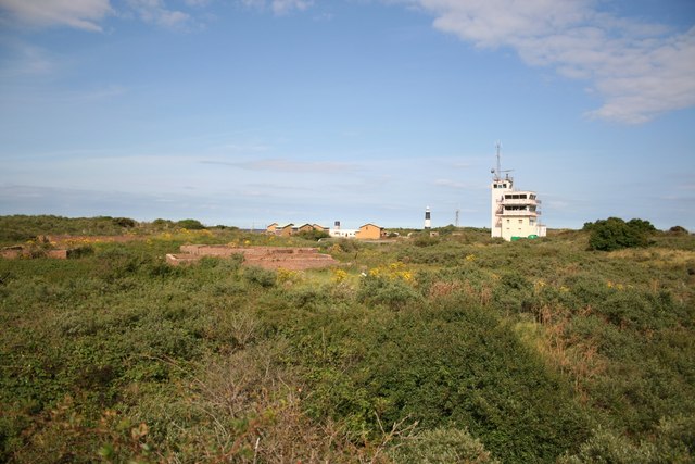
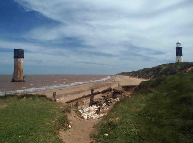
You can park at the car park at Kilnsea to start your walk/ride. Then head south passing the Spurn Bird Observatory and Kilnsea Warren, with fine views across Kilnsea Clays. You continue along the peninsula to Spurn Head at the tip of the reserve. Here you will find the RNLI lifeboat station and two disused lighthouses.
As you make your way through the reserve look out for a large variety of birdlife. This includes rare birds such as the cliff swallow from North America, a lanceolated warbler from Siberia and a black-browed albatross from the Southern Ocean. More common birds include wheatears, whinchats, common redstarts and flycatchers. Several thousand birds can be seen in and around the reserve on a good day. You may also spot common seals and grey seals feeding and interacting in the month of September. It's a wonderful sight as the seals come right up to the coast so you can spot them without the need for binoculars.
NB please check tide times before visiting the reserve as it is dangerous to walk to the end of the spit at high tide.
To continue your exercise in the Hull area you could visit Humber Bridge Country Park and enjoy great views over the River Humber to Barton Upon Humber.
The Trans Pennine Trail also runs through Hull so you could pick up the trail and enjoy a waterside walk along the Humber to Hessle.
If you head up the coast to Hornsea you can enjoy a walk along the pretty Hornsea Mere which is another great place for birdwatching.
Postcode
HU12 0UH - Please note: Postcode may be approximate for some rural locationsSpurn Point Ordnance Survey Map  - view and print off detailed OS map
Spurn Point Open Street Map  - view and print off detailed map
*New* - Walks and Cycle Routes Near Me Map - Waymarked Routes and Mountain Bike Trails>>
Spurn Point OS Map  - Mobile GPS OS Map with Location tracking
Spurn Point Open Street Map  - Mobile GPS Map with Location tracking
Explore the Area with Google Street View 
Pubs/Cafes
The Discovery Centre cafe is located at the site and provides a good range of meals and snacks. There's great views across the estuary from the cafe too.
Dog Walking
Dogs are not allowed in the nature reserve but there are walks further up the coast for you and your pet. The cafe mentioned above is dog friendly.
Further Information and Other Local Ideas
A few miles to the west of Honrsea there's the lovely Tophill Low Nature Reserve to explore. The reserve includes two pretty reservoirs and easy footpaths along the River Hull. It's another great place for birdwatching with several hides dotted around the site. Near here is also the worthy vlllage of Brandesburton with its medieval church and historic 16th century pub
Head north and you could visit the seaside town of Withernsea.
Cycle Routes and Walking Routes Nearby
Photos
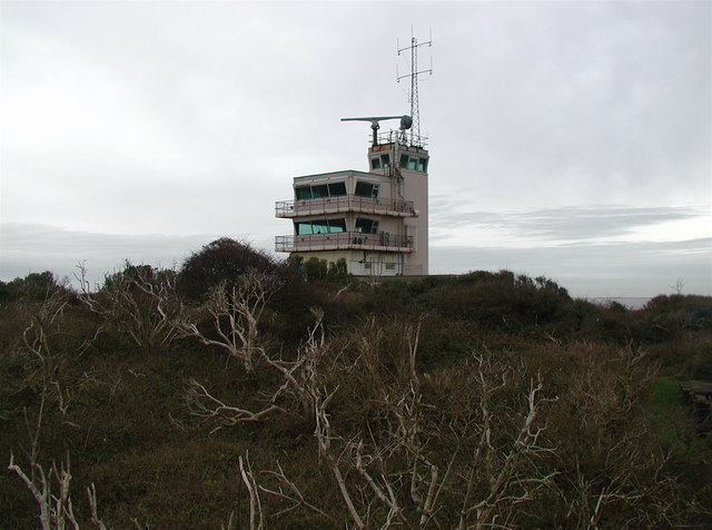
The view from the car park looking towards the lifeboat and pilot station. The lifeboat station was built in 1810. Due to the remote location, houses for the lifeboat crew and their families were added a few years later. The station is now one of only a very few in the UK which has full-time paid staff (the others all being on the River Thames in London).
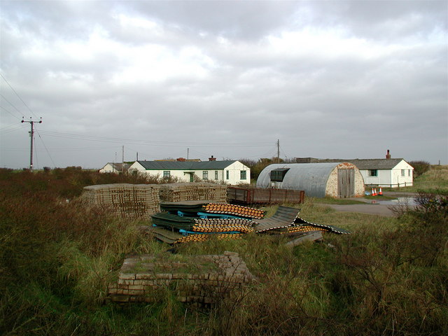
Warren Head, Spurn. The northern end of Spurn Peninsula, home to the Spurn Bird Observatory and the Yorkshire Wildlife Trust Information Centre. In the foreground are plastic rafts and concrete sets tied together with steel cables, used to replace sections of the road to Spurn Point whenever it gets washed away by the sea. This bird observatory is used for monitoring migrating birds and providing accommodation to visiting birdwatchers. The migration of the birds is assisted by east winds in autumn sometimes leading to a spectacular "fall" of thousands of birds. You can often see wheatears, whinchats, common redstarts and flycatchers in the area. Rarer bird sightings include a cliff swallow from North America, a lanceolated warbler from Siberia and a black-browed albatross from the Southern Ocean.


