Walks Near Hull - Canals, Coast and Country
![]()
![]() This Yorkshire port city has some fine riverside trails and pictureque local parks to explore on foot.
This Yorkshire port city has some fine riverside trails and pictureque local parks to explore on foot.
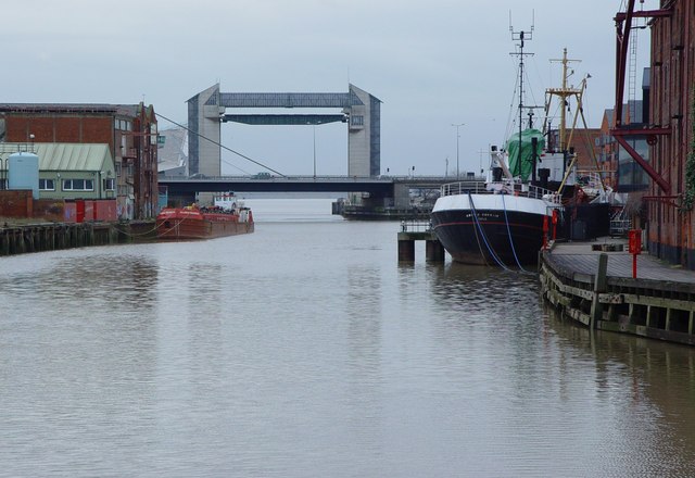
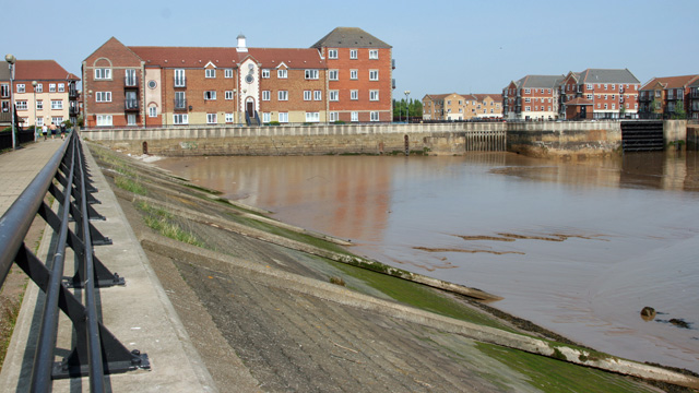
This walk from the Paragon train station follows a section of the Trans Pennine Trail along the docks on the River Humber. On the way you'll cross the River Hull and visit the Victoria Docks and the adjacent Victoria Park. The route then continues to Alexandra Dock and King George Dock.
Walk highlights include The Deep, a huge aquarium with over 3500 fish. You can find them at Sammy's Point, at the confluence of the River Hull and the Humber Estuary just after you cross the River Hull.
See the video below for a virtual walk taking you to the historic buildings and landmarks in this fascinating city.
Please scroll down for the full list of walks near and around Hull. The detailed maps below also show a range of footpaths, bridleways and cycle paths in the area.
Postcode
HU1 3QX - Please note: Postcode may be approximate for some rural locationsHull Ordnance Survey Map  - view and print off detailed OS map
Hull Open Street Map  - view and print off detailed map
*New* - Walks and Cycle Routes Near Me Map - Waymarked Routes and Mountain Bike Trails>>
Hull OS Map  - Mobile GPS OS Map with Location tracking
Hull Open Street Map  - Mobile GPS Map with Location tracking
Walks near Hull
- Hessle Foreshore Walk - This walk takes you along a section of the Trans Pennine Trail from Hessle to Hull in East Riding of Yorkshire
- Beverley Beck - Enjoy a short stroll along the Beverley Beck on this easy walk in the Yorkshire town
- Beverley Twenty - This 20 mile walk runs from Hessle to Beverley through the Yorkshire wolds.
The walk starts near Hull in Hessle, at Humber Bridge Country Park and takes you to the Humber Estuary with fine views of the Humber Bridge - River Hull - Enjoy a walk along the Beverley Beck and the River Hull on this pleasant waterside walk in Beverley
- Humber Bridge - Follow the footpath across the Humber Bridge and enjoy fine views over the River Humber and the city of Hull in East Riding of Yorkshire
- Hornsea Mere - Enjoy a walk along this lovely freshwater lake in the seaside town of Hornsea
- Humber Bridge Country Park - This Country Park and Local Nature Reserve consists of woods, meadows, ponds and cliffs
- Welton Dale - A circular walk around Welton Dale in East Riding of Yorkshire
- Blacktoft Sands - Enjoy a circular walk around this pretty RSPB nature reserve
- Burton Constable - Explore the extensive parks and gardens of this Elizabethan country house near Hull
- Market Weighton Canal - Follow the Market Weighton Canal from the town of Market Weighton to the Humber Estuary on this waterside walk in the East Riding of Yorkshire.
Starting in the town centre follow the Weighton Beck south west for about 1.5 miles and you will join with the canal - Market Weighton Circular Walk - This circular walk around Market Weighton makes use of the Yorkshire Wolds Way to take you on a tour of the countryside, woodland, lakes and parkland surrounding the East Riding town
- Londesborough Park - Enjoy a lovely stroll through the Londesborough Estate on this short walk near Pocklington, in the East Riding of Yorkshire
- Normanby Hall Country Park - Explore the three hundred acres of parkland and woodland surrounding the 19th century Normanby Hall
- Scunthorpe - The industrial Lincolnshire town of Scunthorpe has some nice local parks and woodland to explore on foot.
- Keadby Canal - This circular walk takes you along a section of the Stainforth and Keadby Canal in Crowle, Lincolnshire
- Spurn Point - This walk explores the splendid Spurn Point National Nature Reserve on the tip of the coast of the East Riding of Yorkshire
- Cottingham - This village is located in East Riding of Yorkshire on the edge of the Yorkshire Wolds near Hull
- Barton Upon Humber - This Lincolnshire based market town sits in a nice location for waterside walks on the banks of the Humber Estuary.
- Withernsea - This coastal village in East Riding of Yorkshire has some nice beach walks to enjoy
Pubs/Cafes
The Humber Dock is in a great location with fine views across the marina. They serve good food at reasonable prices. You can find them at 9 Humber Dock Street with postcode HU1 1TB for your sat navs.
Further Information and Other Local Ideas
To continue your walking in the area follow the river trail west to Hessle on the popular Hessle Foreshore Walk. Here you can visit the iconic Humber Bridge and the adjacent Humber Bridge Country Park. On the opposite side of the river there's a similar walk along the Humber foreshore at Barton Upon Humber.
Photos
On the Bank of the River Humber. This footpath runs eastwards from Hull City's 'Old Town'. Hull's eastern docks and the chemical works at Saltend can be seen in the distance.
The Deep. This massive aquarium is one of the major tourist attractions in the city. There's over 3000 creatures, including sharks and sawfish, plus an evening restaurant. In 2013, the aquarium was voted the best family place to visit in Hull.


