Stainforth Force Walk
![]()
![]() Enjoy a short walk to Stainforth Force waterfall from the North Yorkshire village of Stainforth.
Enjoy a short walk to Stainforth Force waterfall from the North Yorkshire village of Stainforth.
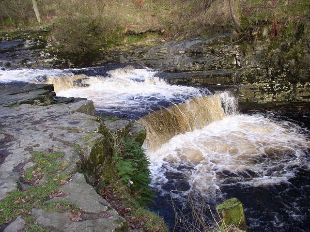
Start the walk from the main parking area in the village and head west, crossing the bridge over the river. Just to the south of the bridge you will find the pretty falls. Here the River Ribble falls over a series of limestone ledges into a deep, broad pool. In October you can see leaping Salmon on their annual migration up the River Ribble.
The falls are located very close to Catrigg Force which you can easily reach from the village. Just head east along the Stainforth Beck and you will soon reach the beauty spot which includes 2 main drops of about 20 feet and a series of smaller waterfalls.
You could also pick up the Settle Caves and Waterfalls Walk and visit Scaleber Force, a few miles to the south east of Stainforth. The Settle Riverside Walk will take you from neighbouring Settle to Stainforth along the Ribble Way. You can also visit the pretty village of Giggleswick can also be visited in this area.
Postcode
BD24 9QD - Please note: Postcode may be approximate for some rural locationsStainforth Force Ordnance Survey Map  - view and print off detailed OS map
Stainforth Force Open Street Map  - view and print off detailed map
*New* - Walks and Cycle Routes Near Me Map - Waymarked Routes and Mountain Bike Trails>>
Stainforth Force OS Map  - Mobile GPS OS Map with Location tracking
Stainforth Force Open Street Map  - Mobile GPS Map with Location tracking
Pubs/Cafes
The Craven Heifer Hotel is a great choice for some post walk refreshments. They have three real fires indoors for colder days. Outside there's a covered beer garden with a flowing stream feeding into the River Ribble. It's a lovely spot to relax in on warmer days. You can find the pub in the village on the Main Road with a postcode of BD24 9PB for your sat navs. They are also very dog friendly if you have your canine friend with you.
Further Information and Other Local Ideas
In the village you can pick up the Ribble Way and follow the river path north to visit the neighbouring village of Horton in Ribblesdale. The village is often used as the start point for the Yorkshire Three Peaks which includes Whernside, Ingleborough Mountain and Pen y ghent. The latter is particularly close to the village and many climbs begin from Horton. Our walk from the village visits Stainforth before climbing to the nearby Winskill Stones Nature Reserve where there is some wonderful limestone pavement and fine views of the area. The stones are located just to the south east of Stainforth and another good option for walkers.
Head west of Stainforth and you could pay a visit to Feizor. It's a lovely hidden gem of a place with fine limestone scenery and a delightful local tea room with a falconry. The circular Feizor Walk starts from the hamlet and visits Austwick before heading to the falls.
For more walking ideas in the area see the Yorkshire Dales Walks page.
Cycle Routes and Walking Routes Nearby
Photos
Knight Stainforth Bridge, a 17th- or 18th-century packhorse bridge over the River Ribble between Stainforth and Little Stainforth


