Staithes to Runswick Bay Walk
![]()
![]() This short coastal walk follows a lovely section of the Cleveland Way National Trail from Staithes to Runswick Bay. The walk is just over 3 miles, running along the waymarked path along the spectacular cliff tops.
This short coastal walk follows a lovely section of the Cleveland Way National Trail from Staithes to Runswick Bay. The walk is just over 3 miles, running along the waymarked path along the spectacular cliff tops.
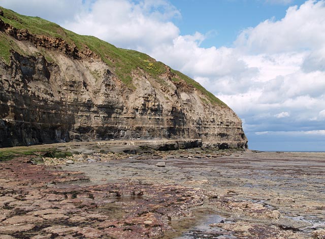
The walk starts at the picturesque harbour in Staithes and heads south along the path towards Beacon Hill. Shortly after you come to the lovely hamlet of Port Mulgrave. The area is well known for its geology with Jurassic (Lias), strata cliffs and fossils of ammonites to be found.
The route then passes Rosedale cliffs before coming into Runswick Bay. The delightful fishing village is a highlight of the Yorkshire coast with its sandy beach, sheltered bay and pretty little cottages.
The white thatched property on the seafront is the only remaining thatched house on the Yorkshire coast. You can enjoy refreshments at one of the many cafes or hotels with lovely views over the bay.
The walk can be extend by continuing along the coast to Sandsend. Here there are some nice woodland trails to try in Mulgrave Woods.
Staithes to Runswick Bay Ordnance Survey Map  - view and print off detailed OS map
Staithes to Runswick Bay Open Street Map  - view and print off detailed map
Staithes to Runswick Bay OS Map  - Mobile GPS OS Map with Location tracking
Staithes to Runswick Bay Open Street Map  - Mobile GPS Map with Location tracking
Further Information and Other Local Ideas
The Runswick Bay to Kettleness Circular Walk will take you to Kettleness on the cliff top path before returning along an inland dismantled railway line.


