Upton Heath Walks
![]()
![]() This local nature reserve is located in the Corfe Mullen/Broadstone/Creekmoor area of Poole in Dorset.
This local nature reserve is located in the Corfe Mullen/Broadstone/Creekmoor area of Poole in Dorset.
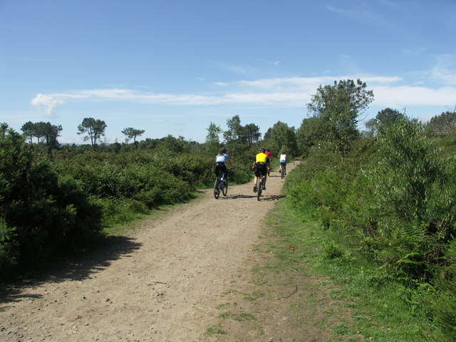
There's a network of footpaths including a bridleway along the trackbed of the old Southampton to Dorchester Railway in the southern part of the reserve. The site includes woodland, heathland, sandy paths, gorse and tranquil lakes with lots of wildlife to see as well. Look out for Dartford Warbler, Nightjar and Stonechat as you make your way across the heath. There are also fine views towards Poole Harbour and Corfe Castle from the high points.
You can start the walk from the parking area off Springdale Road at the northern end of the reserve. Then follow footpaths south to the viewpoint, Beacon Hills Clay Pits, lakes and the dismantled railway at the southern end.
Postcode
BH21 3RX - Please note: Postcode may be approximate for some rural locationsPlease click here for more information
Upton Heath Ordnance Survey Map  - view and print off detailed OS map
Upton Heath Open Street Map  - view and print off detailed map
Upton Heath OS Map  - Mobile GPS OS Map with Location tracking
Upton Heath Open Street Map  - Mobile GPS Map with Location tracking
Further Information and Other Local Ideas
The heath is located just north of Upton Country Park where there are more nice trails to try.
The popular Castleman Trailway also passes the eastern part of the heath. You could follow it north on the Corfe Mullen Walk to visit the pretty Delph Woods Nature Reserve. The peaceful woods include a pretty stream and lots more wildlife. The expansive Canford Heath can also be accessed just to the east of here.
For more walking ideas in the area see the Dorset Walks page.
Cycle Routes and Walking Routes Nearby
Photos
Upton Heath, railway trackbed. Trackbed of the previous Southampton to Dorchester Railway, in this section now a permissive bridleway through the Nature Reserve.
Lake in Upton Heath. Perhaps the trees are recent, workings were dug to get the fine sand and clay, which filled up to produce this lake, very popular with walkers and their dogs from nearby Upton.


