Wincanton Walks - Near and Around
![]()
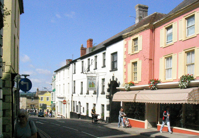
![]() This Somerset based town has some nice trails along the River Cale and a major national long distance footpath running through it. It is located near the borders of three counties and includes an attractive high street with some fine old buildings. Interestingly the town is officially twinned with Ankh-Morpork - the premier city state in author Terry Pratchett's fantasy Discworld novels.
This Somerset based town has some nice trails along the River Cale and a major national long distance footpath running through it. It is located near the borders of three counties and includes an attractive high street with some fine old buildings. Interestingly the town is officially twinned with Ankh-Morpork - the premier city state in author Terry Pratchett's fantasy Discworld novels.
This walk from the town follows a section of the epic Monarch's Way to the neighbouring villages of South Cheriton and Charlton Horethorne.
The walk starts in the town centre where you can pick up the waymarked footpath and follow it south to South Cheriton via Maltkiln Hill Farm. The route continues south west before finishing at Charlton Horethorne. It's an attractive village with a fine old church and a pretty village green.
After exploring the village and enjoying a drink at the local pub you can retrace your steps back to Wincanton.
Wincanton Ordnance Survey Map  - view and print off detailed OS map
Wincanton Open Street Map  - view and print off detailed map
Wincanton OS Map  - Mobile GPS OS Map with Location tracking
Wincanton Open Street Map  - Mobile GPS Map with Location tracking
Walks near Wincanton
- Cadbury Castle - Climb to this Iron Age hillfort on Cadbury Hill on this short walk in Somerset
- Monarch's Way - This incredible 615-mile walk approximates the escape route taken by King Charles II in 1651 after being defeated in the Battle of Worcester
- Stour Valley Way - This splendid walk takes you along the River Stour from Hengistbury Head on the Dorset south coast to Stourton in Wiltshire
- Stourhead - The 1,072 hectare (2,650 acre) Stourhead estate has miles of lovely walking trails to try. You can follow the well surfaced footpaths around the stunning lake and into the surrounding woodlands, parkland and gardens
- White Sheet Hill - Climb to the 245 m (804 ft) summit of this hill in Wiltshire and enjoy wonderful views over the Stourhead Estate and the surrounding countryside
- Leland Trail - Follow in the footsteps of royal librarian John Leland during his 16th century survey of Britain's churches and priories.
You start at King Alfred's Tower at the north-western edge of the Stourhead in Wiltshire and head west towards Bruton and Castle Cary Walk in Somerset - Wylye Way - Follow the River Wylye through Wiltshire on this interesting and varied waterside walk
- Bruton - This pleasant town in Somerset has some interesting features including a hill top 16th century Dovecote and a 15th century packhorse bridge over the River Brue, which runs through the town
- Duncliffe Wood - Explore miles of cycling and walking trails in this large area of ancient woodland near Shaftesbury
- Shaftesbury - Enjoy a short walk around the Dorset town of Shaftesbury with a climb to Gold Hill, made famous from the Hovis adverts of the 1970s
- Fontmell and Melbury Downs - Enjoy a variety of beautiful flora and fauna in this nature reserve in Compton Abbas on the Dorset/Wiltshire border
- Win Green Hill - Climb to the highest point in the Cranborne Chase AONB and enjoy wonderful views over Shaftesbury, Salisbury Plain, Glastonbury Tor, the Mendips, the Quantocks, the Purbecks and the south coast
- Wessex Ridgeway Trail - Follow the Wessex Ridgeway Trail and enjoy spectacular views of the Dorset countryside on this shared walking and cycling path.
The trail begins at Tollard Royal in Wiltshire and heads to Hambledon Hill passing through Ashmore Wood and crossing the River Iwerne on the way - Sturminster Newton - This Dorset based town has some lovely river and country walks with historic mills and local pockets of woodland to visit as well
- Hod Hill - This circular walk climbs to the Hod Hill fort from Stourpaine in Dorset.
- Corton Denham - This Somerset based village is a nice place to start a walk with two significant waymarked trails passing through the settlement.
- Penselwood - This little village in Somerset has a noteworthy 15th century church and some nice country trails to try
Pubs/Cafes
The Nog Inn is a fine place to go for some post walk refreshment in the town. The Grade II listed old pub has a charming interior with two wood burners for colder days. Outside there's a lovely walled beer garden if the sun is shining. They serve freshly cooked British pub food with some classic dishes to enjoy. You can find them on South Street at postcode BA9 9DL for your sat navs.
Dog Walking
The country trails make for a fine dog walk and the Nog Inn mentioned above is also dog friendly.
Further Information and Other Local Ideas
A few miles west of the town there's the Cadbury Castle fort to explore.
Head east into Dorset and you could pick up the Gillingham Walk to visit the splendid Stourhead.
For more walking ideas in the area see the Somerset Walks page.


