Aberglaslyn Pass Beddgelert Walk
![]()
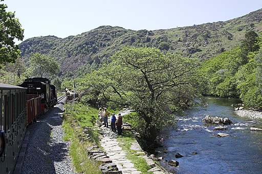
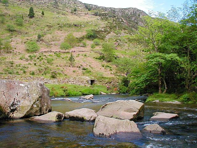
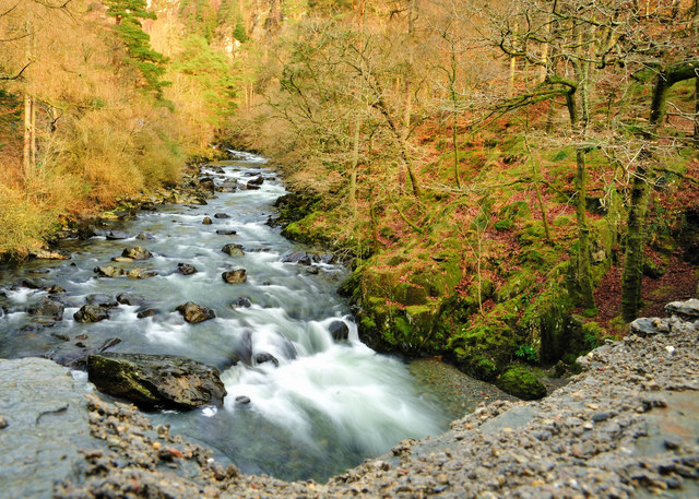
![]() This walk takes you through a stunning narrow gorge in the Snowdonia National Park. The path runs along the running waters of the River Glaslyn with waterfalls, interesting vegetation and wonderful views of the surrounding mountainous scenery. The Welsh Highland Railway runs through the pass so look out for their splendid steam trains as you go.
This walk takes you through a stunning narrow gorge in the Snowdonia National Park. The path runs along the running waters of the River Glaslyn with waterfalls, interesting vegetation and wonderful views of the surrounding mountainous scenery. The Welsh Highland Railway runs through the pass so look out for their splendid steam trains as you go.
The walk starts from the National Trust car park in Nantmor village south of Beddgelert. From here it is a short stroll to the the fisherman's path which will take you along the side of the Aberglaslyn gorge and the River Glaslyn. The path runs for just over a mile to Beddgelert with mature oak woodland and old bridges over the river to observe. The village of Beddgelert is very picturesque with a fine bridge crossing the River Colwyn and a number of good pubs for refreshment. You can of course start the walk from here if you wish.
Part of the walk uses the Fishermans Walk, a rocky path running along the river. The longer circular walk will take you to Llyn Dinas before climbing into the surrounding hills.
On the western side of the river you can extend the walk by visiting Gelert's Grave. Here you will find a memorial to the legendary wolfhound associated with the village. It's a popular local walk with the ancient St Mary's church another highlight here.
Postcode
LL55 4YF - Please note: Postcode may be approximate for some rural locationsAberglaslyn Pass Beddgelert Ordnance Survey Map  - view and print off detailed OS map
Aberglaslyn Pass Beddgelert Open Street Map  - view and print off detailed map
*New* - Walks and Cycle Routes Near Me Map - Waymarked Routes and Mountain Bike Trails>>
Aberglaslyn Pass Beddgelert OS Map  - Mobile GPS OS Map with Location tracking
Aberglaslyn Pass Beddgelert Open Street Map  - Mobile GPS Map with Location tracking
Pubs/Cafes
The Hebog Cafe & Bistro is a great place to head for refreshments after your walk. The food is excellent and there's also a lovely river terrace to sit out and enjoy the surrounding mountainous scenery in the summer months. You can find it in the centre of Beddgelert on Caernarfon Road, with postcode LL55 4UY for your sat navs.
Also near Beddgelert is the excellent Caffi Gwynant. The cafe offers a wide range of foods prepared using local produce, daily specials, homemade cakes and desserts, local ales and free wi-fi. There's also an impressive outdoor glass canopy which is dog friendly. You can find the cafe at postcode LL55 4NH.
Further Information and Other Local Ideas
If you would like to continue your walking in the area then you could climb the imposing Moel Hebog for wonderful views over the area. You could also visit the nearby Beddgelert Forest where you'll find miles of walking paths and mountain bike trails. The Lon Gwyrfai multi user path skirts the eastern edge of the forest. The trail runs between Rhyd Ddu and Beddgelert along a nice easy surfaced path.
There's also two lovely reservoirs with trails along the water and through surrounding woodland. Llyn Gwynant and Llyn Dinas are just a short distance from Beddgelert. Near the latter you can visit the site of the legend of the Red Dragon at the fascinating Dinas Emrys. There's a lovely trail with river views, waterfalls, attractive woodland and a small hill climb to the ancient ramparts of the ancient fort where there are fine views back down to the lake.
Just a few miles to the west there's the splendid Cwm Pennant to explore. This stunning valley has a number of walking trails with fine views of the Afon Dwyfor and the surrounding mountains to enjoy.
The Snowdonia Slate Trail runs through the area. You could pick up this circular route and follow it south east to visit the old quarries at Blaenau Ffestiniog and the lake at Tanygrisiau.
For more walking ideas in the area see the Beddgelert Walks and the Snowdonia Walks pages.
Cycle Routes and Walking Routes Nearby
Photos
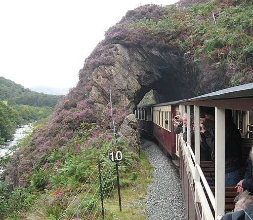
A train of the Welsh Highland Railway entering the Aberglaslyn Pass section, seen from the train. This picture was taken from the open observation car.
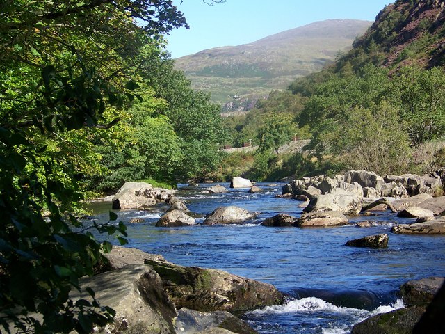
Pass of Aberglaslyn Looking across to the trackbed of the Welsh Highland Railway, re-construction of which is now progressing towards Porthmadog.
