Gelert's Grave Walk
![]()
![]() This walk visits the site of Gelert's Grave in the village of Beddgelert in the Snowdonia National Park.
This walk visits the site of Gelert's Grave in the village of Beddgelert in the Snowdonia National Park.
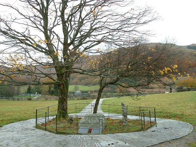
The site is located just to the south of the village and includes a memorial to a legendary wolfhound associated with the village. The plaque describes the legend of the wolfhound who was slain by his master Llywelyn the Great for the supposed crime of savaging his young child. In fact the loyal hound has been protecting the infant from the attack of another wolf.
You can follow footpaths south along the River Glaslyn towards the site which lies on the western side of the river. There's some nice footpaths around the park with views of the surrounding mountains to enjoy. On the way you'll also pass the ancient St Mary's church which has retained some of its original medieval features.
To extend the walk continue south through the wonderful scenery of the Aberglaslyn Pass on the rocky Fishermans Walk. You could also head north east to enjoy more waterside walks along the beautiful Llyn Dinas.
Gelert's Grave Ordnance Survey Map  - view and print off detailed OS map
Gelert's Grave Open Street Map  - view and print off detailed map
*New* - Walks and Cycle Routes Near Me Map - Waymarked Routes and Mountain Bike Trails>>
Gelert's Grave OS Map  - Mobile GPS OS Map with Location tracking
Gelert's Grave Open Street Map  - Mobile GPS Map with Location tracking
Further Information and Other Local Ideas
The waymarked Hafod Y Llan Walk also passes through the area. The trail will take you through the National Trust's historically important hill farm with lots of wildlife and wonderful views from the high points.
Cycle Routes and Walking Routes Nearby
Photos
Meadows beside the Afon Glaslyn Meadows line the east side of the Afon Glaslyn south of Beddgelert. The footpath is the heavily used route to Gelert's Grave.
Beddgelert from Bedd-y-bryn. This view looking towards Beddgelert from the ruin known as Bedd-y-bryn shows the position of "Gelerts Grave" which is under the tree along side the path. The building in the distance is St. Mary's Church, which has been built on the remains of an earlier Priory. The distant hills are Dinas and old hill fort, Yr Aran (747m) and finally Snowdon (1085m).
St Mary's Church stands on the site of a 6th century Celtic religious community which was endowed by Llywelyn the Great. The original building was burned by English troops in the 13th century. Medieval features still survive in the transept arches and the stonework around the three lancet windows.


