Aberporth to Mwnt Coastal Path
![]()
![]() Follow the Ceredigion Coast Path from Aberporth to Mwnt on this splendid coastal walk.
Follow the Ceredigion Coast Path from Aberporth to Mwnt on this splendid coastal walk.
The walk starts in Aberporth where you pick up the waymarked footpath and follow it west past the Government MOD site to Mwnt. The area is run by the National Trust and includes a stunning secluded bay with a sandy beach. It's a great for a peaceful stroll and for spotting sea life such as dolphins and seals.
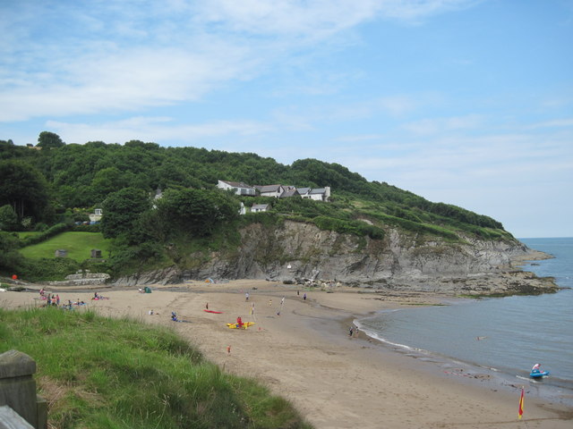
The route runs for just under 5 miles with some moderate climb on the cliff top paths along the way. Towards the end of the walk you will pass Foel y Mwnt where you can enjoy wonderful views over Cardigan Bay from the hill top location. At the beach you'll also find some splendid geological cliff formations which make a great photograph.
You can extend the walk by continuing along the coastal path to nearby Cardigan where there are some lovely trails along the Teifi Estuary to the 13th century castle ruins at Cilgerran.
Aberporth to Mwnt Coastal Path Ordnance Survey Map  - view and print off detailed OS map
Aberporth to Mwnt Coastal Path Open Street Map  - view and print off detailed map
Aberporth to Mwnt Coastal Path OS Map  - Mobile GPS OS Map with Location tracking
Aberporth to Mwnt Coastal Path Open Street Map  - Mobile GPS Map with Location tracking
Further Information and Other Local Ideas
The Aberporth Coastal Walk will take you in the other direction to the lovely Tresaith and Penbryn Beaches. Near here you can also visit Llangrannog where you'll find a blue flag beach and a wonderful headland area with fine views over the bay. There's also an elevated hill fort and views of the River Hawen's waterfall in the village centre. In the village you can pick up the Llangrannog to Cwmtydu Walk and continue north to the beautiful secluded cove at Cwmtydu. The beach is a great place to look out for seals during September and October.
Cycle Routes and Walking Routes Nearby
Photos
Edge of MoD Aberporth. This is the edge of the rocky promontory that blocks the progress along the coast of the Ceredigion Coast Path, which has to detour inland from this point


