St Dogmaels to Poppit Sands Walk
![]()
![]() This Welsh village sits in a lovely location on the River Teifi estuary near Cardigan.
This Welsh village sits in a lovely location on the River Teifi estuary near Cardigan.
The village is notable for its historic abbey and pretty beach. It is also the start point for the epic Pembrokeshire Coast Path National Trail.
This walk in the village takes you north along the opening section of the path to Poppit Sands. It's about a 2 mile walk with a moderate climb along the way.
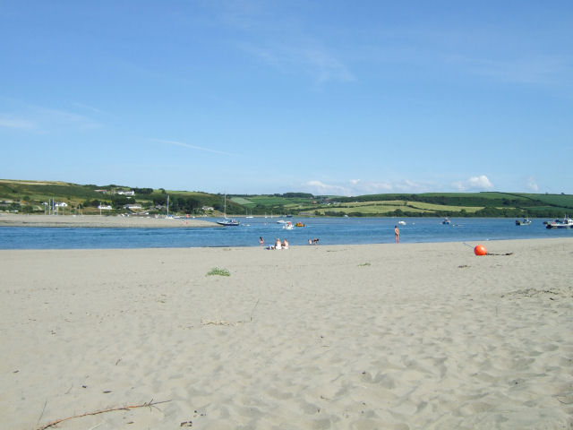
The walk starts off from St Dogmaels Abbey, one of the major local attractions. The Grade I listed abbey dates back to the 12th century and sits in a splendid locations on the banks of the river. You can explore the substantial ruins before picking up the coast path and following it north along the estuary to the beach at Poppit Sands. Here you will find a lovely sandy Blue Flag with views across the estuary and bay towards Gwbert and Cardigan Island.
You can extend the walk by continuing along the coast path to Cemaes Head. See the video below for a longer circular walk taking in this wonderful viewpoint.
St Dogmaels Ordnance Survey Map  - view and print off detailed OS map
St Dogmaels Open Street Map  - view and print off detailed map
St Dogmaels OS Map  - Mobile GPS OS Map with Location tracking
St Dogmaels Open Street Map  - Mobile GPS Map with Location tracking
Walks near St Dogmaels
- Cardigan - The town of Cardigan is located in a lovely spot on the Teifi Estuary
- Pembrokeshire Coast Path - Brace yourself for some spectacular coastal scenery on this magnificent 186 mile trail that passes through the Pembrokeshire Coast National Park
- Penrhyn Castle - Explore 60 acres of woodland and parkland surrounding this large 19th-century neo-Norman castle near Bangor, Gwynedd.
- Ceredigion Coast Path - This walk follows the beautiful coastline of Ceredigion from Cardigan to Borth.The walk is waymarked with a coast and sea logo.
- Aberporth - This walk follows a section of the Ceredigion Coast Path from the village of Aberporth to Tresaith and Traeth Penbryn
- Pentre Ifan - Visit the largest and most well preserved neolithic dolmen in Wales on this fascinating walk in Pembrokeshire
- Llangrannog - This circular walk explores the area surrounding the village of Llangrannog on the Ceredigion coast
- Aberporth to Mwnt Coastal Path - Follow the Ceredigion Coast Path from Aberporth to Mwnt on this splendid coastal walk.
- Cilgerran - This historic Welsh village is located in North Pembrokeshire, close to Cardigan and the Teifi Estuary on the coast.
- Aberporth to Llangrannog Coastal Path - This walk takes you along a section of the Ceredigion Coast Path from Aberporth to Llangrannog.
- Newcastle Emlyn - This lovely Welsh town is located in the heart of the Teifi Valley near Carmarthen.
- Cenarth Falls - Visit these beautiful falls and enjoy a woodland stroll along the Afon Teifi on this walk in Carmarthenshire
- Llangrannog to Cwmtydu - This walk follows a section of the Ceredigion Coast Path from Llangrannog to the beautiful beach at Cwmtydu.
- Tresaith to Penbryn Walk - This walk from the village of takes you to neighbouring Penbryn along the Ceredigion Coast Path.
- Gwbert - This small cliff top village is located on the beautiful Ceredigion coast near St Dogmaels.
Photos
Ruins of St. Dogmaels Abbey, Pembrokeshire. The abbey is now in ruins, but substantial parts of the abbey remain, including the western end wall, the north wall, the north transept, and eastern walls of the crypt. There are also several monastic buildings which survive to the south of the abbey and a detached 13th century building, most likely an infirmary, which is located to the south east
High Street. By a curious boundary quirk, St Dogmaels is in Pembrokeshire whereas the rest of the Teifi estuary is in Ceredigion.
Netpool, Llandudoch/St Dogmaels. This is the name for the Afon Teifi here as it flows down from Cardigan to the sea a few kilometres further north. "The waterway was the main source of employment for the village of St.Dogmaels. Herring fishing was very important from the Middle Ages to the mid-18th century and continued until 1914, salted herrings being exported to Ireland and Spain. In summer, salmon fishing took place using Seine nets. Circa 1884 there were 21 fishing boats operating. Numbered stones were drawn at the Netpool before each tide to establish the order which the pools were to be fished. There were a number of well-known salmon pools, but because of silting, most have virtually disappeared. There are four licences now available but only one boat actually fishing. It was early in the 20th century that the last Seine fishing boats were built in St. Dogmaels."


