Walks In Bacup
![]()
![]() This Lancashire based town is located in the Rossendale Valley area of the South Pennines. The historic town has an interesting industrial past with many old buildings surviving today. In fact, English Heritage has classified Bacup town centre as a protected area for its special architectural qualities.
This Lancashire based town is located in the Rossendale Valley area of the South Pennines. The historic town has an interesting industrial past with many old buildings surviving today. In fact, English Heritage has classified Bacup town centre as a protected area for its special architectural qualities.
This walk from the town follows a section of the Irwell Sculpture Trail west to visit neighbouring Rawtenstall. The popular waymarked trail explores the valley of the River Irwell with some pleasant waterside sections and old mills to see.
The route runs for just over 4 miles on a steadily descending footpath. At the end of the walk you can catch the bus back if you prefer.
On the way you will pass close to Stubbylee Park which lies just to the south of the town. The public park has some nice footpaths, a play area, outdoor gym, bowling greens, tennis courts and a newly opened off road cycling ‘pump track’.
You can continue your exercise around the town by heading south to visit Lee Quarry. The quarry includes a popular mountain bike trail and footpaths with some fabulous views from the elevated position of the site.
Bacup Ordnance Survey Map  - view and print off detailed OS map
Bacup Open Street Map  - view and print off detailed map
Bacup OS Map  - Mobile GPS OS Map with Location tracking
Bacup Open Street Map  - Mobile GPS Map with Location tracking
Walks near Bacup
- Rawtenstall - This Lancashire based town is in a great place for exploring the River Irwell and the Rossendale Valley
- Irwell Sculpture Trail - Follow the River Irwell on this splendid waterside walk through Greater Manchester and enjoy over 70 artworks by renowned artists
- Rossendale Way - This circular walk takes you on a tour of the lovely Rossendale area of Lancashire and Greater Manchester.
The path passes Haslingden, Rawtenstall, Whitworth, Stubbins and Healey with a series of attractive reservoirs including Cowpe and Calf Hey real highlights - Calf Hey Reservoir - The attractive area of Haslingden Grane includes some nice walking trails around Calf Hey Reservoir and through the adjacent woodland
- Haslingden - This walk climbs to an interesting art structure and viewpoint in Haslingden, Lancashire
- Musbury Tor - This walk climbs to Musbury Tor or Tor Hill in the Rossendale Valley
- Peel Tower - This walk climbs to the Peel Monument on Holcombe Hill in Ramsbottom near Bury
- Summerseat - This village near Ramsbottom is a lovely place for a stroll
- Salford Trail - This circular walk explores the city of Salford on a long distance waymarked trail.
- Ramsbottom - A circular walk around Ramsbottom visiting some of the highlights of the area including River Irwell, Nuttall Park, Holcombe and the iconic Peel Tower.
The walk starts from the train station and heads a short distance to the east to pick up the Irwell Sculpture Trail - Clowbridge Reservoir - Enjoy a circular walk around this pretty reservoir near Burnley
- Entwistle Reservoir - This circular walk follows the waterside footpath around Turton and Entwistle Reservoir near Bolton in Lancashire
- Wayoh Reservoir - Enjoy an easy circular walk around this pretty reservoir near Bolton
- Jumbles Country Park - Enjoy a short stroll around Jumbles Reservoir in this pretty country park in Bolton
- Redisher Wood - This walk visits the pretty Redisher Wood in Ramsbottom
- Haslingden Grane - This area of moorland in Rossendale includes several historic ruined farmhouses and a series of picturesque reservoirs.
- Waugh's Well - This walk visits Waugh's Well in the Rossendale Valley area of Lancashire.
- Hail Storm Hill - This circular walk in the Rossendale Valley climbs to Hail Storm Hill and the Scout Moor Wind Farm
Further Information and Other Local Ideas
The Irwell Trail joins with the waymarked Rossendale Way in the Bacup area. The long distance circular walk explores the valley visiting local highlights such as Calf Hey Reservoir, the 19th century Peel Tower and the Healey Dell Nature Reserve.
Photos
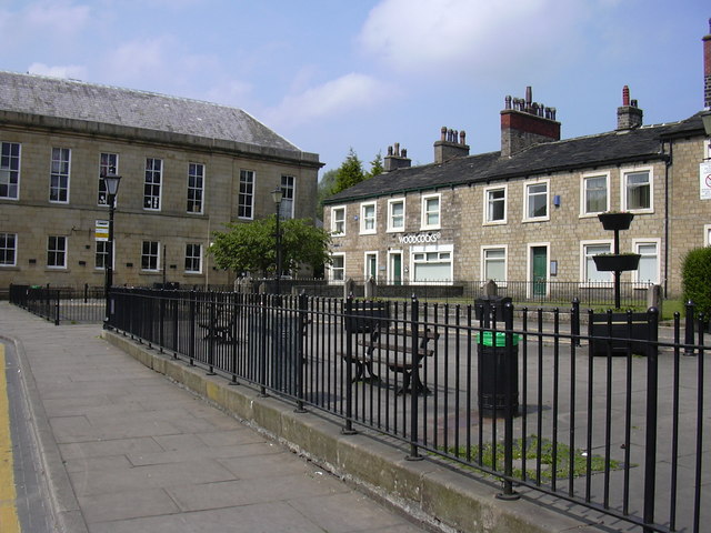
Irwell Terrace Bacup. For many years the town was the centre of domestic flannel and woollen cloth production, and many of the original weavers' cottages survive today as listed buildings.
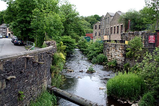
Bacup, River Irwell. Following the Industrial Revolution, Bacup became a mill town, growing up around the now covered over bridge crossing the River Irwell and the north–south / east-west crossroad at its centre. During that time its landscape became dominated by distinctive and large rectangular woollen and cotton mills.


