Bagshot Park
![]()
![]() This walk visits Bagshot Park and Rapley Lake on Bagshot Heath in Surrey. There's some lovely wide bridle tracks which are ideal for walking and cycling in this area. Please note the park itself is private so it's important to keep within the boundary of the forest. There are views towards the park though from the surrounding public access area.
This walk visits Bagshot Park and Rapley Lake on Bagshot Heath in Surrey. There's some lovely wide bridle tracks which are ideal for walking and cycling in this area. Please note the park itself is private so it's important to keep within the boundary of the forest. There are views towards the park though from the surrounding public access area.
Start the walk on the western side of Bagshot, about half a mile south west of the train station. Here you can pick up the Vicarage Lane track and follow it north west across Bagshot Heath, Queen's Wood and Bagshot Park will be on your left on this section. The route then passes Cobblers Hole before turning east at Cuckoo Pen to take you to the pretty Rapley Lake along Lake Ride.
You can easilty extend the walk by following the woodland trails north to visit Swinley Forest in Bracknell Forest.
Bagshot Park Ordnance Survey Map  - view and print off detailed OS map
Bagshot Park Open Street Map  - view and print off detailed map
Bagshot Park OS Map  - Mobile GPS OS Map with Location tracking
Bagshot Park Open Street Map  - Mobile GPS Map with Location tracking
Pubs/Cafes
The Three Mariners in Bagshot village is a good choice for some post walk refreshment. It's a historic pub of some note, dating back to the 16th century. There's a cosy interior with wooden beams, low ceilings and a real fire for colder days. Outside there's a small garden area if the sun is shining. They have a good menu and can be easily found on the High Street at postcode GU19 5AW for your sat navs.
Dog Walking
The woodland trails are ideal for a dog walk so expect to see other owners on a fine, weekend day. The Three Mariners mentioned above is also dog friendly.
Further Information and Other Local Ideas
Just to the north of the lake you can pick up the waymarked Three Castles Path in Swinley Forest. You could follow the trail north east to Englemere Pond or south west towards Crowthorne, Sandhurst and the lovely Tri Lakes Country Park. The longer Bracknell Circular Walk uses part of the trail to create a 25 mile loop around the forest.
The Wokingham Way passes through the area and the pretty Bramshill Forest is also not far away. Here you can explore the RSPB's Hazeley Heath and look out for red kites, dartford warblers and deer. In nearby Hook there's also some pleasant trails along the River Whitewater in the pretty Bassets Mead park on the eastern side of the town.
The Ascot Walk can be picked up in the nearby town. Here you can also visit the famous racecourse, home to Royal Ascot.
For more walking ideas in the area see the Berkshire Walks page.
Cycle Routes and Walking Routes Nearby
Photos
Looking towards Bagshot village centre from the Three Mariners Pub. The main coaching route from London to the south west went through the village of Bagshot and during the 18th century Bagshot was a well known stopping point on the main road. The many inns provided stabling and even horse swapping services to thousands of stage coaches, and numerous inns once catered for the needs of the thousands of travellers who passed through each year. Of the inns remaining in the village from medieval times, only the Three Mariners still retains some of the original features from when it was a coaching inn. Its name suggests a sea connection, and this might be because of the timber piles supporting the building. This timber is over 150 years old and was originally from a ship.
The end of Vicarage Lane. Shown on the 1:25000 map as a public footpath which ends at this gate. After the gate is Crown Estate land to which access on foot is permitted. The forest attracts many visitors from across the region each year, it in fact forms one forest with Bagshot/Windlesham/Camberley Heaths or Woods in Surrey which were traditionally demarcated but now few divides exist between the counties.
Along the Roman Road. This path is actually on the boundary of Surrey and Berkshire in the area where it meets up with the course of the roman road, heading south west from London (through Silchester). Two cyclists can just be seen heading towards the camera!
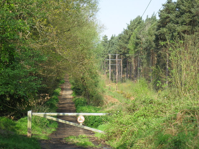
Strictly Private. The Crown Estate sign 'Strictly Private' indicates the end of the open access area.
Bagshot Park. Looking across the fields to the Bagshot Park buildings. The Royal residence is Grade II listed a building of special architectural or historic interest. Built with red brick and stone dressings in Tudor gothic style, with side and rear extensions in late 19th and early 20th centuries. The landscaped grounds are also Grade II listed on the Register of Historic Parks and Gardens. It has been country home of Prince Edward and Sophie Wessex since their 1999 wedding.


