Bardon Hill
![]()
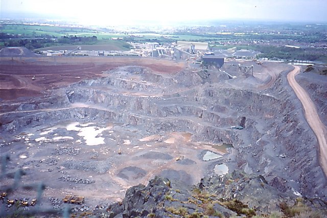
![]() Climb to the highest point in Leicestershire on this walk near Coalville. The hill is located just a couple of miles east of Coalville town centre. A good start point for the walk is the village of Whitwick just to the north of the hill. From here you can follow the Ivanhoe Way long distance trail to the hill. It's about a 2.5 mile walk from the village to the 912 feet (278 m) high hill summit where you will find a radio mast and wonderful views over the Charnwood Forest and the extensive Bardon Hill quarry below. On a clear day you can see as far as the Malvern Hills, the Shropshire Hills and the Peak District.
Climb to the highest point in Leicestershire on this walk near Coalville. The hill is located just a couple of miles east of Coalville town centre. A good start point for the walk is the village of Whitwick just to the north of the hill. From here you can follow the Ivanhoe Way long distance trail to the hill. It's about a 2.5 mile walk from the village to the 912 feet (278 m) high hill summit where you will find a radio mast and wonderful views over the Charnwood Forest and the extensive Bardon Hill quarry below. On a clear day you can see as far as the Malvern Hills, the Shropshire Hills and the Peak District.
To extend your walking in the area you could pick up the Charnwood Forest circular walk which runs past the hill. Following it south will take you to the village of Markfield which is an alternative start point for visiting the hill.
Postcode
LE67 4QQ - Please note: Postcode may be approximate for some rural locationsBardon Hill Ordnance Survey Map  - view and print off detailed OS map
Bardon Hill Open Street Map  - view and print off detailed map
Bardon Hill OS Map  - Mobile GPS OS Map with Location tracking
Bardon Hill Open Street Map  - Mobile GPS Map with Location tracking
Pubs/Cafes
About half a mile north of the hill you can enjoy some post walk refreshment at The Bulls Head in Abbot's Oak. They serve good food with particularly fine Italian stone-baked pizzas. There's also a lovely garden area to relax in on warmer days. You can find them at postcode LE67 4QQ for your sat navs.
Dog Walking
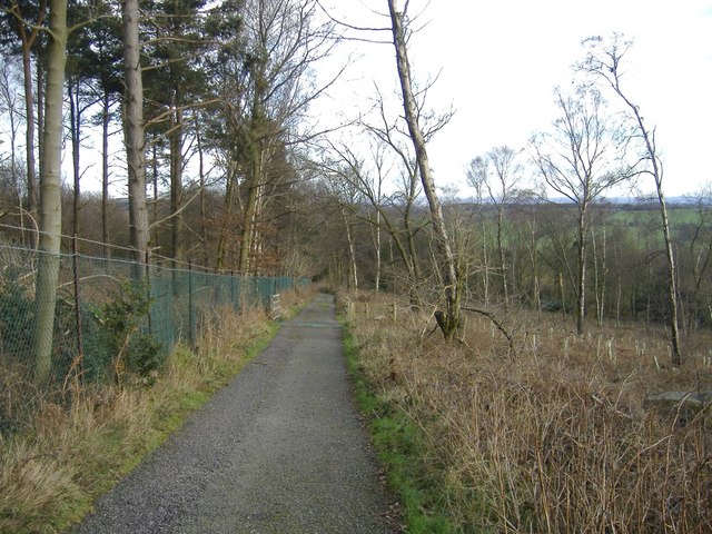
The hill and woods are an ideal place for a dog walk. The Bulls Head mentioned above is also dog friendly with water and treats available for your canine friend.
Further Information and Other Local Ideas
Just to the north east you can pick up the Shepshed Walk. It visits the pretty Blackbrook Reservoir and the 11th century Mount St Bernard Abbey where you can see the monks brew the only Trappist beer in Britain. Near the abbey you can also visit local historic landmark at the 13th century Grace Dieu Priory. The anicent ruins of the priory are surrounded by some pleasant woodland with trails along the Grace Dieu brook.There's also a delightful old watermill and mill pond in Shepshed itself.
The circular Coalville Walk visits the hill and several other local highlights including the historic 17th century Donington le Heath Manor House, Sence Valley Forest Park, Queen Elizabeth Diamond Jubilee Wood, Grange Woods, Bagworth Heath Woods and Thornton Reservoir.
For more walking ideas in the area see the Leicestershire Walks page.
Cycle Routes and Walking Routes Nearby
Photos
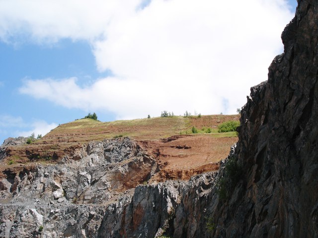
Bardon Quarry, Leicestershire. A beautiful unconformity. The grey rock is Precambrian volcanics (600 million years old) that was covered, resurrected 300+ million years later, worn down and the valleys infilled with Triassic mud/siltstone, buried yet again, then resurrected in 'modern' times to what you see now - palaeovalleys.


