Bingham Linear Walk
![]()
![]() This Nottinghamshire based market town is well positioned for exploring the countryside of the River Trent Valley.
This Nottinghamshire based market town is well positioned for exploring the countryside of the River Trent Valley.
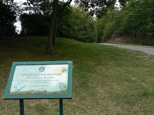
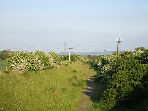
This easy walk in the town centre takes you along the Linear Walk. The walk runs along a nice surfaced path through a local nature reserve and along a disused railway line. Along the way you will pass the old Bingham Road Station which closed back in the 1950s. There's also old rail bridges, countryside paths and views of the River Smite at the south eastern end of the route.
Habitats on the path include woodland, mature trees, scrub and grassland. There's also lots of interesting plants, flowers and wildlife to see, particularly in the warmer months. The first section of the footpath is quite sheltered and shady before coming out into more open countryside with wider views.
To continue your walking around Bingham head north to pick up the Trent Valley Way. The waymarked long distance trail will take you along a pleasant section of the river around Gunthorpe.
Postcode
NG13 8AW - Please note: Postcode may be approximate for some rural locationsBingham Linear Walk Ordnance Survey Map  - view and print off detailed OS map
Bingham Linear Walk Open Street Map  - view and print off detailed map
Bingham Linear Walk OS Map  - Mobile GPS OS Map with Location tracking
Bingham Linear Walk Open Street Map  - Mobile GPS Map with Location tracking
Walks near Bingham
- Gunthorpe - This village near Nottingham is a popular place for riverside strolls
- Trent Valley Way - Follow the River Trent from Long Eaton in Derbyshire to West Stockwith in Nottinghamshire on this lovely waterside walk
- Holme Pierrepont Country Park - Enjoy a waterside walk or cycle in this splendid 270 acre country park in Nottingham
- Nottingham Circular Walk - This long circular walk makes use of various waymarked footpaths to take you on a tour of the city's rivers, canals, nature reserves and parks.
The walk starts at the train station and heads a short distance south to the River Trent - Shelford - This attractive Nottinghamshire village has some nice river and country trails to try
- West Bridgford - This Nottinghamshire based market town is located just south of the city of Nottingham
- Radcliffe on Trent - This village near Nottingham has some fine riverside trails and two fine local country parks to visit.
- Fiskerton - This rural Nottinghamshire village has some pleasant riverside and and countryside trails to try
- Burton Joyce - This Nottinghamshire village has some nice riverside trails and peaceful footpaths across the Burton Meadows.
- Car Colston - This Nottinghamshire based village is located in the Rushcliffe borough of the county.
Pubs/Cafes
The Horse & Plough is a nice choice for some post walk refreshments. The pub is housed in the former Methodist chapel, and has a cottage-style interior and flagstone floor. They sell a good range of ales and have a pleasant sun trap garden for warmer days. You can find them at postcode NG13 8AF.
There's also the Wheatsheaf which is Grade II listed and dates back to 1779. They sell good quality food in their modern restaurant area. You can find them at postcode NG13 8BG.
Dog Walking
The path is ideal for a dog walk. You will probably meet other owners on your walk. The two local pubs mentioned above are also dog friendly.
Further Information and Other Local Ideas
Just to the north is the neighbouring village of Car Colston. The village is an interesting place for a stroll with two picturesque village greens, the larger of which is thought to be the biggest green in England. There's also a number of listed buildings dating to the 18th and 19th century in this historic settlement.


