Burton Joyce Walks
![]()
![]() This Nottinghamshire village has some nice riverside trails and peaceful footpaths across the Burton Meadows.
This Nottinghamshire village has some nice riverside trails and peaceful footpaths across the Burton Meadows.
This walk takes you east to visit the neighbouring village of Gunthorpe.
The walk starts on the southern side of the village where you can pick up a country lane taking you east across Burton Meadows. You then come to Gunthorpe where you can pick up a section of the Trent Valley Way to take you along the river to the pretty Gunthorpe Lock.
The route then returns to Burton Joyce following an alternative riverside footpath through Burton Meadows.
Burton Joyce Ordnance Survey Map  - view and print off detailed OS map
Burton Joyce Open Street Map  - view and print off detailed map
Burton Joyce OS Map  - Mobile GPS OS Map with Location tracking
Burton Joyce Open Street Map  - Mobile GPS Map with Location tracking
Walks near Burton Joyce
- Gunthorpe - This village near Nottingham is a popular place for riverside strolls
- Trent Valley Way - Follow the River Trent from Long Eaton in Derbyshire to West Stockwith in Nottinghamshire on this lovely waterside walk
- Holme Pierrepont Country Park - Enjoy a waterside walk or cycle in this splendid 270 acre country park in Nottingham
- Nottingham Circular Walk - This long circular walk makes use of various waymarked footpaths to take you on a tour of the city's rivers, canals, nature reserves and parks.
The walk starts at the train station and heads a short distance south to the River Trent - Shelford - This attractive Nottinghamshire village has some nice river and country trails to try
- West Bridgford - This Nottinghamshire based market town is located just south of the city of Nottingham
- Radcliffe on Trent - This village near Nottingham has some fine riverside trails and two fine local country parks to visit.
- Fiskerton - This rural Nottinghamshire village has some pleasant riverside and and countryside trails to try
- Car Colston - This Nottinghamshire based village is located in the Rushcliffe borough of the county.
- Bingham Linear Walk - This Nottinghamshire based market town is well positioned for exploring the countryside of the River Trent Valley
Further Information and Other Local Ideas
Just east of Gunthorpe is the worthy village of Car Colston. The village is an interesting place for a stroll with two picturesque village greens, the larger of which is thought to be the biggest green in England. Near here there's also the town of Bingham where you can try the Bingham Linear Walk. The pleasant route runs along a disused railway line through the town and then out into the countryside where there are views of the River Smite.
Photos
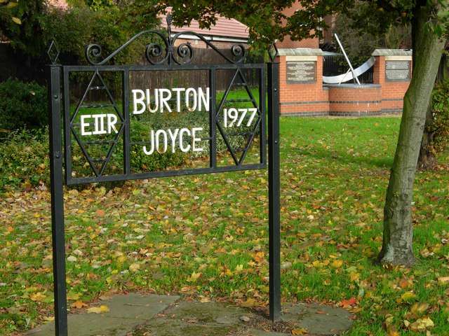
Burton Joyce Monuments. Contrasting styles of monuments alongside the A612 in Burton Joyce; the one in the foreground commemorates the Queen's silver jubilee in 1977, the more substantial brick affair behind was built for the millennium.


