Shelford Walks
![]()
![]() This attractive Nottinghamshire village has some nice river and country trails to try. It sits in a fine rural spot just a couple of miles east of Nottingham.
This attractive Nottinghamshire village has some nice river and country trails to try. It sits in a fine rural spot just a couple of miles east of Nottingham.
This walk from the village takes you to the nearby Holme Pierrepont Country Park along the Trent Valley Way.
The walk starts in the village and heads west to the river where you can pick up the Trent Valley Way, opposite Stoke Bardolph. Follow the waymarked footpath south and it will take you past Radcliffe on Trent to Holme Pierrepont Park. Here you'll find a nature reserve, a number of lakes and the National Watersports Centre. On the opposite side of the river there's more nice waterside trails in Colwick Country Park near West Bridgford.
The route returns to the village on the same paths though you could take a small detour to climb Shelford Hill to the south of the settlement. There are nice views over the area from this elevated spot.
Shelford Ordnance Survey Map  - view and print off detailed OS map
Shelford Open Street Map  - view and print off detailed map
Shelford OS Map  - Mobile GPS OS Map with Location tracking
Shelford Open Street Map  - Mobile GPS Map with Location tracking
Pubs/Cafes
The Earl of Chesterfield is a good choice for some post walk refreshment. It's a fine village pub, serving good quality food and with a decent selection of ales. They also have a garden area for warmer weather. You can find them on Manor Lane with a postcode of NG12 1EQ for your sat navs.
Dog Walking
The river and country trails make for a fine dog walk and the The Earl of Chesterfield pub mentioned above is also dog friendly.
Further Information and Other Local Ideas
The circular Gunthorpe Walk explores the delightful neighbouring village. There's an old bridge, a picturesque lock and a fine riverside pub to enjoy here. The route additionally visits Shelford and nearby East Bridgford.
Just a few miles north west there's the delightful Lambley Dumbles to visit. There's much to enjoy here with steep sided valleys, streams, orchards, waterfalls, ancient woodland and lots of interesting geology and flora to see. Lambley village is also worth a visit with two fine pubs to relax in after your exercise. Just next to here is the neighbouring settlement of Lowdham where there are some fine walks through the valley of the Cocker Beck.
Just to the west of the village there's some nice trails to follow around Gedling Country Park.
You could also head into the city and pick up the Nottingham Circular Walk.
To the west is the Radcliffe on Trent Cliff Walk which takes you along an elevated tree lined path above the river. The area also includes the Rockley Memorial Park where you'll find lovely gardens in a peaceful setting. To the north east there's Rolleston and the attractive Fiskerton where there are several million pound properties and a fine riverside pub.
For more walking ideas in the area see the Nottinghamshire Walks page.
Cycle Routes and Walking Routes Nearby
Photos
Seat and millennium stone on road through Shelford. The stone is a rather incongruous lump of granite, inscribed 'Shelford 2000'. Waterlane Farm behind, with the date 1834 in the brickwork, is one of several farms in the area belonging to the Crown Estate.
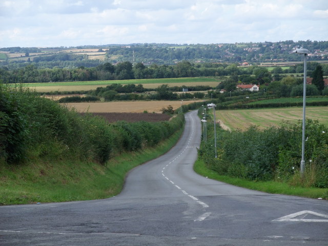
The road, Shelford Hill, leading up from the valley of the Trent. Burton Joyce sits on the horizon among trees on the far, northern bank of the Trent. The hill is located just to the south of the village.
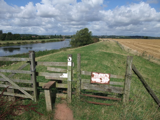
Trent Valley Way. rejoining theTrent Having left the banks of the Trent at Holme Pierrepont, about 4 miles upstream, the TVW rejoins on the flood embankment near Stoke Bardolph.
Finger ponds. This is the name given to the area of former gravel workings at the eastern end of Holme Pierrepont Country Park. It derives from the way that this area was worked leaving long narrow strips of water divided by narrow banks. The formation shows up better on the 1:25000 maps than on the 1:50000.


