Broad Chalke Walks
![]()
![]() This picturesque Wiltshire based village is a lovely place for an easy stroll.
This picturesque Wiltshire based village is a lovely place for an easy stroll.
There's some pleasant countryside trails and views of the River Ebble which meanders through the village. Broad Chalke is located in the Cranborne Chase AONB, a few miles south west of the famous cathedral city of Salisbury.
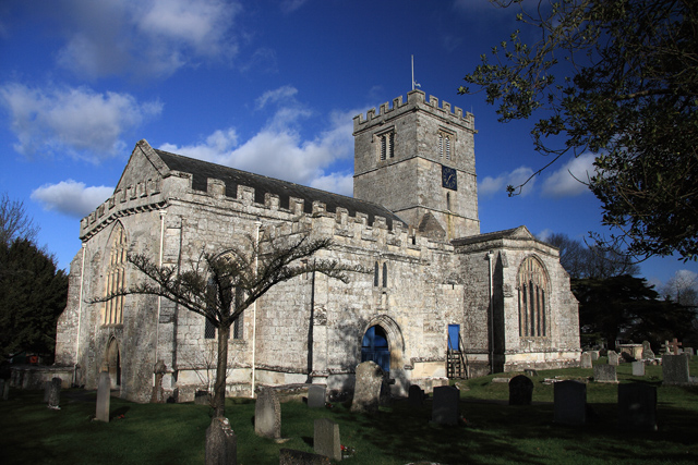
This circular walk explores the settlement visiting the watercress beds, the 15th century Kings Old Rectory and the ancient parish church before heading into the surrounding countryside on the local public footpaths and bridleways.
To continue your walking in the area head south to visit Martin Down Nature Reserve where there's hundreds of acres of chalk download with wildflower meadows and lots of wildlife to see.
Postcode
SP5 5EN - Please note: Postcode may be approximate for some rural locationsBroad Chalke Ordnance Survey Map  - view and print off detailed OS map
Broad Chalke Open Street Map  - view and print off detailed map
Broad Chalke OS Map  - Mobile GPS OS Map with Location tracking
Broad Chalke Open Street Map  - Mobile GPS Map with Location tracking
Walks near Broad Chalke
- Martin Down Nature Reserve - This beautiful nature reserve on the Hampshire/Dorset border consists of 350 hectares of unspoiled chalk downland
- Salisbury Circular Walk - Enjoy a stroll around the grounds of the famous cathedral before exploring the surrounding rivers, gardens and streets of this famous Wiltshire city
- Old Sarum Castle - Visit the site of the earliest settlement of Salisbury on this fascinating walk in Wiltshire
- Pepperbox Hill - This walk climbs to a distinctive 17th century folly on Pepperbox Hill near Salisbury in Wiltshire.
- Coombe Bissett Down - Enjoy a short walk around this pretty nature reserve near Salisbury
- Salisbury Country Way - A super circular walk through the countryside around Salisbury
- Salisbury Plain - This walk explores a section of the ancient Salisbury Plain with its chalk grassland, fascinating historical sites and wide ranging views
- Salisbury to Stonehenge Walk - This walk takes you from the city centre of Salisbury to the iconic Stonehenge
- Great Wishford - Enjoy a peaceful stroll along the River Wylye on this waterside walk in the Wiltshire village of Great Wishford
- Grovely Wood - Enjoy cycling and walking trails in this large area of woodland near the Wiltshire village of Great Wishford.
- Stonehenge - This circular walk visits the countryside and woodland around this famous historical site
- Woodhenge to Stonehenge Walk - This circular walk takes you from the car park at Woodhenge to the world famous Stonehenge
- Figsbury Ring - This walk visits the Iron Age hill fort of Figsbury Ring near the city of Salisbury in Wiltshire.
- Old Sarum Way - This circular route takes you on tour through the river valleys, woodland and downland around Salisbury
- Tisbury - This Wiltshire based village is located in a lovely spot in the valley of the River Nadder
- Ebbesbourne Wake - This pretty little Wiltshire village is a fine place to start a walk
Pubs/Cafes
The Queen's Head Inn is a fine place for post walk refreshment. The historic pub dates back to the 18th century and was once part of the Earl of Pembroke's estate. The building has a charming interior with many original features such as a cosy inglenook fireplace with a large wood burner that is lit all through the winter. Outside there is a lovely leafy courtyard garden to the rear and a summer beer garden in the field across the road. You can find them on North Street at postcode SP5 5EN for your sat navs.
Further Information and Other Local Ideas
Just to the west is the neighbouring village of Ebbesbourne Wake where you will find two lovely old pubs and the walk to Prescombe Down.
For more walking ideas in the area see the Cranborne Chase Walks page.
Photos
A Quiet Corner - Broad Chalke. Looking north towards South Street and the C15 entrance to Kings Old Rectory, before the installation of wooden gates. The larger of the two Tudor arches was intended for carts, whilst the smaller entry was for pedestrians.
Kings Old Rectory. The south front of Kings Old Rectory, a Grade II* Listed C15 detached house, with C16 and C17 additions at the rear. This is a former rectory owned by Kings College, Cambridge till 1923.


