Corwen Walks - Around and Near
![]()
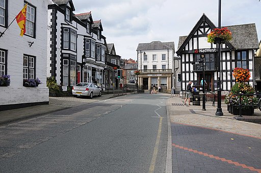
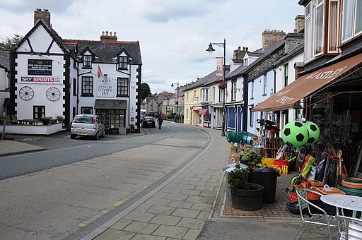
![]() This Denbighshire based town is positioned in a lovely area with easy walks along the River Dee and more challenging climbs into the surrounding Berwyn Mountains. The town is also the start point for several popular long distance walking trails and designated as a Walkers are Welcome town.
This Denbighshire based town is positioned in a lovely area with easy walks along the River Dee and more challenging climbs into the surrounding Berwyn Mountains. The town is also the start point for several popular long distance walking trails and designated as a Walkers are Welcome town.
Corwen has strong connections with Owain Glyndwr, the last native-born Prince of Wales. A large statue of the warrior can be found in the town square.
This route from the town uses sections of the Clwydian Way, the Dee Valley Way, the Brenig Way and the North Berwyn Way to create a circular walk through the surrounding area. On the way there are nice views of the River Dee and the Berwyn Mountains. You'll also enjoy a climb to the fine viewpoint at Moel Fferna.
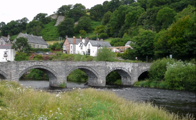
The walk starts in the town centre and heads north to cross the River Dee on Corwen Bridge. Here you meet up with the Clwydian Way and follow the waymarked footpath east to Rhagatt Hall and the neighbouring villlage of Carrog.
The route then heads south, crossing the river and passing through the woodland of the Carrog Plantation before climbing to Moel Fferna. The 630 metre high mountain is the most northern outpost of the Berwyn range.
At the mountain you pick up the North Berwyn Way and follow the trail west to Cynwyd, passing through the Cynwyd Forest and enjoying views of the waterfalls on the Afon Trystion. At Cynwyd you pick up a riverside path heading north along the Dee to return you to Corwen.
Postcode
LL21 0AH - Please note: Postcode may be approximate for some rural locationsCorwen Ordnance Survey Map  - view and print off detailed OS map
Corwen Open Street Map  - view and print off detailed map
Corwen OS Map  - Mobile GPS OS Map with Location tracking
Corwen Open Street Map  - Mobile GPS Map with Location tracking
Walks near Corwen
- North Berwyn Way - This challenging walk explores the North Berwyn Mountains, to the south of the River Dee, in Denbighshire
- Brenig Way - Follow the Brenig Way way from Corwen, in the Dee Valley, to the beautiful Llyn Brenig, in the heart of the Denbigh Moors
- Cadair Berwyn - Climb to the highest point in the Berwyn Mountains range on this challenging walk in North East Wales
- Lake Vyrnwy - Follow the lakeside cycle lanes around this lovely reservoir on this circular ride in Powys
- Pistyll Rhaeadr - This circular walk visits a spectacular 240-foot (73 m) waterfall regarded as one of the Seven Wonders of Wales
- Chirk Castle - Explore the gardens an wider estate surrounding this 13th century castle in Wrexham.
- Pontcysyllte Aqueduct - Visit the longest and highest aqueduct in Britain and enjoy waterside walking along the Llangollen Canal on this lovely walk in Denbighshire
- Oswestry - This large market town near the Welsh border has some nice walking trails to try to the west
- Glyn Ceiriog - This delightful riverside village is a great base for exploring the beautiful Ceiriog Valley in north-east Wales.
- Chirk to Llangollen Canal Walk - An easy waterside walk along a nice section of the Llangollen Canal from Chirk to Llangollen
- Llangollen Round - Explore the beautiful area around the town of Llangollen, in Denbighshire, on this circular walk, devised to raise funds for the Cancer Research UK charity
- Horseshoe Falls Llangollen - Enjoy a stroll along the River Dee to these lovely falls on this short walk in Denbighshire
- Llangollen Canal - Enjoy a waterside walk or cycle along the Llangollen Canal
- Upper Ceiriog Valley Walk - This is a circular cycling or walking trail through the countryside around Llanarmon Dyffryn Ceiriog near Wrexham.
- Dee Valley Way - This walk follows the Dee Valley Way from Corwen to Llangollen in Denbighshire, North Wales.
- Llandrillo - This Denbighshire based village sits a few miles south of Corwen in the Berwyn Mountains
Pubs/Cafes
The historic Crown Hotel dates all the way back to 1628. The interior is full of olde worlde character with interesting features including pewter tankards hanging from the ceiling. They serve good food and are designated as a Camra Welsh Heritage pub. There's also a snooker table upstairs. You can find them on Bridge Street at postcode LL21 0AH.
Further Information and Other Local Ideas
To the south is Llandrillo where you can climb to Cadair Berwyn, the highest point in the Berwyn Mountains range. The village itself is well worth exploring with several listed buildings and views of the River Dee.
Photos
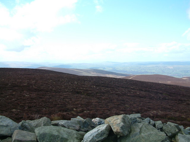
Moel Fferna. It is the highest peak in the Clwydian Range and Dee Valley Area of Outstanding Natural Beauty. The summit is covered in deep heather and has a shelter cairn. To the south lies Pen Bwlch Llandrillo, followed by Cadair Bronwen.


