East Grinstead Walks
![]()
![]() The town of East Grinstead is located in the Mid Sussex District of West Sussex. It's nicely situated on the edge of the High Weald AONB where there are great opportunities for walking. It's also located close to a number of historic houses and a splendid reservoir and nature reserve.
The town of East Grinstead is located in the Mid Sussex District of West Sussex. It's nicely situated on the edge of the High Weald AONB where there are great opportunities for walking. It's also located close to a number of historic houses and a splendid reservoir and nature reserve.
This circular walk from the town uses the High Weald Landscape Trail, the Sussex Border Path and the Forest Way to visit the nearby Weir Wood Reservoir. The route runs for about 7 miles with countryside, woodland and waterside footpaths to enjoy on the way. There's also a visit to the National Trust's lovely Standen House.
The walk starts at the train station and heads through the town along the High Weald Landscape Trail. You then head south through the countryside to Dunning's Wood before coming to Standen House. The house dates from the 19th century and includes gardens, parkland and bluebell woodland.
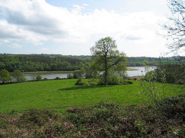
Shortly after leaving the house you'll come to the expansive Weir Wood Reservoir. The western end of the 280 acre reservoir is a protected nature reserve and bird sanctuary. You can follow the Sussex Border Path east along the water before heading north east to meet up with the Forest Way. This shared cycling and walking path will take you north west back into the town centre.
Postcode
RH19 1EB - Please note: Postcode may be approximate for some rural locationsEast Grinstead Ordnance Survey Map  - view and print off detailed OS map
East Grinstead Open Street Map  - view and print off detailed map
East Grinstead OS Map  - Mobile GPS OS Map with Location tracking
East Grinstead Open Street Map  - Mobile GPS Map with Location tracking
Walks near East Grinstead
- High Weald Landscape Trail - Explore the High Weald AONB on this fabulous 90 mile walk that links the ridge-top villages and historic gardens for which the area is famous
- Forest Way - This cycling and walking route runs from East Grinstead to Groombridge following National Cycle Route 21 along a flat tree lined path
- Weir Wood Reservoir - This 280 acre reservoir has a super circular walking path to try
- Sussex Border Path - A fabulous long distance walk following the Sussex county border from Thorney Island in West Sussex to Rye in East Sussex
- Standen House - Explore the gardens, parkland and woodland surrounding this 19th century National Trust house near East Grinstead
- Worth Way - This 7 mail long bridleway and footpath runs along National Cycle Route 21 from Crawley to East Grinstead.
- Hever Castle - Explore the beautiful grounds of this historic castle in Kent on this circular walk
- Wakehurst Place - Located in Haywards Heath, Wakehurst is the country estate of the Royal Botanic Gardens, Kew
- Forest Row - This large East Sussex based village is in a good spot for exploring the countryside and woodland of the High Weald
- Ashdown Forest - Explore the 'home' of Winnie-the-Pooh in this large area of woodland and heathland near Crowborough
- Ashurst Wood - This Sussex based village has some nice trails through the surrounding woodland and countryside of the High Weald AONB.
- Chiddingstone - This delightful Kent village includes many picturesque features including a village pond, Chiddingstone Castle and several historic timber framed properties dating back to the Tudor period.
- Crawley Down - This West Sussex based village, lies just to the west of East Grinstead on the edge of the High Weald AONB.
- Tandridge Border Path - This long distance circular walk explores the Tandridge District of Surrey
- Hedgecourt Lake - This walk visits Hedgecourt Lake near East Grinstead in Surrey.
Pubs/Cafes
The Ship Inn is a good choice for some post walk refreshments. They do very good food and have an attractive interior with a cosy fire for cold days. If the weather is fine there's a nice terraced garden outside too. You can find the pub on Ship Street at a postcode of RH19 4EG for your sat navs.
Dog Walking
The area around the town is great for dog walking and the Ship Inn pub mentioned above is also dog friendly.
Further Information and Other Local Ideas
You can catch regular trains to the town from both London Bridge and London Victoria. The journey time is about an hour.
The popular Worth Way also starts from the town. This shared cycling and walking trail runs along a disused railway line to Crawley Down and Crawley.
The villages of Ashurst Wood and Forest Row are located a few miles to the south east. Here you can pick up trails leading into the expansive Ashdown Forest.
For more walking ideas in the area see the High Weald Walks page.
Photos
Cromwell House, High Street, East Grinstead. This building dates from the 19th century and is Grade II listed.


