Finchampstead Ridges Circular Walk
![]()
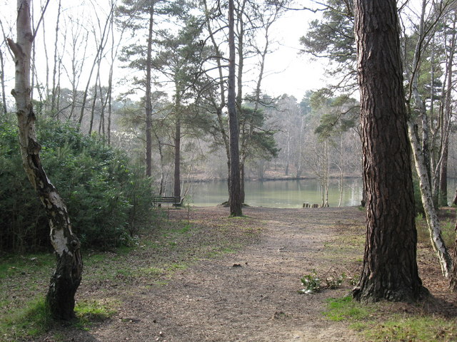
![]() This circular walk takes you through this peaceful common near Crowthorne. There are a number of delightful woodland trails, heather, bracken and two tranquil ponds to relax next to. From the high points on the ridges there are wonderful views over the River Blackwater Valley. The walk also visits Simon's Wood where there is a very large Heath Pond. You can start the walk from the National Trust car park here at a postcode of RG45 6AE for your sat navs. Also look out for a variety of wildlife including the Green Woodpecker in this peaceful area.
This circular walk takes you through this peaceful common near Crowthorne. There are a number of delightful woodland trails, heather, bracken and two tranquil ponds to relax next to. From the high points on the ridges there are wonderful views over the River Blackwater Valley. The walk also visits Simon's Wood where there is a very large Heath Pond. You can start the walk from the National Trust car park here at a postcode of RG45 6AE for your sat navs. Also look out for a variety of wildlife including the Green Woodpecker in this peaceful area.
You can easily extend your walk by heading to the nearby Tri Lakes Country Park, Horseshoe Lake or Yately Common Country Park for more lovely walking trails.
Postcode
RG45 6AE - Please note: Postcode may be approximate for some rural locationsFinchampstead Ridges Ordnance Survey Map  - view and print off detailed OS map
Finchampstead Ridges Open Street Map  - view and print off detailed map
*New* - Walks and Cycle Routes Near Me Map - Waymarked Routes and Mountain Bike Trails>>
Finchampstead Ridges OS Map  - Mobile GPS OS Map with Location tracking
Finchampstead Ridges Open Street Map  - Mobile GPS Map with Location tracking
Pubs/Cafes
Head west into Finchampstead village and you could pay a visit to the Queen's Oak. The historic pub was originally called The White Horse, but renamed after Queen Victoria planted an oak tree opposite the pub. There's a cosy log fire indoors while outside you can enjoy your meal in the garden area in finer weather. It's located in a lovely spot, close to the pretty village green on Church Lane. Postcode for your sat navs is RG40 4LS.
Dog Walking
With its woodland and heathland trails the area is ideal for dog walking. You will probably bump into other owners on your visit. There's also miles of good dog walking country in Bracknell Forest to the east of the site. The Queen's Oak pub mentioned above is also very dog friendly and will provide treats for your hungry friend.
Further Information and Other Local Ideas
If you wish to visit the area by public transport then Crowthorne Rail Station is located just to the east of the site, less than a mile away.
About a mile south of the site you'll find Tri Lakes Country Park and the Sandhurst Memorial Park. There's some lovely waterside footpaths passing around a series of lakes here. You can pick up the waymarked Three Castles Path in the park and follow it north east into Bracknell Forest and Swinley Forest near Ascott.
Just a couple of miles to the north west there's California Country Park where there are more good lakeside walking trails and wildlife watching opportunities.
Also nearby is the expansive Bramshill Forest where you can explore the RSPB's Hazeley Heath and look out for red kites, dartford warblers and deer. In nearby Hook there's also some pleasant trails along the River Whitewater in the pretty Bassets Mead park on the eastern side of the town.
For more walking ideas in the area see the Berkshire Walks page.
Cycle Routes and Walking Routes Nearby
Photos
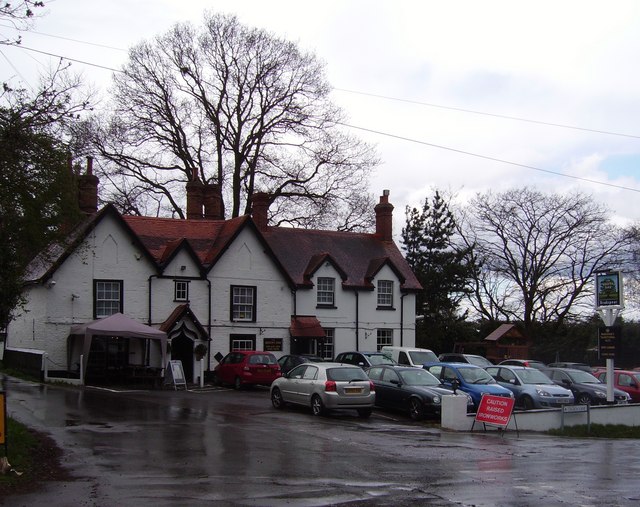
View of The Queen's Oak Public House in the nearby Finchampstead village. Photo shows the attractive exterior and good sized car park at the pub.


