Honiton Walks
![]()
![]() This historic Devon based town is situated on the edge of two Area's of Outstanding Natural Beauty - the East Devon AONB and the Blackdown Hills AONB. There's also some nice easy walks along the River Otter which flows through the town. The area has an interesting past being regarded as the antiques capital of the south west with a rich history in lace making and pottery.
This historic Devon based town is situated on the edge of two Area's of Outstanding Natural Beauty - the East Devon AONB and the Blackdown Hills AONB. There's also some nice easy walks along the River Otter which flows through the town. The area has an interesting past being regarded as the antiques capital of the south west with a rich history in lace making and pottery.
This walk from Honiton takes you to the nearby town of Ottery St Mary. It follows a section of the Exeter to Honiton Way, a waymarked trail running between the two settlements. On the way there are nice countryside trails and a waterside stretch along the River Otter to enjoy.
The walk starts at the train station in Honiton which is run by South Western Railway. They operate hourly services between London Waterloo and Exeter St Davids. From here you follow roads south out of the town towards Coombehayes Farm. You continue west to Roundball Hill before coming to the village of Gittisham, along a series of country lanes. There's some nice thatched cottages in this little settlement.
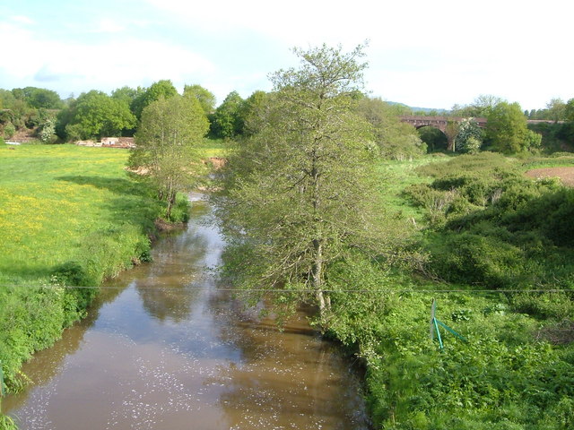
The trail then heads north west to Fenny Bridge where you cross the River Otter, just north of Alfington. It's a pretty spot with views towards the old mills at Feniton and the tranquil river surrounding by some attractive countryside.
From Fenny Bridges you head south west toward Woodford Barton where you pick up riverside trails to take you along the Otter into Ottery St Mary.
Postcode
EX14 2DA - Please note: Postcode may be approximate for some rural locationsHoniton Ordnance Survey Map  - view and print off detailed OS map
Honiton Open Street Map  - view and print off detailed map
Honiton OS Map  - Mobile GPS OS Map with Location tracking
Honiton Open Street Map  - Mobile GPS Map with Location tracking
Pubs/Cafes
The Railway is a nice place to enjoy refreshments in the town. They do good Italian food with a bit of classic French influence. There's also an outdoor area if the weather is fine. You can find the pub on Queen Street with a postcode of EX14 1HE for your sat navs.
Dog Walking
The country and river trails on the route make for a good dog walk. There's also some woodland trails in Colwell Wood and Aplin's Common just to the south east of the town. The Railway pub mentioned above is also dog friendly.
Further Information and Other Local Ideas
At the end of the route you can try the circular Ottery St Mary Walk. This take you along both sides of the river, visiting the nearby village of Tipton St John on the way.
The town is located on the south western edge of the Blackdown Hills AONB. There's lot of trails here including the popular climbs to Culmstock Beacon and the Wellington Monument. There's also some nice waterside trails around Otterhead Lakes.
To the south of the town you can pick up the East Devon Way. This long distance trail will take you through the East Devon AONB on a waymarked footpath. You can pick it up a few miles south of the town at Farway Hill where there's some woodland trails and the old Farway Castle to see. Following it east will take you to Northleigh, while heading south will take you to Sidbury. Near here there's the town of Sidmouth where you can enjoy coastal walks on the Sidmouth to Beer Walk, the Sidmouth to Budleigh Salterton Walk and the Sidmouth to Ladram Bay Walk. East of the town you can visit the splendid Donkey Sanctuary in Salcombe Regis. This free tourist attraction includes a series of walkways taking you around the site and providing plenty of opportunities to interact with the resident donkeys. There's also a fine restaurant with wonderful views over the surrounding countryside. You can reach the site by following a footpath north from Weston Mouth.
To the south east you'll find the attractive town of Colyton. There's nice paths through the River Coly Valley and a wonderful heritage tramway to try here.
For more walking ideas in the area see the Devon Walks page.


