Littlebredy Walks
![]()
![]() This delightful village in Dorset is a lovely place for an easy stroll.
This delightful village in Dorset is a lovely place for an easy stroll.
The settlement includes the Little Bredy Walled Garden, a waterfall, a lake, an old church and footpaths along the River Bride which runs through the village.
This circular walk visits the gardens before heading into the surrounding countryside to visit some of the local ancient sites. This includes the Kingston Russell stone circle which includes a late Neolithic or early Bronze Age circle of 18 fallen stones, on a hilltop overlooking Abbotsbury. To the south east there's also The Valley of Stones, another historic site described by Sir Frederick Treves as "a mysterious glen among the downs, on whose grassy slopes many huge stones are scattered".
To continue your walking in the area head a couple of miles east to visit the Hardy Monument. There's some wonderful views over the area from the elevated position of the monument to Vice-Admiral Sir Thomas Masterman Hardy. The epic South West Coast Path can also be picked up in this area.
Postcode
DT2 9HL - Please note: Postcode may be approximate for some rural locationsLittlebredy Ordnance Survey Map  - view and print off detailed OS map
Littlebredy Open Street Map  - view and print off detailed map
Littlebredy OS Map  - Mobile GPS OS Map with Location tracking
Littlebredy Open Street Map  - Mobile GPS Map with Location tracking
Walks near Littlebredy
- Hardy Monument - Enjoy wonderful views over the Dorset countryside from this historical viewpoint near Portesham and Abbotsbury
- Chesil Beach - This walk takes you along Chesil Beach to St Catherine's Chapel in Weymouth, Dorset
- Abbotsbury Castle - This walk from the pretty Dorset village of Abbotsbury visits the Iron Age Hillfort of Abbotsbury Castle
- Abbotsbury Subtropical Gardens - Enjoy a short walk around these beautiful gardens in Abbotsbury, Dorset
- Weymouth - This seaside resort in Dorset has some fine coastal walks to try
- Maiden Castle Dorset - Climb to this Iron Age hill fort near Dorchester and enjoy wonderful views over the surrounding countryside
- Burton Bradstock - There are a number of lovely coastal walking trails around this pretty National Trust run estate in Dorset.The estate is part of the Jurassic Coast and includes cliff-top trails along Burton cliff and the popular shingle Hive beach
- Eggardon Hill - Climb to this Iron Age hill fort and enjoy wonderful views over Marshwood Vale on this hilltop walk near Bridport.
The walk starts from the roadside parking area shown on the google street view link below - Powerstock Common - This pretty nature reserve is located close to the town of Bridport in Dorset
- Weymouth Circular Walk - A circular walk around the seaside town of Weymouth, visiting the promenade, the ruins of Sandsfoot Castle and the pretty Radipole Lake Nature Reserve.
The walk starts on the front, near to the train station - Weymouth to Durdle Door - Follow the coast path from Weymouth to one of the geological highlights of the Jurassic Coast on this Dorset walk
- Weymouth to Swanage Coastal Walk - Explore the Jurassic Coast on this coastal walk between Weymouth and Swanage
- Langton Herring - This delightful little village sits close to the Jurassic Coast in Dorset
- Dorchester - The historic county town of Dorset has some fine river trails, expansive local woodlands and a noteworthy hill fort to explore.
- Shipton Gorge - This small village is located just east of Bridport in the county of Dorset
- St Catherine's Chapel - This circular walk takes you to the historic St Catherine's Chapel in Abbotsbury
Pubs/Cafes
At the walled gardens there's a splendid tea room where you can enjoy a delicious cream tea after your exercise.
Photos
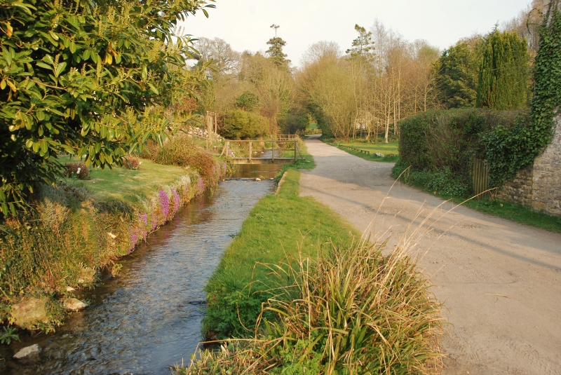
The village green. Littlebredy is located at the head of the valley of the small River Bride, surrounded by wooded chalk hills of the Dorset Downs.
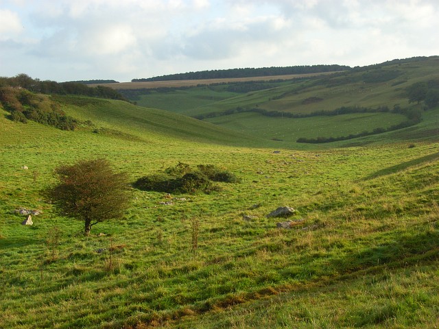
The Valley of Stones. The downland is named after the sarsen stones that are scattered across the valley. It is part of the Bridehead estate but is a nature reserve managed by Natural England. Sheep graze in the bottom field (pictured). The higher slopes are populated by English longhorn cattle. Their beef is for sale in Abbotsbury. Folklore attributes the origin of the stones to have been two giants playing stone-throwing games, but they are the result of conditions at the end of the last ice age, when freezing and thawing caused sandstone on surrounding hilltops to break up and slump downhill.


