Weymouth to Chesil Beach Walk with OS Map
![]()
![]() This seaside resort in Dorset has some fine coastal walks to try. There's also some pretty nature reserves with lots of wildlife to look out for.
This seaside resort in Dorset has some fine coastal walks to try. There's also some pretty nature reserves with lots of wildlife to look out for.
This walk takes you along a section of the South West Coast Path from the town to the famous Chesil Beach. It's about a 3.5 mile walk from the train station to the pebble beach where you can also access the Isle of Portland.
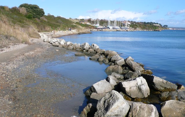
On the way you'll pass the ruins of the 16th century Sandsfoot Castle and the beautiful Sandsfoot Cove. The walk finishes at the Chesil Beach Centre at Portland Harbour. The centre has information about the area and a good cafe for refreshments after your walk.
The pebble beach runs for 18 miles with a series of beautiful lagoons on one side and the sea on the other. You can follow it all the way to the lovely Abbotsbury Subtropical Gardens to extend the walk.
The town also has some good wildlife spotting opportunities in two nature reserves located close to the town centre. Just up the coast to the north east is Lodmoor Country Park. The park is also a designated nature reserve with an easy access walking path taking you through various habitats including reedbed, saltmarsh and wet grassland. The RSPB Radipole Lake Reserve is also located close by. There's some nice waterside trails around the pretty lakes to try here.
Weymouth Ordnance Survey Map  - view and print off detailed OS map
Weymouth Open Street Map  - view and print off detailed map
*New* - Walks and Cycle Routes Near Me Map - Waymarked Routes and Mountain Bike Trails>>
Weymouth OS Map  - Mobile GPS OS Map with Location tracking
Weymouth Open Street Map  - Mobile GPS Map with Location tracking
Walks near Weymouth
- Weymouth to Durdle Door - Follow the coast path from Weymouth to one of the geological highlights of the Jurassic Coast on this Dorset walk
- Weymouth to Swanage Coastal Walk - Explore the Jurassic Coast on this coastal walk between Weymouth and Swanage
- Chesil Beach - This walk takes you along Chesil Beach to St Catherine's Chapel in Weymouth, Dorset
- South West Coast Path - This incredible 600 mile walk follows the coast from Minehead in Somerset, through Devon and Cornwall and onto the finish point at Poole in Dorset
- Isle of Portland - Follow the Portland Coast Path around the Isle of Portland on this wonderful coastal circular walk in Dorset
- Rodwell Trail - The Rodwell Trail is a nice easy off road trail through Weymouth using a disused railway path
- Osmington White Horse - Climb to the Osmington White Horse and enjoy wonderful views along the Jurassic Coast on this circular walk in Dorset
- Ringstead Bay - This walk takes you along a particularly lovely section of the Jurassic coastline near Weymouth in Dorset
- Weymouth Circular Walk - A circular walk around the seaside town of Weymouth, visiting the promenade, the ruins of Sandsfoot Castle and the pretty Radipole Lake Nature Reserve.
The walk starts on the front, near to the train station - Littlebredy - This delightful village in Dorset is a lovely place for an easy stroll.
- Portland Quarry - This walk visits the Tout Quarry Sculpture Park & Nature Reserve on the Isle of Portland in Dorset.
- Radipole Lake - This walk visits the RSPB's Radipole Lake Nature Reserve in Weymouth
- St Catherine's Chapel - This circular walk takes you to the historic St Catherine's Chapel in Abbotsbury
Further Information and Other Local Ideas
On the Isle of Portland you could pay a visit to the Portland Quarry. Here you will find the noteworthy Tout Quarry Sculpture Park, a popular attraction on the island. The site includes many interesting sculptures by artist's such as Anthony Gormley. There's also a nature reserve with lots of interesting wildflowers and butterflies.
Just a few miles to the west there's the worthy village of Langton Herring to explore. The settlement includes a 17th century village pub and nice trails leading to the Moonfleet Manor Hotel. The coastal hotel is in a fine position with wonderful views to enjoy with your delicious afternoon tea.
For more walking ideas in the area see the Dorset Walks page.


