Nant Gwrtheyrn Walks
![]()
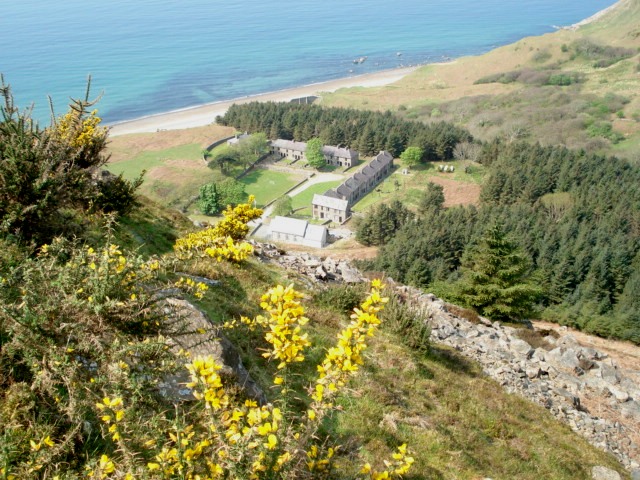
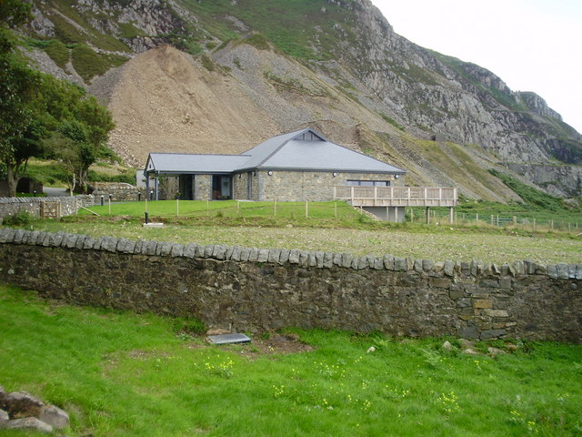
![]() This Welsh Language Heritage Centre is located near the village of Llithfaen on the wonderful Llyn Peninsula.
This Welsh Language Heritage Centre is located near the village of Llithfaen on the wonderful Llyn Peninsula.
It's a fine place to start a walk with car parking and a lovely cafe for refreshments afterwards. You can enjoy a stroll around the pleasant grounds and then walk down to the beach. It's a remote place so an ideal place for a peaceful walk in a lovely surroundings. On the way there are historic signs of the old quarrying village of Porth y Nant, which was abandoned midway through World War II after the cessation of quarrying.
This circular walk uses part of the Wales Coast path and other footpaths to explore the area around the centre.
Local highlights include the climb to the wonderful viewpoint at Yr Eifl, the ancient hillfort at Trer Ceiri and the epic Llyn Coastal Path. Scroll down for a list of walks near the centre.
Postcode
LL53 6NL - Please note: Postcode may be approximate for some rural locationsNant Gwrtheyrn Ordnance Survey Map  - view and print off detailed OS map
Nant Gwrtheyrn Open Street Map  - view and print off detailed map
Nant Gwrtheyrn OS Map  - Mobile GPS OS Map with Location tracking
Nant Gwrtheyrn Open Street Map  - Mobile GPS Map with Location tracking
Walks near Nant Gwrtheyrn
- Yr Eifl - Climb the Yr Eifl mountain group on this challenging circular walk on the Llyn Peninsula
- Llyn Coastal Path - Follow the Llyn Peninsula from Caernarfon to Porthmadog on this stunning coastal walk
- Trer Ceiri - This walk climbs to the Iron Age Hillfort of Tre'r Ceiri on the Llyn Peninsula in Wales
- Garn Fadryn - This walk climbs to the remote Iron Age Hillfort at Garn Fadryn in the Llyn Peninsula .
- Garn Boduan - This walk takes you up to the Iron Age Hill fort of Garn Boduan on the Llyn Peninsula near Nefyn
- Trefor Quarry - This walk visits the Yr Eifl Quarry in the coastal village of Trefor on the Llyn Peninsula, Gwynedd.
Pubs/Cafes
The on site Caffi Meinir is ideal for some post walk refreshment. The cafe is in a wonderful location, overlooking the beautiful coastline of the area. You can sit outside and enjoy your meal with wonderful views over Porth Y Nant. You can find the cafe at Nant Gwrtheyrn, Llithfaen with a postcode of LL53 6NL for your sat navs. The site also includes a Welsh language school and museum where you can find out about the fascinating history of the area.
Further Information and Other Local Ideas
Near Yr Eifl there's the Trefor Quarry to visit. There's some good footpaths around the unusual quarry landscape with more fine coastal views from the elevated position of the site. You can also visit the photogenic rock formations at the Trefor Sea Stacks to see in this area.
Photos
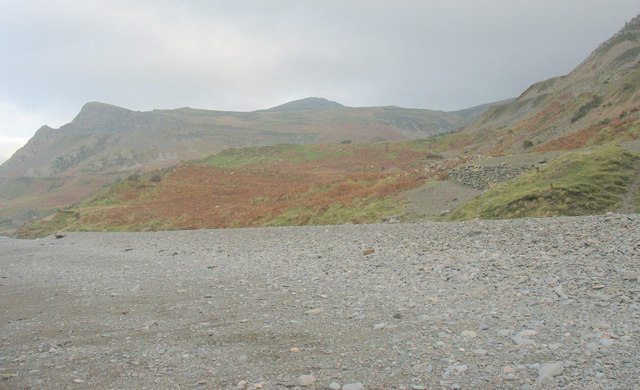
Path at Porth y Nant. This path leads from Nant Gwrtheyrn across spoil tips to the buildings at what was once the pier of the Porth y Nant granite quarry. Only the footings of the pier remain. More disused quarry workings can be seen at Penrhyn Glas across the bay.


