Walks near Oban
![]()
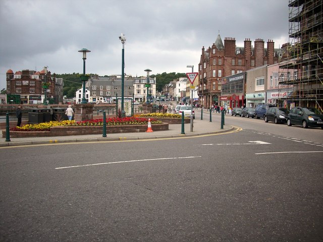
![]() This coastal town sits in a lovely position on the Firth of Lorn in Argyll and Bute. There's a lovely harbour and bay with fine views to the surrounding islands of Kerrera and the Isle of Mull.
This coastal town sits in a lovely position on the Firth of Lorn in Argyll and Bute. There's a lovely harbour and bay with fine views to the surrounding islands of Kerrera and the Isle of Mull.
This walk in the town takes you up to a fine viepwoint on McCaig's Tower before heading along the front to the cathedrals. The walk starts at the train station and heads north east through the town to climb to McCaig's Tower. There's excellent views over the town and the bay from this 19th century folly.
The route then heads along the attractive promenade where you can enjoy a fine view across Oban Bay to Kerrera Island in the Scottish Inner Hebrides.
For detailed information on the town's history, climate, culture, local attractions and transport links see the informative wikipedia page.
Postcode
PA34 4NT - Please note: Postcode may be approximate for some rural locationsOban Ordnance Survey Map  - view and print off detailed OS map
Oban Open Street Map  - view and print off detailed map
*New* - Walks and Cycle Routes Near Me Map - Waymarked Routes and Mountain Bike Trails>>
Oban OS Map  - Mobile GPS OS Map with Location tracking
Oban Open Street Map  - Mobile GPS Map with Location tracking
Walks near Oban
- Buachaille Etive Mor - Explore the stunning Buachaille Etive Mor ridge on this exhilarating walk in Fort William.
- Glencoe Lochan Trail - This lovely, waymarked trail takes you around the Lochan in Glencoe
- Oban To Ganavan Sands Beach Walk - This coastal walk takes you from Oban to the secluded beach at Ganavan Bay on the west coast of Scotland.
- West Highland Way - This is a fabulous long distance walking and cycling* route from Milngavie, north of Glasgow, to Fort William in the Scottish Highlands.
- Pap of Glencoe - This challenging walk takes you up the 742 m (2,434 ft) high Pap of Glencoe in the Highlands of Scotland
- Loch Ossian - This walk visits the beautiful Loch Ossian from the remote Corrour Station on Rannoch Moor
- Three Sisters Glencoe Waterfall Walk - This circular walk visits the Three Sisters, the Hidden Valley and the meeting of the Three Waters in the Pass of Glencoe.
- Three Lochs Way - This super route is suitable for both walkers and mountain bikers
- Cowal Way - This stunning walk starts at Portavadie on the banks of Loch Fyne and heads to Inveruglas
- The Cobbler Mountain - The Cobbler or Ben Arthur is one of the most popular climbs in the highlands
- Loch Sloy - This walk visits the photogenic Loch Sloy Dam at the southern end of Loch Sloy.
- Crinan Canal - Enjoy a waterside walk or cycle along the Crinan Canal in Argyll and Bute
- Knapdale Forest - Enjoy miles of cycling and walking trails in this expansive forest in Argyll and Bute
- Loch Long - This circular walk follows two delightful waymarked trails on the western side of Loch Long at Ardentinny in the Loch Lomond and the Trossachs National Park.
The walk starts in the pretty little village of Ardentinny on the western shores of the expansive loch - Loch Eck - This walk follows a trail along the western side of the stunning Loch Eck in the Loch Lomond and the Trossachs National Park
- Inveraray Castle - This fascinating castle sits in a wonderful location near the shores of Loch Fyne in Argyll.
- Loch Awe and Kilchurn Castle - Visit this fascinating ruined 15th and 17th century castle and enjoy wonderful views over Loch Awe
- Loch Creran - This walk visits the Shian Woodland Wildlife Reserve at the southern end of Loch Creran.
- Cruachan Dam and Falls of Cruachan Waterfall - This walk visits the Falls of Cruachan waterfall before heading to the nearby Cruachan Reservoir dam in Argyll and Bute.
- Kilmartin Glen - This walk visits a fascinating ancient site near the village of Kilmartin in Argyll and Bute.
- Loch Treig - This walk visits Loch Treig near Fort William, in Lochaber, in the Scottish Highlands.
- Coire Gabhail Lost Valley Walk - A walk through the Lost Valley is a magnificent and memorable experience in Glencoe, Scotland
Further Information and Other Local Ideas
The Oban To Ganavan Sands Beach Walk starts in the town. The walk will take you north to a beautiful secluded beach, passing the historic ruins of Dunollie Castle on the way.
A 45 minute drive to the south will take you to the fascinating Kilmartin Glen. The ancient site is one of the historic highlights of the area with over 800 prehistoric monuments and an interesting museum to visit.
For more walking ideas in the area see the Scottish Highlands Walks page.
Photos
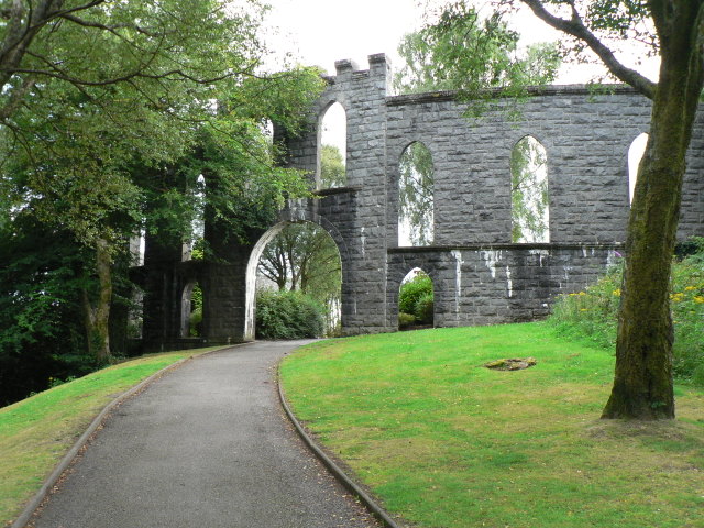
Oban, McCaig's Tower. This folly was built by John Stuart McCaig in 1895-1902. It may have been even bigger had his death not put a stop to things. Its wall runs in a complete circle and from its western end provides very good views over the bay.


