Porthdinllaen Walk
![]()
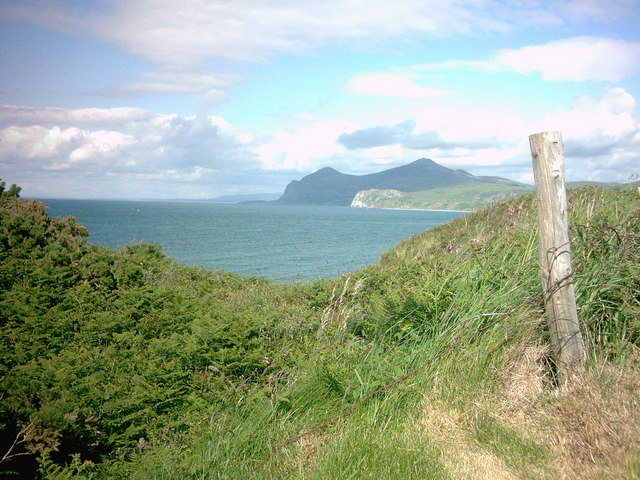
![]() Enjoy stunning coastal views and delightful coastal villages on this walk on the Llyn Peninsula. There are also fine sandy beaches, interesting rock pools and great views to the mountains of Yr Eifl and Snowdonia to enjoy on this bracing walk.
Enjoy stunning coastal views and delightful coastal villages on this walk on the Llyn Peninsula. There are also fine sandy beaches, interesting rock pools and great views to the mountains of Yr Eifl and Snowdonia to enjoy on this bracing walk.
The walk starts from the car park at the little village of Morfa Nefyn. You then walk along the attractive headland to the fishing village of Porthdinllaen where you will find the well known Ty Coch Inn. The distinctive pub is considered one of the best in Wales with its wonderful views over the Irish Sea to The Rivals.
You continue around the headland passing the lifeboat station and heading through the local golf course before returning to the car park. The area is wonderful for wildlife. Look out for a variety of sea birds including oystercatchers, sand martins and cormorants. Grey seals can also be seen around the coast.
The area can also be reached on the Nefyn Walk which starts at the nearby town and heads along the beaches to the site.
Postcode
LL53 6DB - Please note: Postcode may be approximate for some rural locationsPlease click here for more information
Porthdinllaen Ordnance Survey Map  - view and print off detailed OS map
Porthdinllaen Open Street Map  - view and print off detailed map
Porthdinllaen OS Map  - Mobile GPS OS Map with Location tracking
Porthdinllaen Open Street Map  - Mobile GPS Map with Location tracking
Explore the Area with Google Street View 
Pubs/Cafes
Head to the Tŷ Coch Inn for some refreshments after your walk. The excellent pub is one of the best in Wales and was named in the top ten beach bars in the world in a recent survey. It's located next to the beach where you can sit outside and look out for seals in the water. You can find the inn at postcode LL53 6DB for your sat navs.
Dog Walking
The beach and coast path are great for dog walking so you're bound to see plenty of other owners with their pets on a fine day. The Tŷ Coch Inn mentioned above is also dog friendly.
Further Information and Other Local Ideas
To continue your walking in the area you could pick up the waymarked Llyn Coastal Path and follow it a few miles north to the village of Llithfaen. Here you can enjoy a climb to the wonderful hill fort at Trer Ceiri and the substantial peak of Yr Eifl. The unusual landscape at the Trefor Quarry can also be visited near here. There's wonderful views back to the coast and some fascinating history to be found in this area.
If you head a few miles to the south you'll come to the southern side of the peninsula where you can visit the coastal settlements of Pwllheli, Llanbedrog and Abersoch.
The Garn Boduan Walk starts from nearby Nefyn. It will take you up to the viewpoint and Iron Age Hill fort located just south of the settlement.
A few miles to the south there's the inland climb to the remote Garn Fadryn. There's an Iron Age Hillfort and some incredible views from the top of this peaceful hill.
Cycle Routes and Walking Routes Nearby
Photos
Nefyn: Porthdinllaen. Seen from the National Trust car park at Morfa Nefyn – at SH281407. In 1807 Porthdinllaen was preferred to Holyhead as the new departure point for Ireland but the bill for its development was rejected in 1810. In the nineteenth century pigs reared on the Llŷn peninsula were shipped here to Liverpool and salted herrings went to Ireland. Sailing vessels were built at Porthdinllaen
The sheltered beachhead hamlet of Porthdinllaen The hamlet of Porthdinllaen, once inhabited by fishermen, is sheltered from the prevailing wind by the Trwyn Porthdinllaen headland. If William Madocks' plan for a packet port to Ireland had succeeded the whole of the area around Porthdinllaen Bay would now be urbanised.


