Circular Walk around Pwllheli
![]()
![]() This circular walk takes you around the town of Pwllheli on the Llyn Peninsula. On the walk you'll visit the harbour, beach, the River Rhydir and the Lon Cob Bach Nature Reserve. Pwllheli is considered the the main town of the peninsula, with a train station and a range of shops and other services.
This circular walk takes you around the town of Pwllheli on the Llyn Peninsula. On the walk you'll visit the harbour, beach, the River Rhydir and the Lon Cob Bach Nature Reserve. Pwllheli is considered the the main town of the peninsula, with a train station and a range of shops and other services.
The walk starts from the train station and heads south to the front where there are two blue flag beaches. You then head west along the beach before following a footpath north to the River Rhydir and the Lon Cob Bach Nature Reserve. There's some nice walkways here with interesting flora and fauna to look out for.
You continue east through the town to the Inner Harbour where there's a nice path to follow to South Beach. You then retrace your steps to return to the train station and the finish point of the walk.
To continue your walking in the area pick up the Llyn Coastal Path which runs through the town. Heading east will take you to Criccieth with its historic castle and the grave of former Prime Minister David Lloyd George in neighbouring Llanystumdwy. Heading west will take you to the beautiful National Trust beach at Llanbedrog before coming to Abersoch where you can visit the southernmost point of the peninsula at Cilan Head.
Pwllheli Ordnance Survey Map  - view and print off detailed OS map
Pwllheli Open Street Map  - view and print off detailed map
Pwllheli OS Map  - Mobile GPS OS Map with Location tracking
Pwllheli Open Street Map  - Mobile GPS Map with Location tracking
Walks near Pwllheli
- Portmeirion - Enjoy a walk around this popular tourist attraction built in the style of an Italian village
- Llyn Coastal Path - Follow the Llyn Peninsula from Caernarfon to Porthmadog on this stunning coastal walk
- Moel y Gest - This hill near Porthmadog offers fine views over North Wales including the Llyn Peninsula, the Rhinogydd, Moelwynion, Moel Hebog, and Snowdon.
This walk starts at the lovely harbour in Porthmadog and follows the coastal path south to Borth-Y-Gest - Porthmadog - This attractive coastal town in Gwynedd has some lovely coastal walking paths and beautiful beaches to explore
- Criccieth - This circular walk explores the coast and countryside surrounding the town of Criccieth in the Eifionydd area of Gwynedd
- Abersoch - This circular walk around Abersoch uses the Llyn Coastal Path to explore the beautiful beaches and bays to the south and west of the village.
- Llanbedrog - This pretty Welsh village is located in a lovely spot on the south side of the Llyn Peninsula.
- Garn Fadryn - This walk climbs to the remote Iron Age Hillfort at Garn Fadryn in the Llyn Peninsula .
- Garn Boduan - This walk takes you up to the Iron Age Hill fort of Garn Boduan on the Llyn Peninsula near Nefyn
- Llanystumdwy - This little Welsh village is located in a fine spot on the Llyn Peninsula near Criccieth and Pwllheli.
- Borth-Y-Gest - This coastal Gwynedd village is located just south of Porthmadog in the Snowdonia National Park.
Further Information and Other Local Ideas
If you head west along the Wales Coast path you could visit the National Trust's Plas yn Rhiw. The picturesque 17th century manor house is surrounded by some beautiful ornamental gardens with great views over Cardigan Bay and Hell's Mouth from the elevated position of the house.
Head a few miles north and you can explore the northern side of the peninsula and visit Nefyn,Porthdinllaen, Yr Eifl and Trer Ceiri. The unusual landscape at the Trefor Quarry can also be visited near here.
The Garn Boduan Walk starts from nearby Nefyn. It will take you up to the viewpoint and Iron Age Hill fort located just south of the settlement.
Head inland and there's climb to the remote Garn Fadryn. There's an Iron Age Hillfort and some incredible views from the top of this peaceful hill.
Photos
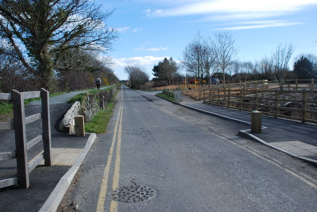
Lôn Cob Bach Pwllheli. Lôn Cob Bach separates Harbwr Bach (the little harbour) from the reclaimed land between here and the sea.
Afon Rhydhir and Information Board. The Afon Rhydhir flows into Pwllheli harbour from the west. The area has recently been developed as a town-centre nature reserve around Lôn Cob Bach


