Llanbedrog Walks - Llanbedrog to Pwllheli Coastal Path
![]()
![]() This pretty Welsh village is located in a lovely spot on the south side of the Llyn Peninsula.
This pretty Welsh village is located in a lovely spot on the south side of the Llyn Peninsula.
There's a fine National Trust owned beach with wildlife such as oyster catchers and curlew to look out for at low tide. It's a great place for coastal walking with a wide area of beach, a large headland area, woodland and heathland to explore.
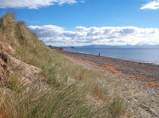
This walk takes you along a section of the Wales Coast Path from Llanbedrog to neighbouring Pwllheli. The walk runs for just over 4 miles along the attractive beach. Along the way you'll pass sand dunes and the Pwllheli Golf Course towards the end of the route.
To continue your walking from Llanbedrog you could head south along the coast path to visit Abersoch. On the way you will pass Mynydd Tir y Cwmwd (Llanbedrog headland) where there are more great views to enjoy.
Llanbedrog Ordnance Survey Map  - view and print off detailed OS map
Llanbedrog Open Street Map  - view and print off detailed map
Llanbedrog OS Map  - Mobile GPS OS Map with Location tracking
Llanbedrog Open Street Map  - Mobile GPS Map with Location tracking
Pubs/Cafes
The Llanbedrog Beach Bar is in a great spot for some post walk refreshment. There's sunny sheltered terraces a cosy restaurant where you can enjoy splendid sea views with your meal. The bar was named in the UK’s Top 20 Beach Bars by the Sunday Times.
Dog Walking
The area is great for dog walking. You are asked to keep them on leads on the beach during the summer months as it can get quite busy. The beach bar mentioned above is also dog friendly.
Further Information and Other Local Ideas
Head a few miles north and you can explore the northern side of the peninsula and visit Nefyn,Porthdinllaen, Yr Eifl and Trer Ceiri. The unusual landscape at the Trefor Quarry can also be visited near here.
A few miles to the north west there's the inland climb to the remote Garn Fadryn. There's an Iron Age Hillfort and some incredible views from the top of this peaceful hill.
The Garn Boduan Walk starts from nearby Nefyn. It will take you up to the viewpoint and Iron Age Hill fort located just south of the settlement.
For more walking ideas in the area see the Llyn Peninsula Walks page.
Cycle Routes and Walking Routes Nearby
Photos
Carreg y Defaid from the headland. Looking north eastwards along the low sandy coastline between Llanbedrog and Pwllheli.
Llanbedrog Headland - Quarry Hopper Building. Quite a hard to see or find structure as it is neither visible from the popular spots for visitors of nearby Llanbedrog or Abersoch. It is equally hidden when on the headland walk between the Llanbedrog and the Warren beach. This photo was taken from about 3 miles away from Pwllheli beach. Originally used as a storage building before stones from the quarry were shipped out.


