Ringmer Walks
![]()
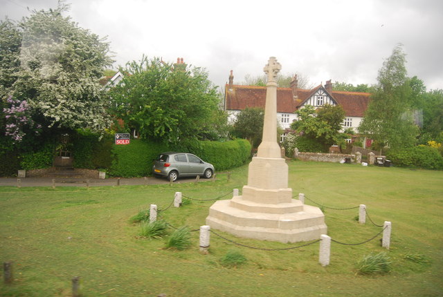
![]() This East Sussex based villlage is located just to the east of Lewes. The village is one of the largest in Southern England and includes a 13th century church and the remains of an old post mill.
This East Sussex based villlage is located just to the east of Lewes. The village is one of the largest in Southern England and includes a 13th century church and the remains of an old post mill.
This circular walk from the village takes you south onto the South Downs to visit two local highlights at Mount Caburn Nature Reserve and the historic Glynde Place.
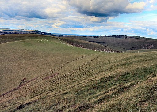
Mount Caburn includes a wide variety of flora and fauna and a fine viewpoint with views over the South Downs.
In Glynde there's an Elizabethan Manor House to see. It is a Grade I listed building while the adjacent church was built in the eighteenth century.
Please scroll down for the full list of walks near and around Ringmer. The detailed maps below also show a range of footpaths, bridleways and cycle paths in the area.
Ringmer Ordnance Survey Map  - view and print off detailed OS map
Ringmer Open Street Map  - view and print off detailed map
Ringmer OS Map  - Mobile GPS OS Map with Location tracking
Ringmer Open Street Map  - Mobile GPS Map with Location tracking
Walks near Ringmer
- Lewes - This circular walk around the county town of East Sussex includes riverside paths, lovely views of the South Downs and a visit to Lewes Castle
- Barcombe Mills - This delightful area of East Sussex has riverside trails, a small reservoir and lovely countryside views
- Sussex Ouse Valley Way - This splendid waterside walk follows the River Ouse from its source near Lower Beeding to the coast at Seaford Bay.
The walk starts near Horsham at the village of Lower Beeding and passes through Slaugham, Handcross and Staplefield - Mount Caburn - This walk visits the delightful Mount Caburn Nature Reserve in the South Downs
- Firle Beacon - This circular walk takes you to the splendid Firle Beacon in the South Downs
- The South Downs Way - This beautiful 100 mile long trail runs from Winchester to the coastal town of Eastbourne
- Lewes to Alfriston - A lovely walk from Lewes to Alfriston, first following the River Ouse before picking up the South Downs Way
- Glynde to Lewes Walk - This popular circular walk on the South Downs takes you from the village of Glynde to the town of Lewes
- Rottingdean - This attractive coastal village is located in the city of Brighton in East Sussex
- Iford - A circular walk from the Sussex village of Iford, visiting the River Great Ouse and the neighbouring villages of Southease and Rodmell.
The village sits just a couple of miles south of Lewes on slopes of the South Downs in the valley of the River Ouse - Seaford - This East Sussex based town is a great place for cliff top coastal walking
- Falmer - This small East Sussex based village is located between Brigthe campus of Brighton & Hove Albion's Falmer Stadium
- Castle Hill Nature Reserve - This circular walk visits the Castle Hill National Nature Reserve on the eastern outskirts of Brighton in the South Downs National Park
Pubs/Cafes
Green Man, Lewes Road, BN8 5NA. This country pub has a decked patio area and serves good quality dishes. They are Dog Friendly.
Photos
Derelict Buildings by Acorn Cottage on the edge of Plashetts Wood. Plashett Park Wood is a Site of Special Scientific Interest partly in the parish. It is a site of biological importance as an area of ancient woodland. Plashett Wood and the adjoining Plashett Park Farm provide habitats for a wide variety of breeding birds and bats, and a number of rarer invertebrates and flora


