Saltburn to Staithes Walk
![]()
![]() This walk follows a fine section of the Cleveland Way from Saltburn to Staithes. The route runs for about 8 miles along an undulating, waymarked footpath. On the way there's some wonderful cliff top views, lots of seabirds, fascinating geology, lovely beaches and interesting villages to enjoy.
This walk follows a fine section of the Cleveland Way from Saltburn to Staithes. The route runs for about 8 miles along an undulating, waymarked footpath. On the way there's some wonderful cliff top views, lots of seabirds, fascinating geology, lovely beaches and interesting villages to enjoy.
The walk starts at Saltburn Sands Cliff, just a short distance from the train station. From here you can pick up the trail and follow it east, past Saltburn Scar to Hunt Cliff.
You continue south east to Skinningrove, passing the pretty Cattersty Beach on the way.
After leaving the village the path heads past Hummersea Point towards Boulby, passing Rockhole Hill on the way. At Boulby you will past some of the highest cliffs in England, standing at a height of 203 metres (666 ft) above sea level.
The final section takes you past Cowbar Nab to finish at the delightful Staithes Harbour. Here you can enjoy a stroll through the characterful village with its old cobbled streets and little cottages. Also look out for the large seabird colony in the are which includes Kittiwake, Fulmar and Razorbill.
Saltburn to Staithes Walk Ordnance Survey Map  - view and print off detailed OS map
Saltburn to Staithes Walk Open Street Map  - view and print off detailed map
Saltburn to Staithes Walk OS Map  - Mobile GPS OS Map with Location tracking
Saltburn to Staithes Walk Open Street Map  - Mobile GPS Map with Location tracking
Pubs/Cafes
In Staithes head to the excellent Cod and Lobster for some refreshments after your walk. The pub is in a great location right next to the harbour where you can sit outside and enjoy sea views with your fish and chips. Indoors there's old photos displaying the history of the area including the violent storms that have visited this little village. You can easily find it on the High Street at a postcode of TS13 5DF for you sat navs.
Dog Walking
The coastal path makes for an excellent walk for fit dogs. The Cod and Lobster pub mentioned above is also very dog friendly.
Further Information and Other Local Ideas
To extend the walk continue along the coast path to Port Mulgrave and the picturesque Runswick Bay on the Staithes to Runswick Bay Walk. The delightful fishing village is a highlight of the Yorkshire coast with its sandy beach, sheltered bay and pretty little cottages. It's about a further 3 miles to the Bay.
You can also try the Staithes to Port Mulgrave Circular Walk which starts from the harbour and visits the old abandoned mining port before heading inland for some woodland and country trails.
Just to the south of Saltburn you can pick up the Cleveland Street Walk. Follow the trail west and it will take you to Guisborough where you can visit the photogenic ruins of the historic Guisborough Priory.
The easy walk along the picturesque Saltburn Gill is another fine local option.
Cycle Routes and Walking Routes Nearby
Photos
Saltburn Sands. This is a seminal moment for walkers on the Cleveland Way. Having started from Helmsley, and followed an inland route for 56 miles round the west and north sides of the North York Moors, the sea is reached here at Saltburn. The routes follows the coast south for the remaining 52 miles. The first objective though is Huntcliff, ahead.
High tide at Cattersty Sands. This view looks across the sea defences behind the sands across the beck outfall towards Hummersea Cliff.
The jetty at Skinningrove. This photograph shows a view of the (now disused) jetty near Cattersty Sands in Skinningrove. On the horizon, just above the jetty, two big ships can be seen waiting to enter Teesport on the high tide. The picture was taken looking in a north-westerly direction towards Cattersty Sands.
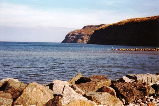
Hummersea Cliff. Viewed from the foreshore at Skinningrove. Beyond lies Boulby Cliff, one of the highest in England.
Post Box, Boulby. Looking east towards Cowbar Nab and Staithes. The large house is the former alum house, now a private residence. It once comprised several ranges of single storey buildings. This three storey building was probably a store for barrels of the finished product. Later it was used as a stable for the ironstone mine. Liquid alum was culverted from the workings to the alum house where further refining took place. Somewhere on the "lawn" a vertical shaft was sunk in 1683 leading to a tunnel at the bottom of the cliff 100' below. A horse gin would have operated to drop the barrels of alum down to waiting boats.


