Spalding Circular River Walk
![]()
![]() This Lincolnshire based market town has some nice waterside walking trails to try through the attractive countryside of the Fens.
This Lincolnshire based market town has some nice waterside walking trails to try through the attractive countryside of the Fens.
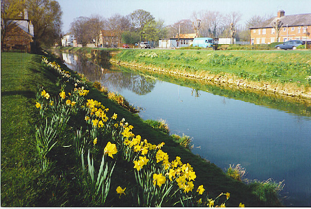
This circular walk from the town visits the Willow Tree Fen Nature Reserve, the River Glen and the neighbouring village of Pinchbeck. The walk starts on Sharp's Bridge to the north of the town. Here you can pick up a waterside trail heading south west along Vernatt's Drain to the Nature Reserve. Here you pick up the Macmillan Way and follow it north along the River Glen to Pinchbeck. Head south through the town and it will bring you out near Sharp's Bridge.
Spalding Circular River Walk Ordnance Survey Map  - view and print off detailed OS map
Spalding Circular River Walk Open Street Map  - view and print off detailed map
*New* - Walks and Cycle Routes Near Me Map - Waymarked Routes and Mountain Bike Trails>>
Spalding Circular River Walk OS Map  - Mobile GPS OS Map with Location tracking
Spalding Circular River Walk Open Street Map  - Mobile GPS Map with Location tracking
Further Information and Other Local Ideas
Just to the east you can enjoy a walk around the pleasant scenery of Holbeach Marsh. Near here there's also the wildlife rich Moulton Marsh Nature Reserve. The man-made reserve features woodland, lagoons, creeks, saltmarsh and nice trails along the River Welland.
A few miles to the south west is the market town of Market Deeping. The historic town includes several 17th century stone buildings, a weekly market dating back to 1220 and a well known stone bridge from the mid 17th century. There's also pleasant walking trails along the River Welland to enjoy here.
For more walking ideas in the area see the Lincolnshire Walks page.
Cycle Routes and Walking Routes Nearby
Photos
River Welland, Spalding. Showing the terminus of the Spalding Water Taxi and the Lincolnshire Poacher pub.
River Glen at Willow Tree Fen. Although a remote area, there are a number of features to describe here. The River Glen, running south to north, is channelled to provide drainage and flood protection. The flood banks are further apart than normal here though. Although mainly still arable farming, these are the first cows we have seen since leaving Boston on the Macmillan Way 24 miles earlier. The brick pillars in the middle distance are the remains of a bridge over the river carrying the Bourne to Spalding railway, closed in 1959. Beyond are two poles carrying owl nesting boxes, provided by the Hawk and Owl Trust. Most are inhabited by anything other than owls these days though.


