Spencers Wood Walks
![]()
![]() This Berkshire based village is located in a rural spot just south of the town of Reading.
This Berkshire based village is located in a rural spot just south of the town of Reading.
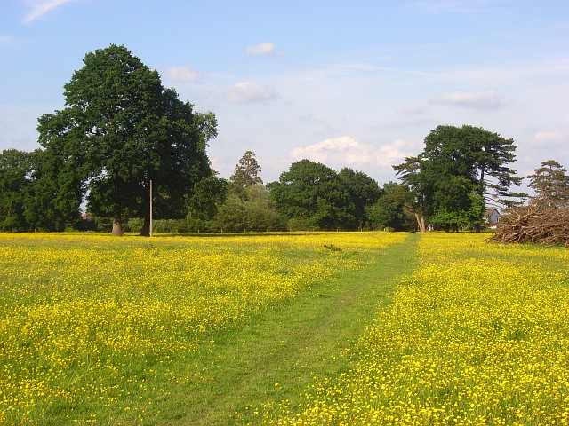
This circular walk from the village takes you south along public footpaths through the meadows to the River Loddon. You can then follow the river west before returning on country lanes to the village.
To continue your walking in the area head north into Reading where you can enjoy waterside walking along the Kennet and Avon Canal and the Thames Path National Trail.
A few miles to the south there's Wellington Country Park where you can enjoy some peaceful woodland trails, a 35 acre lake with picnic and BBQ areas, an Animal Farm with a Petting Barn, Miniature Golf and a Miniature Railway.
Scroll down to see the full list of walks near and around Spencer's Wood.
Postcode
RG7 1AE - Please note: Postcode may be approximate for some rural locationsSpencers Wood Ordnance Survey Map  - view and print off detailed OS map
Spencers Wood Open Street Map  - view and print off detailed map
Spencers Wood OS Map  - Mobile GPS OS Map with Location tracking
Spencers Wood Open Street Map  - Mobile GPS Map with Location tracking
Walks near Spencers Wood
- Reading Canal Walk - This walk takes you along the Kennet and Avon Canal from Reading to Aldermaston Wharf
- Reading Circular River Walk - This circular walk takes in a number of waterways including the River Thames, the River Kennet and the Kennet and Avon Canal
- Thames Path - Starting at the Source of the Thames at Thames Head in Gloucestershire, follow the iconic river through beautiful countryside and historic towns to the city of London.
- Kennet and Avon Canal Walk - A splendid waterside walk from the Thames at Reading, through Thatcham, Newbury, Hungerford, Great Bedwyn, Pewsey, Devizes, Bradford on Avon to Bath
- Tadley - This Hampshire based town is located near to some large areas of woodland and the attractive scenery of the North Downs
- Pamber Forest - This large forest in Tadley covers nearly 500 acres
- Silchester - This walk follows the waymarked Silchester trail around the Hampshire village
- Aldermaston - This Berkshire based village has some nice river and canalside trails to try.
- Burghfield Wokefield Common - This walk explores Wokefield Common Nature Reserve in Burghfield Common, West Berkshire.
- Wellington Country Park - This 350 acre park is very popular with walkers with four splendid nature trails to follow
- Bramshill Forest - This circular walk takes you around the pretty Bramshill Forest, near Eversley in Hampshire
- Blackwater Valley Footpath - This is a nice easy waterside walk along the Blackwater River from Aldershot to Swallowfield.
The walk starts at the delightful Rowhill Nature Reserve in Aldershot and heads along the river to Farnborough, passing Gold Valley Lakes and Willow Park on the way - California Country Park - This country park is located near Wokingham in Berkshire and has two lovely short walks
- Swinley Forest - This forest in Bracknell has miles of good walking trails and some good mtb trails as well
- Hazeley Heath - This walk explores the RSPB'S Hazeley Heath near Hook in Hampshire.
- Hook - This Hampshire based town has some nice local woods, river walks, a pleasant local nature reserve and a number of nearby country parks to explore.
Photos
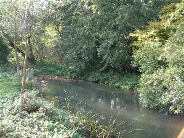
River Loddon at Sheepbridge. Sheepbridge used to have a mill on the River Loddon and this is the bypass channel that took excess water away from upstream of it. It is viewed here looking downstream from Sheep Bridge. One of the quirky joys of the English language is illustrated here. This photograph was taken from Sheep Bridge in the hamlet of Sheepbridge, and these separate spellings have been used in every edition of the Ordnance Survey mapping from the edition of 1872 right up to the present day.


