Tywyn Walks
![]()
![]() This seaside resort is located on Cardigan Bay in Gwynedd. The town is located on the Wales coast path which can be followed north to Llwyngwril or south to Aberdovey.
This seaside resort is located on Cardigan Bay in Gwynedd. The town is located on the Wales coast path which can be followed north to Llwyngwril or south to Aberdovey.
There's a lovely long beach to walk along and you are also close to the Snowdonia National Park where there are numerous walking opportunites. The town also has a train station on the Cambrian Line and one on the Talyllyn Railway. The heritage steam railway dates back to 1865 and will take you into Snowdonia on the wonderful old trains. One nice idea is to catch the train to the nearby Dolgoch Falls which are a splendid sight after wet weather.
This circular walk from the town takes you along the beach to the mouth of the
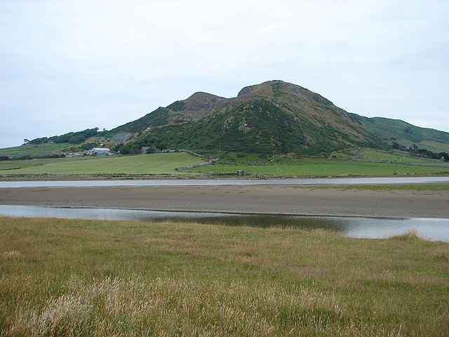
River Dysynni. The river mouth is a very pretty area located just north west of the town.
The walk then visits the Broad Water, a large lake to the north. The lake has some pleasant waterside paths with lots of wildlife to look out for on the water. There's also some great views over the lake to the Snowdonia hills which make a fine backdrop to any photo.
Tywyn Ordnance Survey Map  - view and print off detailed OS map
Tywyn Open Street Map  - view and print off detailed map
Tywyn OS Map  - Mobile GPS OS Map with Location tracking
Tywyn Open Street Map  - Mobile GPS Map with Location tracking
Walks near Tywyn
- Aberdovey - The town of Aberdovey (Aberdyfi) is located in a lovely position on the west coast of Wales
- Dolgoch Falls - Travel on the marvellous Talyllyn Railway to Dolgoch and visit the beautiful Dolgoch Falls on this circular walk in the Snowdonia National Park
- Tal-y-llyn Lake - Enjoy a waterside walk around this stunning glacial lake in the Snowdonia National Park
- Machynlleth to Llanidloes - Follow National Cycle Route 8 from Machynlleth to Llanidloes and enjoy some splendid scenery.
You start off with a lovely run along the River Dulas and some beautiful mountainous scenery around Dylife and Aberhosan - Llyn Cau - This walk climbs to the beautiful Llyn Cau on the slopes of Cadir Idris in the Snowdonia National Park
- Cregennan Lakes - This circular walk takes you around these two beautiful lakes in Snowdonia
- Arthog Waterfalls - This walk visits the North Wales village of Arthog where you can enjoy a lovely walking trail along a series of waterfalls
- Mawddach Trail - This splendid cycling and walking trail takes you along the old Ruabon to Barmouth railway line on excellent paths
- Panorama Walk Barmouth - A classic circular walk around Barmouth climbing above the town for magnificent views over the Mawddach estuary and the Snowdonia National Park
- Dyfi Valley Way - A walk through the beautiful Dyfi Valley taking you from Aberdovey (Aberdyfi) on the coast to Llanuwchllyn before returning along the river to Borth
- Dinas Oleu - This walk climbs to a hill fort and lovely viewpoint above the town of Barmouth
- Precipice Walk Dolgellau - A lovely circular walk through the hills surrounding Llyn Cynwch in the Snowdonia National Park
- Barmouth to Fairbourne - Enjoy fabulous views of the Mawddach estuary and Barmouth Bay on this popular walk from Barmouth to Fairbourne
- Precipice Walk Dolgellau - A lovely circular walk through the hills surrounding Llyn Cynwch in the Snowdonia National Park
- Llanbedr - The Gwynedd village of Llanbedr is in a great location on the edge of the Snowdonia National Park and close to some beautiful coast, riverside trails and a scenic river estuary.
- Dyffryn Ardudwy - This North Wales village sits in a lovely position on the edge of the Snowdonia National Park and only a short walk from the coast
- Nantcol Waterfalls Walk - This circular walk explores the beautiful Rhaeadr Nantcol Waterfalls in Snowdonia in North Wales.
- Cadair Idris - The epic circular walk to the 893 m (2,930 ft) summit of Cadair Idris is one of the most popular climbs in the Snowdonia National Park
- Machynlleth - This market town in Powys has some lovely trails to try through the Dovey and Lllyfnant Valleys
- New Precipice Walk - This lovely trail follows the New Precipice Walk along the hills to the west of Llanelltyd, near Dolgellau in Gwynedd.
Pubs/Cafes
The Victorian Slipway is located in a lovely spot on the sea front. You can sit outside and enjoy a meal with fine beach views. The pub is located at 6 Marine Parade, LL36 0DE.
Further Information and Other Local Ideas
For cyclists the popular Lon Las Cymru or National Cycle Route 8 runs through the town. The epic route runs for nearly 250 miles through some of Wales' most beautiful scenery. You could follow the trail north to visit Llwyngwril and Barmouth.


